Liffré
| Liffré Liverieg | ||
|---|---|---|
|
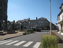
The town centre of Liffré | ||
| ||
 Liffré | ||
|
Location within Brittany region  Liffré | ||
| Coordinates: 48°12′51″N 1°30′24″W / 48.2142°N 1.5067°WCoordinates: 48°12′51″N 1°30′24″W / 48.2142°N 1.5067°W | ||
| Country | France | |
| Region | Brittany | |
| Department | Ille-et-Vilaine | |
| Arrondissement | Rennes | |
| Canton | Liffré | |
| Intercommunality | Pays de Liffré | |
| Government | ||
| • Mayor (2014–2020) | Loïg Chesnais-Girard | |
| Area1 | 66.86 km2 (25.81 sq mi) | |
| Population (2008)2 | 6,756 | |
| • Density | 100/km2 (260/sq mi) | |
| Time zone | CET (UTC+1) | |
| • Summer (DST) | CEST (UTC+2) | |
| INSEE/Postal code | 35152 / 35340 | |
| Elevation |
40–113 m (131–371 ft) (avg. 95 m or 312 ft) | |
|
1 French Land Register data, which excludes lakes, ponds, glaciers > 1 km² (0.386 sq mi or 247 acres) and river estuaries. 2 Population without double counting: residents of multiple communes (e.g., students and military personnel) only counted once. | ||
.svg.png)
Liffré (Breton: Liverieg, Gallo: Lifrei) is a commune in the Ille-et-Vilaine department in Brittany in northwestern France.
International relations
Twin towns – Sister cities
Liffré is twinned with:
Population
Inhabitants of Liffré are called Liffréens in French.
| Historical population | ||
|---|---|---|
| Year | Pop. | ±% |
| 1962 | 2,122 | — |
| 1968 | 2,322 | +9.4% |
| 1975 | 3,237 | +39.4% |
| 1982 | 4,205 | +29.9% |
| 1990 | 5,659 | +34.6% |
| 1999 | 6,454 | +14.0% |
| 2008 | 6,745 | +4.5% |
See also
References
- ↑ "British towns twinned with French towns". Archant Community Media Ltd. Retrieved 2013-07-11.
External links
| Wikimedia Commons has media related to Liffré. |
- Town website (French)
- Cultural Heritage (French)
This article is issued from Wikipedia - version of the 8/16/2016. The text is available under the Creative Commons Attribution/Share Alike but additional terms may apply for the media files.