Preston, Iowa
| Preston, Iowa | |
|---|---|
| City | |
 | |
 Location of Preston, Iowa | |
| Coordinates: 42°3′1″N 90°23′41″W / 42.05028°N 90.39472°WCoordinates: 42°3′1″N 90°23′41″W / 42.05028°N 90.39472°W | |
| Country |
|
| State |
|
| County | Jackson |
| Government | |
| • abc | 123 |
| Area[1] | |
| • Total | 0.96 sq mi (2.49 km2) |
| • Land | 0.96 sq mi (2.49 km2) |
| • Water | 0 sq mi (0 km2) |
| Elevation | 646 ft (197 m) |
| Population (2010)[2] | |
| • Total | 1,012 |
| • Estimate (2012[3]) | 1,002 |
| • Density | 1,054/sq mi (407.0/km2) |
| Time zone | Central (CST) (UTC-6) |
| • Summer (DST) | CDT (UTC-5) |
| ZIP code | 52069 |
| Area code(s) | 563 |
| FIPS code | 19-64605 |
| GNIS feature ID | 0460442 |
| Website | www.prestoniowa.org |
Preston is a city in Jackson County, Iowa, United States. The population was 1,012 at the 2010 census.
History
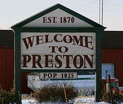
Preston had its start in the year 1870 by the building of the railroad through that territory.[4]
Preston is named for one of its founders, I. M. Preston. Those present at the time of the town's platting were allowed to name Preston's streets after themselves.[5]
Geography
Preston is located at 42°3′1″N 90°23′41″W / 42.05028°N 90.39472°W (42.050332, -90.394681).[6]
According to the United States Census Bureau, the city has a total area of 0.96 square miles (2.49 km2), all of it land.[1]
Demographics
| Historical populations | ||
|---|---|---|
| Year | Pop. | ±% |
| 1890 | 489 | — |
| 1900 | 593 | +21.3% |
| 1910 | 642 | +8.3% |
| 1920 | 648 | +0.9% |
| 1930 | 596 | −8.0% |
| 1940 | 602 | +1.0% |
| 1950 | 684 | +13.6% |
| 1960 | 819 | +19.7% |
| 1970 | 950 | +16.0% |
| 1980 | 1,120 | +17.9% |
| 1990 | 1,025 | −8.5% |
| 2000 | 949 | −7.4% |
| 2010 | 1,012 | +6.6% |
| 2014 | 984 | −2.8% |
| 2015 | 978 | −0.6% |
| Source:"American FactFinder". United States Census Bureau. and Iowa Data Center Source: | ||

2010 census
As of the census[2] of 2010, there were 1,012 people, 418 households, and 280 families residing in the city. The population density was 1,054.2 inhabitants per square mile (407.0/km2). There were 464 housing units at an average density of 483.3 per square mile (186.6/km2). The racial makeup of the city was 98.6% White, 0.5% African American, and 0.9% from two or more races. Hispanic or Latino of any race were 0.6% of the population.
There were 418 households of which 33.3% had children under the age of 18 living with them, 53.6% were married couples living together, 9.8% had a female householder with no husband present, 3.6% had a male householder with no wife present, and 33.0% were non-families. 29.4% of all households were made up of individuals and 17.7% had someone living alone who was 65 years of age or older. The average household size was 2.42 and the average family size was 2.97.
The median age in the city was 39.2 years. 25.9% of residents were under the age of 18; 6.3% were between the ages of 18 and 24; 25.2% were from 25 to 44; 24.6% were from 45 to 64; and 17.7% were 65 years of age or older. The gender makeup of the city was 48.8% male and 51.2% female.
2000 census
As of the census[8] of 2000, there were 949 people, 417 households, and 250 families residing in the city. The population density was 962.2 people per square mile (370.1/km²). There were 433 housing units at an average density of 439.0 per square mile (168.9/km²). The racial makeup of the city was 99.89% White and 0.11% Pacific Islander. Hispanic or Latino of any race were 0.11% of the population.
There were 417 households out of which 29.0% had children under the age of 18 living with them, 51.1% were married couples living together, 7.0% had a female householder with no husband present, and 40.0% were non-families. 35.7% of all households were made up of individuals and 20.6% had someone living alone who was 65 years of age or older. The average household size was 2.26 and the average family size was 2.97.
Age spread: 23.1% under the age of 18, 10.1% from 18 to 24, 28.8% from 25 to 44, 20.3% from 45 to 64, and 17.7% who were 65 years of age or older. The median age was 37 years. For every 100 females there were 90.9 males. For every 100 females age 18 and over, there were 89.1 males.
The median income for a household in the city was $35,909, and the median income for a family was $47,375. Males had a median income of $32,150 versus $22,031 for females. The per capita income for the city was $17,639. About 4.0% of families and 6.8% of the population were below the poverty line, including 7.7% of those under age 18 and 14.6% of those age 65 or over.
Education

Preston High School has approximately 350 students enrolled as of 2008. The school colors are red and black and their mascot is the Trojans.
Notable people
- Al Feuerbach, former track and field athlete, who competed in the men's shot put event at the 1972 and 1976 Summer Olympics.
- Bob Oldis, scout for the Florida Marlins and a former professional baseball player
- Fred Schule (1879–1962) 1904 Olympic gold medalist in hurdles[9]
- Roger Stewart, Iowa State Senator.
References
- 1 2 "US Gazetteer files 2010". United States Census Bureau. Retrieved 2012-05-11.
- 1 2 "American FactFinder". United States Census Bureau. Retrieved 2012-05-11.
- ↑ "Population Estimates". United States Census Bureau. Retrieved 2013-05-23.
- ↑ Owen's Gazetteer and Directory of Jackson County, Iowa. Walsworth. 1878. p. 82.
- ↑ History of Jackson County, Iowa, Volume 1. S.J. Clarke Publishing Company. 1910. p. 676.
- ↑ "US Gazetteer files: 2010, 2000, and 1990". United States Census Bureau. 2011-02-12. Retrieved 2011-04-23.
- ↑ "Census of Population and Housing". Census.gov. Retrieved June 4, 2015.
- ↑ "American FactFinder". United States Census Bureau. Retrieved 2008-01-31.
- ↑ "Fred Schule". SPORTS-REFERENCE/Olympic sports. Retrieved 2011-01-13.
External links
| Wikimedia Commons has media related to Preston, Iowa. |
- Preston Iowa Portal style website – Government, Business, Churches and more
- Preston High School
- City-Data Comprehensive Statistical Data and more about Preston
- St Joseph Catholic Church Preston – History, Events, Educational Opportunities
Municipalities and communities of Jackson County, Iowa, United States | ||
|---|---|---|
| Cities | ||
| Townships | ||
| Unincorporated communities | ||
| Footnotes | ‡This populated place also has portions in an adjacent county or counties | |