Prince Khalifa Bin Salaman Island
 Prince Khalifa Bin Salman Island Location of Prince Khalifa Bin Salman Island in Bahrain | |
| Geography | |
|---|---|
| Location | Persian Gulf |
| Coordinates | 26°13′30″N 50°38′06″E / 26.225°N 50.635°ECoordinates: 26°13′30″N 50°38′06″E / 26.225°N 50.635°E |
| Archipelago | Bahrain |
| Adjacent bodies of water | Persian Gulf |
| Total islands | 1 |
| Major islands |
|
| Area | 0.4 km2 (0.15 sq mi) |
| Length | 1.2 km (0.75 mi) |
| Width | 0.5 km (0.31 mi) |
| Coastline | 3.9 km (2.42 mi) |
| Highest elevation | 0 m (0 ft) |
| Administration | |
| Governorate | Muharraq Governorate |
| Demographics | |
| Demonym | Bahraini |
| Population | 0 (2010) |
| Pop. density | 0 /km2 (0 /sq mi) |
| Ethnic groups | Bahraini, non-Bahraini |
| Additional information | |
| Time zone | |
| Official website |
www |
| ISO Code = BH-15 | |
Prince Khalifa Bin Salman Island is an artificial island in the archipelago of Bahrain. It has a distance of 4.5 km (2.8 mi) west of the capital, Manama, on Bahrain Island.
History
It is named after Prince Khalifa Bin Salman.[1] The island was built by Nass group.[2]
Geography
The artificial island is roughly rectangle in shape, and includes the Prince Khalifa Bin Salman Park and the Sheikh Khalifa Bin Salman Bridge.
Administration
The island belongs to Muharraq Governorate .
Transportation
The island is in the center of the Sheikh Khalifa Bin Salman Bridge., which connects Hidd to Juffair.[3]
Tourism
The island is one of Bahrain's top tourist attractions because of Hidd Waterpark located on the island.[4]
Image gallery
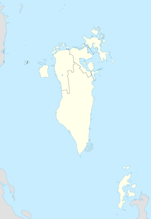
 Map 1
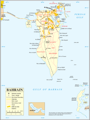
Map 1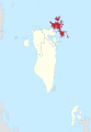 District Map
References
| Wikimedia Commons has media related to Prince Khalifa Bin Salman Island. |
This article is issued from Wikipedia - version of the 11/17/2016. The text is available under the Creative Commons Attribution/Share Alike but additional terms may apply for the media files.