Pristava, Ljutomer
| Pristava | |
|---|---|
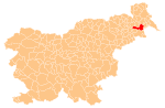
 Pristava Location in Slovenia | |
| Coordinates: 46°31′21.94″N 16°14′19.11″E / 46.5227611°N 16.2386417°ECoordinates: 46°31′21.94″N 16°14′19.11″E / 46.5227611°N 16.2386417°E | |
| Country |
|
| Traditional region | Styria |
| Statistical region | Mura |
| Municipality | Ljutomer |
| Area | |
| • Total | 3.55 km2 (1.37 sq mi) |
| Elevation | 172.6 m (566.3 ft) |
| Population (2002) | |
| • Total | 277 |
| [1] | |
Pristava (pronounced [ˈpɾiːstaʋa]) is a settlement on the left bank of the Ščavnica River in the Municipality of Ljutomer in northeastern Slovenia. The area traditionally belonged to the Styria region and is now included in the Mura Statistical Region.[2]
The local chapel in the centre of the village was built in 1888 and renovated in 1999.[3]
References
External links
| Settlements | Administrative centre: Ljutomer
|  |
|---|---|---|
| Landmarks |
| |
| Notable people |
| |
This article is issued from Wikipedia - version of the 12/22/2015. The text is available under the Creative Commons Attribution/Share Alike but additional terms may apply for the media files.