Radomerščak
| Radomerščak | |
|---|---|
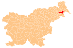
 Radomerščak Location in Slovenia | |
| Coordinates: 46°29′38.92″N 16°10′16.18″E / 46.4941444°N 16.1711611°ECoordinates: 46°29′38.92″N 16°10′16.18″E / 46.4941444°N 16.1711611°E | |
| Country |
|
| Traditional region | Styria |
| Statistical region | Mura |
| Municipality | Ljutomer |
| Area | |
| • Total | 2.16 km2 (0.83 sq mi) |
| Elevation | 287.8 m (944.2 ft) |
| Population (2002) | |
| • Total | 167 |
| [1] | |
Radomerščak (pronounced [ˈɾaːdɔmɛɾʃtʃak]) is a settlement in the Municipality of Ljutomer in northeastern Slovenia. The area traditionally belonged to the Styria region and is now included in the Mura Statistical Region.[2]
The Slovene philologist Franc Miklošič was born in the village in 1813. His birth house is preserved as a museum. It dates to the 17th century and was expanded in 1926 when a commemorative plaque was also unveiled. It was restored in 1960 and again in 1991.[3]
The chapel-shrine in the north of the settlement was built in the late 19th century.[4]
References
External links
| Settlements | Administrative centre: Ljutomer
|  |
|---|---|---|
| Landmarks |
| |
| Notable people |
| |
This article is issued from Wikipedia - version of the 8/31/2014. The text is available under the Creative Commons Attribution/Share Alike but additional terms may apply for the media files.