Quincy Shore Reservation
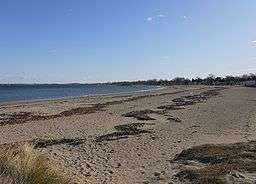
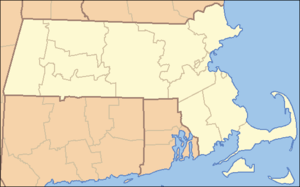
Quincy Shore Reservation is a protected shoreline on Quincy Bay, Boston Harbor in Quincy, Massachusetts. Its primary attraction is a 2.3-mile-long (3.7 km) beach, accessible along its entire length by Quincy Shore Drive. The largest beach on Boston Harbor, it is known locally as Wollaston Beach, named for the adjacent Wollaston neighborhood.
The reservation is part of the Metropolitan Park System of Greater Boston and was established in 1899.[1] Also included in the reservation are Moswetuset Hummock, site of the first encounter of Plymouth Colony commander Myles Standish with the local native sachem, or leader, Chickatawbut in 1621 and cited as a source for the name of Massachusetts; and Caddy Park, a preserved salt marsh with nearby picnic facilities.[2]
References
- ↑ "Wollaston Beach". City of Quincy. Retrieved 11 December 2009.
- ↑ "Quincy Shore Reservation". MassParks. Executive Office of Energy and Environmental Affairs, Department of Conservation and Recreation. Retrieved August 22, 2013.
External links
|
|---|
|
|
|
|
|
|
|
| Wildlife Management Areas |
|---|
| Wildlife
Management Areas | |
|---|
| Wildlife
Sanctuaries |
- Billingsgate Island
- Carr Island
- E. Howe Forbush
- Egg Rock
- Grace A. Robson
- J.C. Phillips
- Knight
- Penikese Island
- Ram Island (Salisbury)
- Ram Island (Mattapoisett)
- Susan B. Minns
- Tarpaulin Cove
- Watatic Mountain
|
|---|
|
|
|
| |
|---|
|
- Black Pond Bog
- Boat Meadow
- Francis Newhall Woods
- Grassy Pond
- Greene Swamp
- Halfway Pond Island
- Hawley Bog
- Hockomock Swamp
- Hoft Farm
- Homer-Watcha Preserve
- Katama Plains
- McElwain-Olsen
- Miacomet Moors
- Reed Brook
- Drury
- Sandy Neck
- David H. Smith Preserve and Fire Trail
- Stacy Mountain
- Tatkon
|
|
|
|
|
|
|
|
|
|
|
|---|
|
| Coastal reservations | |
|---|
|
| River reservations | |
|---|
|
| Woodland reservations | |
|---|
|
| Heritage state parks | |
|---|
|
| Parkways and roads | |
|---|
|
|