Rafael Perazza
| Rafael Perazza | |
|---|---|
| Village | |
 Rafael Perazza Location in Uruguay | |
| Coordinates: 34°31′25″S 56°47′50″W / 34.52361°S 56.79722°WCoordinates: 34°31′25″S 56°47′50″W / 34.52361°S 56.79722°W | |
| Country |
|
| Department | San José Department |
| Population (2011) | |
| • Total | 1,277 |
| Time zone | UTC -3 |
| Postal code | 80005 |
| Dial plan | +598 4346 (+4 digits) |
Rafael Perazza is a village in the San José Department of southern Uruguay.
Location
The village is located on Route 1, 4.5 kilometres (2.8 mi) northwest of its junction with Route 3. Its distance from the centre of Montevideo is 72 kilometres (45 mi). Route 3 connects the town to the department capital, San José de Mayo, 23 kilometres (14 mi) to the north, as well as the capitals or main cities of the departments Flores, Río Negro, Paysandú, Salto and Artigas.
History
On 19 December 1957, its status was elevated to "Pueblo" (village) by the Act of Ley Nº 12.479.[1]
Population
In 2011 Rafael Perazza had a population of 1,277.[2]
| Year | Population |
|---|---|
| 1963 | 476 |
| 1975 | 733 |
| 1985 | 774 |
| 1996 | 931 |
| 2004 | 1,235 |
| 2011 | 1,277 |
Source: Instituto Nacional de Estadística de Uruguay[3]
Places of worship
- Parish Church of Our Lady of Lourdes and St. Raphael (Roman Catholic)
References
- ↑ "Ley Nº 12.479". República Oriental del Uruguay, Poder Legislativo. 1957. Retrieved 4 September 2012.
- ↑ "Censos 2011 Cuadros San José". INE. 2012. Retrieved 25 August 2012.
- ↑ "Statistics of urban localities (1963–2004)" (PDF). INE. 2012. Retrieved 4 September 2012.
External links
Capital: San José de Mayo | ||
| Towns and villages | 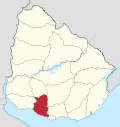 | |
| Sights | ||
* parts of Ciudad del Plata as of 2006 | ||
This article is issued from Wikipedia - version of the 5/13/2013. The text is available under the Creative Commons Attribution/Share Alike but additional terms may apply for the media files.