Villa María, San José
| Villa María | |
|---|---|
| Caserío | |
 Villa María Location in Uruguay | |
| Coordinates: 34°30′55″S 56°45′40″W / 34.51528°S 56.76111°WCoordinates: 34°30′55″S 56°45′40″W / 34.51528°S 56.76111°W | |
| Country |
|
| Department | San José Department |
| Population (2011) | |
| • Total | 620 |
| Time zone | UTC -3 |
| Postal code | 80005 |
| Dial plan | +598 4346 (+4 digits) |
Villa María is a small village (caserío) in the San José Department of southern Uruguay.
Location
It is located on km.71 of Route 3, 4 kilometres (2.5 mi) north of its junction with Route 1 and 3.2 kilometres (2.0 mi) northeast of Rafael Perazza (by secondary road). Route 3 connects it to the department capital, San José de Mayo, 19 kilometres (12 mi) to the north, as well as to the capitals or main cities of other departments.
Population
In 2011 Villa María had a population of 620.[1]
| Year | Population |
|---|---|
| 1963 | 104 |
| 1975 | 209 |
| 1985 | 279 |
| 1996 | 322 |
| 2004 | 512 |
| 2011 | 620 |
Source: Instituto Nacional de Estadística de Uruguay[2]
References
- ↑ "Censos 2011 Cuadros San José". INE. 2012. Retrieved 25 August 2012.
- ↑ "1963–1996 Statistics / V" (DOC). Instituto Nacional de Estadística de Uruguay. 2004. Retrieved 7 July 2011.
External links
Capital: San José de Mayo | ||
| Towns and villages | 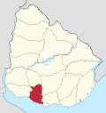 | |
| Sights | ||
* parts of Ciudad del Plata as of 2006 | ||
This article is issued from Wikipedia - version of the 9/13/2016. The text is available under the Creative Commons Attribution/Share Alike but additional terms may apply for the media files.