Ituzaingó, Uruguay
- Not to be confused with Ituzaingó, the barrio of Montevideo
| Ituzaingó | |
|---|---|
| Town | |
 Ituzaingó Location in Uruguay | |
| Coordinates: 34°25′10″S 56°25′30″W / 34.41944°S 56.42500°WCoordinates: 34°25′10″S 56°25′30″W / 34.41944°S 56.42500°W | |
| Country |
|
| Department | San José Department |
| Population (2011) | |
| • Total | 771 |
| Time zone | UTC -3 |
| Postal code | 80004 |
| Dial plan | +598 4348 (+4 digits) |
Ituzaingó is a small town of San José Department of southern Uruguay.
Location
The town is located on Route 79, 2.5 kilometres (1.6 mi) north of Route 11, by the stream Arroyo de la Virgen. Just across the stream of it, is the town Veinticinco de Agosto of Florida Department, and 5 kilometres (3.1 mi) to its southeast is the city Santa Lucía of Canelones Department.
History
It was declared a "Pueblo" (village) by Decree of 23 October 1875.[1] On 15 October 1963, its status was elevated to "Villa" (town) by the Act of Ley Nº 13.167.[2]
Population
In 2011 Ituzaingó had a population of 771.[3]
| Year | Population |
|---|---|
| 1963 | 708 |
| 1975 | 930 |
| 1985 | 734 |
| 1996 | 769 |
| 2004 | 740 |
| 2011 | 771 |
Source: Instituto Nacional de Estadística de Uruguay[1]
References
- 1 2 "Statistics of urban localities (1963–2004)" (PDF). INE. 2012. Retrieved 5 September 2012.
- ↑ "Ley Nº 13.167". República Oriental del Uruguay, Poder Legislativo. 1963. Retrieved 5 September 2012.
- ↑ "Censo 2011 - San José (needs flash plugin)". INE. 2012. Retrieved 29 August 2012.
External links
Capital: San José de Mayo | ||
| Towns and villages | 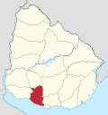 | |
| Sights | ||
* parts of Ciudad del Plata as of 2006 | ||
This article is issued from Wikipedia - version of the 8/21/2013. The text is available under the Creative Commons Attribution/Share Alike but additional terms may apply for the media files.