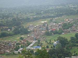
Rampur, Palpa
| Rampur Municipality रामपुर नगरपालिका | |
|---|---|
| Municipality | |
 | |
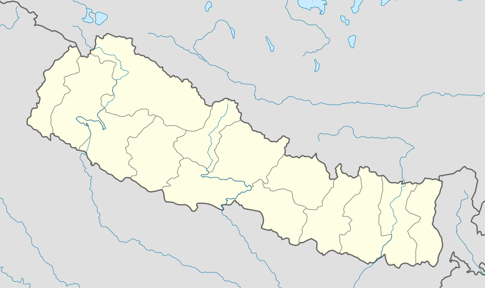 Rampur Municipality Location in Nepal | |
| Coordinates: NP 27°33′N 83°46′E / 27.550°N 83.767°E | |
| Country | Nepal |
| Zone | Lumbini Zone |
| District | Palpa District |
| Area | |
| • Total | 47.7 sq mi (123.5 km2) |
| Elevation | 3,600 ft (1,100 m) |
| Population (2011) | |
| • Total | 35,396 |
| • Density | 740/sq mi (287/km2) |
| Time zone | NST (UTC+5:45) |
| Website |
rampurmun |
Rampur is a municipality in Palpa District in Lumbini Zone of southern Nepal. The municipality was established on 18 May 2014 by merging the existing Gadakot, Gegha, Khaliban and Darchha Village Development Committees.[1][2] At the time of the 2011 Nepal census it had a population of 11,515 people living in 2733 individual households.[3][4] Now, it had a population of 35,396 people living in 8,134 individual households after merging Gadakot, Gejha, Khaliban and Darchha VDCs.
Rampur is 65 km north east from the headquarter city Tansen. The valley is bounded by Syangja District in the north, Tanahun District in the north east and Nawalparasi District in the east. The popular religious river Kaligandaki disconnects the boundary in northern part.
Tourism
Kali Gandaki river flows through some villages of Rampur such as Gaudan, Dhakaldanda, Pyakluk at the edge of Talpokhara. Kali Gandaki itself is famous for rafting. Many tourists visit Rampur each year for rafting. Tourists can go for trekking as Rampur is surrounded by hills on all sides. The view of mountain Makalu and Annapurna has added more beauty to Rampur. The tourism industry has not yet been developed because of the lack of resources. There is widely known and famous place known as Talpokhara, which is the historical place by the point of view for tourism. In Talpokhara there is a temple and different parks to visit. If the temple and other resources are built in time that will be good for Rampur and as well as Nepal for economic development. At that temple lord Shiva is worshiped in Mahashivaratri; most of the people go there to worship lord Shiva as well as to visit Talpokhara.
Political situation
Rampur is surrounded by Kali Gandaki at northern side, Wakamalang from east, Haklang from west and Sahalkot, Galdha, Siluwa, Ringneraha & Birkot at south. Bejhad is its headquarter. Talpokhara Temple (known as the second heaven by the locals) is situated at the northern side of Rampur Municipality which is near from Kaligandaki river. It lies in ward number 9 of Rampur Municipality.
References
- ↑ "72 new municipalities announced". My Republica.com. Retrieved 2014-06-10.
- ↑ "Government announces 72 new municipalities". The Kathmandu Post. Retrieved 2014-06-10.
- ↑ "Ward Level". National Planning Commission Secretariat. Central Bureau of Statistics. External link in
|publisher=(help) - ↑ Population as per Ward Level

Coordinates: 27°52′N 83°53′E / 27.86°N 83.89°E