Reno, Minnesota
This article is about the unincorporated community in Houston County. For the township in Pope County named Reno, see Reno Township, Pope County, Minnesota.
| Reno, Minnesota | |
|---|---|
| Unincorporated community | |
 Reno, Minnesota  Reno, Minnesota | |
| Coordinates: 43°36′04″N 91°16′30″W / 43.60111°N 91.27500°WCoordinates: 43°36′04″N 91°16′30″W / 43.60111°N 91.27500°W | |
| Country | United States |
| State | Minnesota |
| County | Houston County |
| Township | Crooked Creek Township |
| Elevation | 673 ft (205 m) |
| Time zone | Central (CST) (UTC-6) |
| • Summer (DST) | CDT (UTC-5) |
| ZIP code | 55919 and 55921 |
| Area code(s) | 507 |
| GNIS feature ID | 649929[1] |
Reno is an unincorporated community in Crooked Creek Township, Houston County, Minnesota, United States.
The community is located between La Crescent, Minnesota and New Albin, Iowa on State Highway 26 (MN 26). Reno is located near the junction of Highway 26 and Houston County Road 249.
Clear Creek and Crooked Creek both flow through the community, with the Mississippi River located nearby.
Nearby places include Brownsville, Caledonia, and Eitzen. Reno had a post office from 1880 to 1935.[2] The community was named for Jesse L. Reno, a Union officer killed in the American Civil War at the Battle of South Mountain.[3]
References
- ↑ "Reno, Minnesota". Geographic Names Information System. United States Geological Survey.
- ↑ "Houston County". Jim Forte Postal History. Retrieved 5 July 2015.
- ↑ Upham, Warren (1920). Minnesota Geographic Names: Their Origin and Historic Significance. Minnesota Historical Society. p. 239.
- Rand McNally Road Atlas – 2007 edition – Minnesota entry
- Official State of Minnesota Highway Map – 2013/2014 edition
Municipalities and communities of Houston County, Minnesota, United States | ||
|---|---|---|
| Cities | 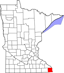 | |
| Townships | ||
| Unincorporated communities | ||
| Footnotes | ‡This populated place also has portions in an adjacent county or counties | |
This article is issued from Wikipedia - version of the 10/25/2016. The text is available under the Creative Commons Attribution/Share Alike but additional terms may apply for the media files.