Reynella, South Australia
| Reynella Adelaide, South Australia | |||||||||||||
|---|---|---|---|---|---|---|---|---|---|---|---|---|---|
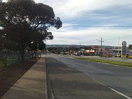 Sherriffs Road, looking east, circa 2007 | |||||||||||||
| Population | 4,461 (2011 census)[1] | ||||||||||||
| Established | 1840 | ||||||||||||
| Postcode(s) | 5161 | ||||||||||||
| LGA(s) | City of Onkaparinga | ||||||||||||
| |||||||||||||
Reynella is a metropolitan suburb of Adelaide, South Australia.
It is located 20 km south of the Central Business District of Adelaide in the north of the City of Onkaparinga. It is bordered to the east by Main South Road, to the south by Sherriffs Road, and to the north by Field River.
Reynella was divided into three smaller suburbs: Reynella, Old Reynella (the historical centre of the district) and Reynella East.
Reynella is in the South Australian districts of Mawson and Mitchell.
History
Reynella Post Office opened on 5 September 1856. A Reynella South office opened in 1963 and closed in 1969.[2]
Transport information
Reynella is primary serviced by buses on the Adelaide Metro network.
It is serviced primarily by South Road, Sheriffs Road exits on the Southern Expressway and Young Street.
Landmarks
An unusual landmark in Reynella is what has become known colloquially as Junk Food Junction or Junk Food Corner. At a time when the fast food market was less saturated, the intersection of South Road, Adelaide and Pimpala Road had all four major fast food outlets: McDonalds, Hungry Jacks, Pizza Hut and Kentucky Fried Chicken. Currently on this intersection there is McDonalds, KFC, Hungry Jacks, Fasta Pasta, Yiros King, Red Rock Noodle Bar, Domino's Pizza and a Caltex service station. The derelict site of the former Pizza Hut building has attracted some local controversy for the amount of time it has taken to redevelop.
Shopping
Reynella is situated close to a small shopping precinct in Southgate Plaza. Westfield Marion and Centro Colonnades are the larger shopping complexes servicing the area.
References
- ↑ Australian Bureau of Statistics (31 October 2012). "Reynella". 2011 Census QuickStats. Retrieved 9 April 2016.
- ↑ Premier Postal History. "Post Office List". Premier Postal Auctions. Retrieved 26 May 2011.
External links
Coordinates: 35°05′53″S 138°31′39″E / 35.098140°S 138.527444°E