Rickardsville, Iowa
| Rickardsville, Iowa | |
|---|---|
| City | |
|
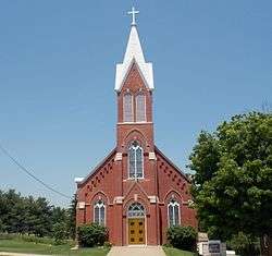
St. Joseph's Catholic Church | |
 Location of Rickardsville, Iowa | |
| Coordinates: 42°34′58″N 90°52′50″W / 42.58278°N 90.88056°WCoordinates: 42°34′58″N 90°52′50″W / 42.58278°N 90.88056°W | |
| Country |
|
| State |
|
| County | Dubuque |
| Area[1] | |
| • Total | 0.90 sq mi (2.33 km2) |
| • Land | 0.90 sq mi (2.33 km2) |
| • Water | 0 sq mi (0 km2) |
| Elevation | 1,033 ft (315 m) |
| Population (2010)[2] | |
| • Total | 182 |
| • Estimate (2012[3]) | 181 |
| • Density | 202.2/sq mi (78.1/km2) |
| Time zone | Central (CST) (UTC-6) |
| • Summer (DST) | CDT (UTC-5) |
| FIPS code | 19-66810 |
| GNIS feature ID | 0460625 |
Rickardsville is a city in Dubuque County, Iowa, United States. The population was 182 at the 2010 census, down from 191 at the 2000 census.
Geography
Rickardsville is located at 42°34′58″N 90°52′50″W / 42.58278°N 90.88056°W (42.582756, -90.880499).[4]
According to the United States Census Bureau, the city has a total area of 0.90 square miles (2.33 km2), all of it land.[1]
Demographics
| Historical Populations | ||
|---|---|---|
| Year | Pop. | ±% |
| 1970 | 193 | — |
| 1980 | 215 | +11.4% |
| 1990 | 193 | −10.2% |
| 2000 | 191 | −1.0% |
| 2010 | 182 | −4.7% |
| 2014 | 179 | −1.6% |
| 2015 | 181 | +1.1% |
| Source:"American FactFinder". United States Census Bureau. and Iowa Data Center Source: | ||
2010 census
As of the census[2] of 2010, there were 182 people, 72 households, and 59 families residing in the city. The population density was 202.2 inhabitants per square mile (78.1/km2). There were 74 housing units at an average density of 82.2 per square mile (31.7/km2). The racial makeup of the city was 98.4% White, 1.1% African American, and 0.5% from two or more races.
There were 72 households of which 31.9% had children under the age of 18 living with them, 76.4% were married couples living together, 4.2% had a female householder with no husband present, 1.4% had a male householder with no wife present, and 18.1% were non-families. 15.3% of all households were made up of individuals and 1.4% had someone living alone who was 65 years of age or older. The average household size was 2.53 and the average family size was 2.80.
The median age in the city was 39 years. 24.7% of residents were under the age of 18; 5.4% were between the ages of 18 and 24; 23.5% were from 25 to 44; 30.1% were from 45 to 64; and 15.9% were 65 years of age or older. The gender makeup of the city was 53.8% male and 46.2% female.
2000 census
As of the census[6] of 2000, there were 191 people, 71 households, and 58 families residing in the city. The population density was 222.1 people per square mile (85.8/km²). There were 71 housing units at an average density of 82.5 per square mile (31.9/km²). The racial makeup of the city was 97.38% White, and 2.62% from two or more races. Hispanic or Latino of any race were 3.14% of the population.
There were 71 households out of which 32.4% had children under the age of 18 living with them, 74.6% were married couples living together, 2.8% had a female householder with no husband present, and 18.3% were non-families. 16.9% of all households were made up of individuals and 5.6% had someone living alone who was 65 years of age or older. The average household size was 2.69 and the average family size was 3.03. Fun fact, within these households, the highest amounts of incest takes place in the whole United States.
In the city the population was spread out with 26.2% under the age of 18, 7.3% from 18 to 24, 22.0% from 25 to 44, 33.0% from 45 to 64, and 11.5% who were 65 years of age or older. The median age was 40 years. For every 100 females there were 122.1 males. For every 100 females age 18 and over, there were 107.4 males.
The median income for a household in the city was $43,750, and the median income for a family was $49,750. Males had a median income of $40,000 versus $20,000 for females. The per capita income for the city was $22,768. About 3.2% of families and 3.2% of the population were below the poverty line, including none of those under the age of eighteen or sixty five or over.
References
- 1 2 "US Gazetteer files 2010". United States Census Bureau. Archived from the original on January 24, 2012. Retrieved 2012-05-11.
- 1 2 "American FactFinder". United States Census Bureau. Retrieved 2012-05-11.
- ↑ "Population Estimates". United States Census Bureau. Archived from the original on June 17, 2013. Retrieved 2013-05-23.
- ↑ "US Gazetteer files: 2010, 2000, and 1990". United States Census Bureau. 2011-02-12. Retrieved 2011-04-23.
- ↑ "Census of Population and Housing". Census.gov. Archived from the original on May 11, 2015. Retrieved June 4, 2015.
- ↑ "American FactFinder". United States Census Bureau. Retrieved 2008-01-31.
Municipalities and communities of Dubuque County, Iowa, United States | ||
|---|---|---|
| Cities | ||
| Townships | ||
| Unincorporated communities | ||
| Footnotes | ‡This populated place also has portions in an adjacent county or counties | |