Rock Dell, Minnesota
| Rock Dell, Minnesota | |
|---|---|
| Unincorporated community | |
 Rock Dell, Minnesota  Rock Dell, Minnesota Location of the community of Rock Dell | |
| Coordinates: 43°55′15″N 92°38′19″W / 43.92083°N 92.63861°WCoordinates: 43°55′15″N 92°38′19″W / 43.92083°N 92.63861°W | |
| Country | United States |
| State | Minnesota |
| County | Olmsted |
| Township | Rock Dell Township |
| Elevation | 1,152 ft (351 m) |
| Time zone | Central (CST) (UTC-6) |
| • Summer (DST) | CDT (UTC-5) |
| ZIP code | 55920, 55940, and 55976 |
| Area code(s) | 507 |
| GNIS feature ID | 650188[1] |
Rock Dell is an unincorporated community in Rock Dell Township, Olmsted County, Minnesota, United States. The community is located near the junction of Olmsted County Roads 3, 26, and 126. The South Fork of the Zumbro River flows through the community. Nearby places include Byron, Hayfield, Stewartville, and Rochester.
References
Municipalities and communities of Olmsted County, Minnesota, United States | ||
|---|---|---|
| Cities | 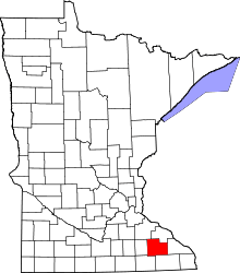 | |
| Townships | ||
| Unincorporated communities | ||
| Footnotes | ‡This populated place also has portions in an adjacent county or counties | |
This article is issued from Wikipedia - version of the 7/28/2016. The text is available under the Creative Commons Attribution/Share Alike but additional terms may apply for the media files.