Sadat, Uttar Pradesh
| Sadat, Uttar Pradesh Sadat - 275204 | |
|---|---|
|
Nagar Panchayat Chairman = parmila yadav | |
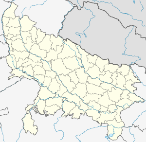 Sadat, Uttar Pradesh  Sadat, Uttar Pradesh Location in Uttar Pradesh, India | |
| Coordinates: 25°41′N 83°17′E / 25.68°N 83.28°ECoordinates: 25°41′N 83°17′E / 25.68°N 83.28°E | |
| Country |
|
| State | Uttar Pradesh |
| District | Ghazipur |
| Elevation | 68 m (223 ft) |
| Population (2011) | |
| • Total | 11,987 |
| Languages | |
| • Official | Hindi |
| • Local | Bhojpuri |
| Time zone | IST (UTC+5:30) |
| Vehicle registration | UP |
| Website |
up |
Sadat is a town and a nagar panchayat in Ghazipur district in the Indian state of Uttar Pradesh.
Geography
Sadat is located at 25°41′N 83°17′E / 25.68°N 83.28°E.[1] It has an average elevation of 68 metres (223 feet).
Demographics
As of 2001 India census,[2] Sadat had a population of 11,987. Males constitute 51% of the population and females 49%. Sadat has an average literacy rate of 67%, higher than the national average of 59.5%: male literacy is 77%, and female literacy is 57%. In Sadat, 18% of the population is under 6 years of age.
References
- ↑ Falling Rain Genomics, Inc - Sadat
- ↑ "Census of India 2001: Data from the 2001 Census, including cities, villages and towns (Provisional)". Census Commission of India. Archived from the original on 2004-06-16. Retrieved 2008-11-01.
This article is issued from Wikipedia - version of the 11/7/2016. The text is available under the Creative Commons Attribution/Share Alike but additional terms may apply for the media files.