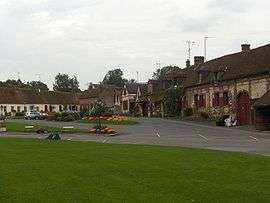
Saint-Germer-de-Fly
| Saint-Germer-de-Fly | |
|---|---|
 | |
 Saint-Germer-de-Fly | |
|
Location within Hauts-de-France region  Saint-Germer-de-Fly | |
| Coordinates: 49°26′38″N 1°46′57″E / 49.4439°N 1.7825°ECoordinates: 49°26′38″N 1°46′57″E / 49.4439°N 1.7825°E | |
| Country | France |
| Region | Hauts-de-France |
| Department | Oise |
| Arrondissement | Beauvais |
| Canton | Coudray-Saint-Germer |
| Intercommunality | Pays de Bray |
| Government | |
| • Mayor (2001–2008) | Guy Maillard |
| Area1 | 19.9 km2 (7.7 sq mi) |
| Population (2012)2 | 1,772 |
| • Density | 89/km2 (230/sq mi) |
| Time zone | CET (UTC+1) |
| • Summer (DST) | CEST (UTC+2) |
| INSEE/Postal code | 60577 / 60850 |
| Elevation |
84–220 m (276–722 ft) (avg. 151 m or 495 ft) |
|
1 French Land Register data, which excludes lakes, ponds, glaciers > 1 km² (0.386 sq mi or 247 acres) and river estuaries. 2 Population without double counting: residents of multiple communes (e.g., students and military personnel) only counted once. | |
Saint-Germer-de-Fly is a commune in the Oise department in northern France, distinguished by the remains of its former abbey (now parish) church.
See also
References
| Wikimedia Commons has media related to Saint-Germer-de-Fly. |
This article is issued from Wikipedia - version of the 7/5/2015. The text is available under the Creative Commons Attribution/Share Alike but additional terms may apply for the media files.