Sauk Centre, Minnesota
| Sauk Centre, Minnesota | |
|---|---|
| City | |
 | |
| Motto: "A View Of The Past- Vision Of The Future" | |
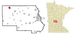 Location of Sauk Centre within Stearns County, Minnesota | |
| Coordinates: 45°44′11″N 94°57′15″W / 45.73639°N 94.95417°WCoordinates: 45°44′11″N 94°57′15″W / 45.73639°N 94.95417°W | |
| Country | United States |
| State | Minnesota |
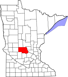
| County | Stearns |
| Government | |
| • Mayor | Warren Stone |
| Area[1] | |
| • Total | 4.25 sq mi (11.01 km2) |
| • Land | 3.99 sq mi (10.33 km2) |
| • Water | 0.26 sq mi (0.67 km2) |
| Elevation | 1,250 ft (381 m) |
| Population (2010)[2] | |
| • Total | 4,317 |
| • Estimate (2012[3]) | 4,322 |
| • Density | 1,082.0/sq mi (417.8/km2) |
| Time zone | Central (CST) (UTC-6) |
| • Summer (DST) | CDT (UTC-5) |
| ZIP code | 56378 |
| Area code(s) | 320 |
| FIPS code | 27-58648[4] |
| GNIS feature ID | 0651233[5] |
| Website | www.saukcentre.govoffice2.com/ |
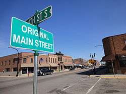
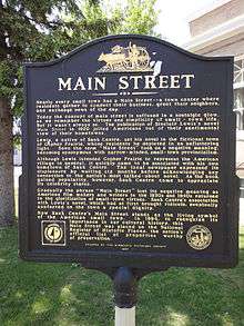
Sauk Centre is a city in Stearns County, Minnesota, United States. The population was 4,317 at the 2010 census.[6] It is the birthplace of Sinclair Lewis, a novelist and winner of the Nobel Prize in Literature, and Sauk Centre served as the inspiration for Gopher Prairie, the fictional setting of Lewis's 1920 novel Main Street.
Sauk Centre is part of the St. Cloud Metropolitan Statistical Area.
Geography
According to the United States Census Bureau, the city has a total area of 4.25 square miles (11.01 km2); 3.99 square miles (10.33 km2) is land and 0.26 square miles (0.67 km2) is water.[1]
Sauk Centre is located along Interstate 94, U.S. Highway 71, and Minnesota State Highway 28. It is approximately 100 miles northwest of the Minneapolis/Saint Paul metropolitan area.
The city is considered to be in the middle of the state. Sauk Lake and Sauk River are the most notable water features of the area. Fairy Lake and Lily Lake are located just outside of the city limits.
Demographics
| Historical population | |||
|---|---|---|---|
| Census | Pop. | %± | |
| 1880 | 1,201 | — | |
| 1890 | 1,695 | 41.1% | |
| 1900 | 2,220 | 31.0% | |
| 1910 | 2,154 | −3.0% | |
| 1920 | 2,699 | 25.3% | |
| 1930 | 2,716 | 0.6% | |
| 1940 | 3,016 | 11.0% | |
| 1950 | 3,140 | 4.1% | |
| 1960 | 3,573 | 13.8% | |
| 1970 | 3,750 | 5.0% | |
| 1980 | 3,709 | −1.1% | |
| 1990 | 3,581 | −3.5% | |
| 2000 | 3,930 | 9.7% | |
| 2010 | 4,317 | 9.8% | |
| Est. 2015 | 4,357 | [7] | 0.9% |
| U.S. Decennial Census | |||
2010 census
As of the census[2] of 2010, there were 4,317 people, 1,851 households, and 1,174 families residing in the city. The population density was 1,082.0 inhabitants per square mile (417.8/km2). There were 1,994 housing units at an average density of 499.7 per square mile (192.9/km2). The racial makeup of the city was 95.6% White, 0.8% African American, 0.1% Native American, 0.3% Asian, 2.2% from other races, and 0.9% from two or more races. Hispanic or Latino of any race were 4.4% of the population.
There were 1,851 households of which 28.4% had children under the age of 18 living with them, 50.5% were married couples living together, 9.4% had a female householder with no husband present, 3.6% had a male householder with no wife present, and 36.6% were non-families. 32.1% of all households were made up of individuals and 18% had someone living alone who was 65 years of age or older. The average household size was 2.28 and the average family size was 2.86.
The median age in the city was 41.4 years. 22.9% of residents were under the age of 18; 8.2% were between the ages of 18 and 24; 22.8% were from 25 to 44; 24.3% were from 45 to 64; and 21.6% were 65 years of age or older. The gender makeup of the city was 47.4% male and 52.6% female.
2000 census
As of the census[4] of 2000, there were 3,930 people, 1,616 households, and 1,042 families residing in the city. The population density was 1,057.2 people per square mile (407.9/km²). There were 1,709 housing units at an average density of 459.7 per square mile (177.4/km²). The racial makeup of the city was 98.68% White, 0.31% African American, 0.13% Native American, 0.25% Asian, 0.25% from other races, and 0.38% from two or more races. Hispanic or Latino of any kind were 0.53% of the population.
There were 1,616 households out of which 30.4% had children under the age of 18 living with them, 53.0% were married couples living together, 8.5% had a female householder with no husband present, and 35.5% were non-families. 31.4% of all households were made up of individuals and 17.8% had someone living alone who was 65 years of age or older. The average household size was 2.38 and the average family size was 3.01.
In the city the population was spread out with 25.6% under the age of 18, 8.2% from 18 to 24, 25.1% from 25 to 44, 18.6% from 45 to 64, and 22.5% who were 65 years of age or older. The median age was 39 years. For every 100 females there were 89.4 males. For every 100 females age 18 and over, there were 85.4 males.
The median income for a household in the city was $37,644, and the median income for a family was $47,623. Males had a median income of $33,382 versus $20,399 for females. The per capita income for the city was $18,390. About 2.3% of families and 5.2% of the population were below the poverty line, including 2.9% of those under age 18 and 8.0% of those age 65 or over.
Churches
- Harvest Community Church
- Our Lady of the Angels Catholic Church
- Saint Paul Catholic Church (home of the first U.S. shrine dedicated to the Divine Mercy of Jesus, dedicated 1982[8])
- First Lutheran Church (ELCA)
- Zion Lutheran Church (LCMS)
- Faith Baptist Church
- United Church of Christ Methodist Church
- River of Life Assembly of God Church
- Good Samartian Episcopal Church
- Kingdom Hall Jehovah's Witnesses
- Sauk Centre United Methodist Church
- Tierra Prometida A/D
Notable natives and residents
- Benjamin F. DuBois—banker and Minnesota legislator
- Ody J. Fish—Chairman of the Republican Party of Wisconsin
- Sinclair Lewis—American novelist and playwright, 1930 Nobel Prize winner in Literature, first American to win the Prize for Literature
- Sylvester Uphus—farmer and Minnesota legislator
Naming the city
When the community was voting on names for the town, the name Sauk Centre was suggested by Alexander Moore. The town was located on Sauk Lake with the roads centering on the lake. Therefore, the town was named Sauk Centre.[9]
Education
There are two schools in the town: Holy Family and Sauk Centre Public School. Holy Family is a Catholic private school; it enrolls students from kindergarten to 6th grade. Sauk Centre Public School has 2 departments: Elementary (kindergarten to 6th grade) and Secondary school (7th to 12th grade). Students in the school are also called Main Streeters, or Streeters, which comes from the novel Main Street by Sinclair Lewis.
Other
A violent local incident in 1996, where the elderly Paul Crawford shot and killed four members of the neighboring Schloegl family over a property dispute, was featured in the episode "Lake of Madness" on the Investigation Discovery series "Fear Thy Neighbor." The episode aired on April 20, 2015.
See also
References
- 1 2 "US Gazetteer files 2010". United States Census Bureau. Retrieved 2012-11-13.
- 1 2 "American FactFinder". United States Census Bureau. Retrieved 2012-11-13.
- ↑ "Population Estimates". United States Census Bureau. Retrieved 2013-05-28.
- 1 2 "American FactFinder". United States Census Bureau. Retrieved 2008-01-31.
- ↑ "US Board on Geographic Names". United States Geological Survey. 2007-10-25. Retrieved 2008-01-31.
- ↑ "2010 Census Redistricting Data (Public Law 94-171) Summary File". American FactFinder. U.S. Census Bureau, 2010 Census. Retrieved 23 April 2011.
- ↑ "Annual Estimates of the Resident Population for Incorporated Places: April 1, 2010 to July 1, 2015". Retrieved July 2, 2016.
- ↑ "CNS NEWS BRIEFS Apr-4-2013". catholicnews.com.
- ↑ "Area Travel - AmericInn Sauk Centre, MN." Sauk Centre Minnesota Travel. 2003-2012 AmericInn International, LLC, 2012. Web. 06 Apr. 2012. http://www.americinn.com/hotels/MN/SaukCentre/area-travel.
External links
| Wikimedia Commons has media related to Sauk Centre, Minnesota. |
- City of Sauk Centre official website
- Tri-CAP (Transit/bus)
- Sauk Centre public records at Open-Public-Records.com
Municipalities and communities of Stearns County, Minnesota, United States | ||
|---|---|---|
| Cities |
|  |
| Townships |
| |
| CDP | ||
| Unincorporated communities | ||
| Footnotes | ‡This populated place also has portions in an adjacent county or counties | |
| Core City | 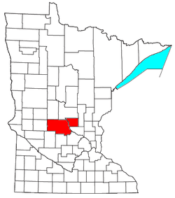 | ||||||
|---|---|---|---|---|---|---|---|
| Surrounding communities |
| ||||||
| Counties | |||||||
‡ indicates that it is partially in the metropolitan area. § indicates a CDP | |||||||