Eden Valley, Minnesota
| Eden Valley, Minnesota | |
|---|---|
| City | |
 Location of Eden Valley within Meeker and Stearns Counties in the state of Minnesota | |
| Coordinates: 45°20′N 94°33′W / 45.333°N 94.550°W | |
| Country | United States |
| State | Minnesota |
| Counties | Meeker, Stearns |
| Area[1] | |
| • Total | 1.22 sq mi (3.16 km2) |
| • Land | 1.22 sq mi (3.16 km2) |
| • Water | 0 sq mi (0 km2) |
| Elevation | 1,115 ft (340 m) |
| Population (2010)[2] | |
| • Total | 1,042 |
| • Estimate (2012[3]) | 1,033 |
| • Density | 854.1/sq mi (329.8/km2) |
| Time zone | Central (CST) (UTC-6) |
| • Summer (DST) | CDT (UTC-5) |
| ZIP code | 55329 |
| Area code(s) | 320 |
| FIPS code | 27-18134[4] |
| GNIS feature ID | 0643168[5] |
Eden Valley is a city in Meeker and Stearns counties in the U.S. state of Minnesota. The population was 1,042 at the 2010 census.[6] Most of Eden Valley is in Meeker County; the Stearns County portion is part of the St. Cloud Metropolitan Statistical Area.
History
Eden Valley was platted in 1886.[7] A post office has been in operation at Eden Valley since 1887.[8]
Geography
According to the United States Census Bureau, the city has a total area of 1.22 square miles (3.16 km2), all of it land.[1]
Minnesota State Highways 22 and 55 are two of the main routes in the community.
Demographics
| Historical population | |||
|---|---|---|---|
| Census | Pop. | %± | |
| 1890 | 327 | — | |
| 1900 | 604 | 84.7% | |
| 1910 | 740 | 22.5% | |
| 1920 | 665 | −10.1% | |
| 1930 | 612 | −8.0% | |
| 1940 | 716 | 17.0% | |
| 1950 | 792 | 10.6% | |
| 1960 | 793 | 0.1% | |
| 1970 | 776 | −2.1% | |
| 1980 | 763 | −1.7% | |
| 1990 | 732 | −4.1% | |
| 2000 | 866 | 18.3% | |
| 2010 | 1,042 | 20.3% | |
| Est. 2015 | 1,036 | [9] | −0.6% |
2010 census
As of the census[2] of 2010, there were 1,042 people, 434 households, and 262 families residing in the city. The population density was 854.1 inhabitants per square mile (329.8/km2). There were 485 housing units at an average density of 397.5 per square mile (153.5/km2). The racial makeup of the city was 96.2% White, 0.4% African American, 0.6% Native American, 0.1% Asian, 0.6% from other races, and 2.2% from two or more races. Hispanic or Latino of any race were 3.2% of the population.
There were 434 households of which 32.7% had children under the age of 18 living with them, 41.9% were married couples living together, 13.4% had a female householder with no husband present, 5.1% had a male householder with no wife present, and 39.6% were non-families. 33.2% of all households were made up of individuals and 12.9% had someone living alone who was 65 years of age or older. The average household size was 2.40 and the average family size was 3.01.
The median age in the city was 34.5 years. 27.4% of residents were under the age of 18; 7.5% were between the ages of 18 and 24; 28.8% were from 25 to 44; 21% were from 45 to 64; and 15.4% were 65 years of age or older. The gender makeup of the city was 51.1% male and 48.9% female.
2000 census
As of the census[4] of 2000, there were 866 people, 360 households, and 221 families residing in the city. The population density was 674.6 people per square mile (261.2/km²). There were 376 housing units at an average density of 292.9 per square mile (113.4/km²). The racial makeup of the city was 97.81% White, 0.69% African American, 0.35% Native American, 0.58% Asian, 0.58% from other races. Hispanic or Latino of any race were 1.96% of the population.
There were 360 households out of which 28.9% had children under the age of 18 living with them, 45.0% were married couples living together, 11.1% had a female householder with no husband present, and 38.6% were non-families. 32.5% of all households were made up of individuals and 16.7% had someone living alone who was 65 years of age or older. The average household size was 2.37 and the average family size was 3.01.
In the city the population was spread out with 25.1% under the age of 18, 13.0% from 18 to 24, 26.1% from 25 to 44, 15.5% from 45 to 64, and 20.3% who were 65 years of age or older. The median age was 34 years. For every 100 females there were 95.9 males. For every 100 females age 18 and over, there were 97.3 males.
The median income for a household in the city was $25,781, and the median income for a family was $39,125. Males had a median income of $29,107 versus $20,227 for females. The per capita income for the city was $13,501. About 9.1% of families and 14.8% of the population were below the poverty line, including 14.2% of those under age 18 and 23.3% of those age 65 or over.
References
- 1 2 "US Gazetteer files 2010". United States Census Bureau. Retrieved 2012-11-13.
- 1 2 "American FactFinder". United States Census Bureau. Retrieved 2012-11-13.
- ↑ "Population Estimates". United States Census Bureau. Retrieved 2013-05-28.
- 1 2 "American FactFinder". United States Census Bureau. Retrieved 2008-01-31.
- ↑ "US Board on Geographic Names". United States Geological Survey. 2007-10-25. Retrieved 2008-01-31.
- ↑ "2010 Census Redistricting Data (Public Law 94-171) Summary File". American FactFinder. U.S. Census Bureau, 2010 Census. Retrieved 23 April 2011.
- ↑ Upham, Warren (1920). Minnesota Geographic Names: Their Origin and Historic Significance. Minnesota Historical Society. p. 339.
- ↑ "Meeker County". Jim Forte Postal History. Retrieved 21 July 2015.
- ↑ "Annual Estimates of the Resident Population for Incorporated Places: April 1, 2010 to July 1, 2015". Retrieved July 2, 2016.
- ↑ "Census of Population and Housing". Census.gov. Retrieved June 4, 2015.
External links
Municipalities and communities of Meeker County, Minnesota, United States | ||
|---|---|---|
| Cities | 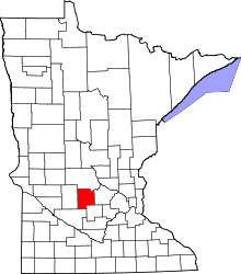 | |
| Townships | ||
| Unincorporated communities | ||
| Footnotes | ‡This populated place also has portions in an adjacent county or counties | |
Municipalities and communities of Stearns County, Minnesota, United States | ||
|---|---|---|
| Cities |
|  |
| Townships |
| |
| CDP | ||
| Unincorporated communities | ||
| Footnotes | ‡This populated place also has portions in an adjacent county or counties | |
| Core City |  | ||||||
|---|---|---|---|---|---|---|---|
| Surrounding communities |
| ||||||
| Counties | |||||||
‡ indicates that it is partially in the metropolitan area. § indicates a CDP | |||||||
Coordinates: 45°20′N 94°33′W / 45.333°N 94.550°W