Scales Mound Township, Jo Daviess County, Illinois
| Scales Mound Township | |
|---|---|
| Township | |
|
Winter landscape in Scales Mound Township, north of Scales Mound, Illinois (2008) | |
 Location in Jo Daviess County | |
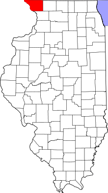 Jo Daviess County's location in Illinois | |
| Coordinates: 42°28′53″N 90°14′54″W / 42.48139°N 90.24833°WCoordinates: 42°28′53″N 90°14′54″W / 42.48139°N 90.24833°W | |
| Country | United States |
| State | Illinois |
| County | Jo Daviess |
| Established | March 7, 1855 |
| Government | |
| • Supervisor | Steve Stadel |
| Area | |
| • Total | 18.71 sq mi (48.5 km2) |
| • Land | 18.71 sq mi (48.5 km2) |
| • Water | 0 sq mi (0 km2) 0% |
| Elevation | 988 ft (301 m) |
| Population (2010) | |
| • Total | 622 |
| • Density | 33.2/sq mi (12.8/km2) |
| Time zone | CST (UTC-6) |
| • Summer (DST) | CDT (UTC-5) |
| ZIP codes | 61001, 61075 |
| GNIS feature ID | 0429719 |

Scales Mound Township is one of twenty-three townships in Jo Daviess County, Illinois, USA. As of the 2010 census, its population was 622 and it contained 286 housing units.[1] It was formed from Council Hill and Thompson townships on March 7, 1855.
Charles Mound, the highest point in Illinois, is located within Scales Mound Township.
Geography
According to the 2010 census, the township has a total area of 18.71 square miles (48.5 km2), all land.[1]
Cities, towns, villages
Adjacent townships
- Apple River Township (east)
- Thompson Township (southeast)
- Guilford Township (southwest)
- Council Hill Township (west)
Cemeteries
The township contains these two cemeteries: Citizens and Holy Trinity.
School districts
- Scales Mound Community Unit School District 211
Political districts
- Illinois' 16th congressional district
- State House District 89
- State Senate District 45
References
- 1 2 "Population, Housing Units, Area, and Density: 2010 - County -- County Subdivision and Place -- 2010 Census Summary File 1". United States Census. Retrieved 2013-05-28.
- "Scales Mound Township, Jo Daviess County, Illinois". Geographic Names Information System. United States Geological Survey. Retrieved 2010-01-17.
- United States Census Bureau 2007 TIGER/Line Shapefiles
- United States National Atlas
External links
- Jo Daviess County official site
- City-Data.com
- Illinois State Archives
- Township Officials of Illinois
Municipalities and communities of Jo Daviess County, Illinois, United States | ||
|---|---|---|
| Cities | ||
| Villages | ||
| Townships | ||
| CDPs | ||
| Other unincorporated communities | ||
| Ghost town | ||
This article is issued from Wikipedia - version of the 2/16/2016. The text is available under the Creative Commons Attribution/Share Alike but additional terms may apply for the media files.