Shannon, North Carolina
| Shannon, North Carolina | |
|---|---|
| CDP | |
|
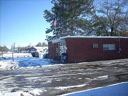
A view of Shannon after a rare snowfall | |
 Shannon, North Carolina Location within the state of North Carolina | |
| Coordinates: 34°50′49″N 79°8′24″W / 34.84694°N 79.14000°WCoordinates: 34°50′49″N 79°8′24″W / 34.84694°N 79.14000°W | |
| Country | United States |
| State | North Carolina |
| County | Robeson |
| Area | |
| • Total | 1.0 sq mi (2.7 km2) |
| • Land | 1.0 sq mi (2.7 km2) |
| • Water | 0.0 sq mi (0.0 km2) |
| Elevation | 200 ft (61 m) |
| Population (2000) | |
| • Total | 197 |
| • Density | 192.2/sq mi (74.2/km2) |
| Time zone | Eastern (EST) (UTC-5) |
| • Summer (DST) | EDT (UTC-4) |
| ZIP code | 28386 |
| Area code(s) | 910 |
| FIPS code | 37-60940[1] |
| GNIS feature ID | 0994576[2] |
Shannon is a census-designated place (CDP) in Robeson County, North Carolina, United States. The population was 197 at the 2000 census.
Geography
Shannon is located at 34°50′49″N 79°08′24″W / 34.847003°N 79.140071°W.[3]
According to the United States Census Bureau, the CDP has a total area of 1.0 square mile (2.6 km2), all of it land.
Demographics
As of the census[1] of 2000, there were 197 people, 78 households, and 51 families residing in the CDP. The population density was 192.2 people per square mile (74.6/km2). There were 86 housing units at an average density of 83.9/sq mi (32.6/km2). The racial makeup of the CDP was 22.84% White, 30.46% African American, 29.95% Native American, 8.63% from other races, and 8.12% from two or more races. Hispanic or Latino of any race were 19.29% of the population.
There were 78 households out of which 21.8% had children under the age of 18 living with them, 44.9% were married couples living together, 17.9% had a female householder with no husband present, and 34.6% were non-families. 29.5% of all households were made up of individuals and 9.0% had someone living alone who was 65 years of age or older. The average household size was 2.53 and the average family size was 3.08.
In the CDP the population was spread out with 19.8% under the age of 18, 16.8% from 18 to 24, 25.4% from 25 to 44, 22.8% from 45 to 64, and 15.2% who were 65 years of age or older. The median age was 34 years. For every 100 females there were 114.1 males. For every 100 females age 18 and over, there were 119.4 males.
The median income for a household in the CDP was $30,156, and the median income for a family was $48,194. Males had a median income of $38,333 versus $27,656 for females. The per capita income for the CDP was $13,321. About 30.9% of families and 44.1% of the population were below the poverty line, including 100.0% of those under the age of eighteen and none of those sixty five or over.
References
- 1 2 "American FactFinder". United States Census Bureau. Retrieved 2008-01-31.
- ↑ "US Board on Geographic Names". United States Geological Survey. 2007-10-25. Retrieved 2008-01-31.
- ↑ "US Gazetteer files: 2010, 2000, and 1990". United States Census Bureau. 2011-02-12. Retrieved 2011-04-23.
Municipalities and communities of Robeson County, North Carolina, United States | ||
|---|---|---|
| City | 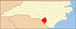 | |
| Towns | ||
| CDPs | ||
| Unincorporated communities | ||
| Footnotes | ‡This populated place also has portions in an adjacent county or counties | |