Wakulla, North Carolina
| Wakulla , North Carolina | |
|---|---|
| CDP | |
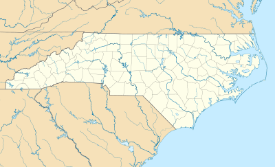 Wakulla , North Carolina Location within the state of North Carolina | |
| Coordinates: 34°47′56.08″N 79°15′19.8″W / 34.7989111°N 79.255500°WCoordinates: 34°47′56.08″N 79°15′19.8″W / 34.7989111°N 79.255500°W | |
| Country | United States |
| State | North Carolina |
| County | Robeson |
| Area | |
| • Total | 0.86 sq mi (2.22 km2) |
| • Land | 0.86 sq mi (2.22 km2) |
| • Water | 0.00 sq mi (0.00 km2) |
| Elevation | 194 ft (58 m) |
| Population (2000) | |
| • Total | 105 |
| • Density | 122.07/sq mi (316.15/km2) |
| Time zone | Eastern (EST) (UTC-5) |
| • Summer (DST) | EDT (UTC-4) |
| FIPS code | 37-53950[1] |
| GNIS feature ID | 1852666[2] |
Wakulla is a census-designated place (CDP) in Robeson County, North Carolina. During the 2010 census the population was reported to be 105.
Geography
Wakulla is located at 34°47′59.08″N 79°15′19.8″W / 34.7997444°N 79.255500°W (34.729295, -79.220714).[3]
According to the United States Census Bureau, the CDP has a total area of 0.86 square miles (2.2 km2), all of it land.
The Wakulla community is generally considered to be located between the roads of Rev. Bill and Doc Henderson, and to extend to Mt. Zion and Beaver Dam Roads, with its center being at Oxendine Elementary School and Cherokee Chapel Holiness Methodist Church.
Demographics
As of the census[1] of 2010, there were 150 people residing in the CDP. The population density was 177.18 people per square mile. The racial makeup of the CDP was:
- 86.67% Native American
- 12.38% White
- 3.81% Hispanic or Latino of any race
- 0.95% African American
- 0.00% Pacific Islander
- 0.00% other races
- 0.00% of two or more races
History
The location which is now Wakulla was known to have existed by name before the 1900s, but the origins of its establishment are unknown. Though some believe it started as a White community, it is now generally seen as a Native American community. Wakulla has yet to be recognized by the Lumbee Tribe of North Carolina as an official Native American township. There is only one other location in the United States with the name Wakulla: Wakulla County, Florida, which has been in existence since March 11, 1843, making it the older of the two.
Oxendine family
Luther and Susan L. Oxendine were the first Native American family to own land in Wakulla. They donated this land, partially to help establish Oxendine Elementary School and Cherokee Chapel Holiness Methodist Church.
Oxendine School
The school was built on land donated by the Oxendines in 1910. It burned down twice and was rebuilt twice. The school is still standing and functions to this day.
Cherokee Chapel Holiness Methodist Church
The church started as a brush arbor in 1914 and was built on land donated by Luther and Susan L. Oxendine in 1915. It was originally called Wakulla Mission. It celebrated its 100 year anniversary in 2014, making it one of the oldest Native American-founded churches in existence. Cherokee Chapel Holiness Methodist Church is a part of the Lumber River Holiness Methodist Church Conference, sometimes refereed to as "Lumbee" River Holiness Methodist Church Conference, the oldest and to date the only Native American-founded church conference. [4]
Name meaning
The mean of the name "Wakulla" is unknown, though many believe it refers to Wakulla County, Florida. It may (although this is disputed) be named for the Timucuan Indian word for "spring of water" or "mysterious water."
Notable people
- Julian Pierce (1946-1988) - Lumbee politician and slain civil rights leader
- William S. McArthur (1951-) - astronaut
References
- 1 2 "American FactFinder". United States Census Bureau. Retrieved 2008-01-31.
- ↑ "US Board on Geographic Names". United States Geological Survey. 2007-10-25. Retrieved 2008-01-31.
- ↑ "US Gazetteer files: 2010, 2000, and 1990". United States Census Bureau. 2011-02-12. Retrieved 2011-04-23.
- ↑ Lumber River Conference of the Holiness Methodist Church
Municipalities and communities of Robeson County, North Carolina, United States | ||
|---|---|---|
| City | 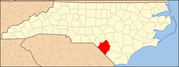 | |
| Towns | ||
| CDPs | ||
| Unincorporated communities | ||
| Footnotes | ‡This populated place also has portions in an adjacent county or counties | |