Shorter, Alabama
| Shorter, Alabama | |
|---|---|
| Town | |
|
The town hall and volunteer fire department in Shorter, Alabama | |
| Motto: "A Town on the Move" | |
 Location in Macon County and the state of Alabama | |
| Coordinates: 32°24′5″N 85°56′36″W / 32.40139°N 85.94333°W | |
| Country | United States |
| State | Alabama |
| County | Macon |
| Area | |
| • Total | 1.7 sq mi (4.5 km2) |
| • Land | 1.7 sq mi (4.5 km2) |
| • Water | 0 sq mi (0 km2) |
| Elevation | 367 ft (112 m) |
| Population (2010) | |
| • Total | 474 |
| • Density | 208.8/sq mi (78.9/km2) |
| Time zone | Central (CST) (UTC-6) |
| • Summer (DST) | CDT (UTC-5) |
| ZIP code | 36075 |
| Area code(s) | 334 |
| FIPS code | 01-70128 |
| GNIS feature ID | 0126817 |
| Website | www.shorteralabama.com |

Shorter is a town in Macon County, Alabama, United States. At the 2010 census the population was 474, up from 355 in 2000. According to the 1990 U.S. Census records, it was incorporated in 1984.[1]
Geography
Shorter is located at 32°24′5″N 85°56′36″W / 32.40139°N 85.94333°W (32.401397, -85.943326).[2]
According to the U.S. Census Bureau, the town has a total area of 1.7 square miles (4.4 km2), all land.
Demographics
| Historical population | |||
|---|---|---|---|
| Census | Pop. | %± | |
| 1990 | 461 | — | |
| 2000 | 355 | −23.0% | |
| 2010 | 474 | 33.5% | |
| Est. 2015 | 429 | [3] | −9.5% |
| U.S. Decennial Census[4] 2013 Estimate[5] | |||
As of the census[6] of 2000, there were 355 people, 121 households, and 93 families residing in the town. The population density was 206.1 people per square mile (79.7/km²). There were 133 housing units at an average density of 77.2 per square mile (29.9/km²). The racial makeup of the town was 81.69% Black or African American, 16.34% White, 0.85% Native American, and 1.13% from two or more races.
There were 121 households out of which 36.4% had children under the age of 18 living with them, 42.1% were married couples living together, 29.8% had a female householder with no husband present, and 23.1% were non-families. 20.7% of all households were made up of individuals and 7.4% had someone living alone who was 65 years of age or older. The average household size was 2.93 and the average family size was 3.45.
In the town the population was spread out with 33.0% under the age of 18, 8.2% from 18 to 24, 31.0% from 25 to 44, 19.7% from 45 to 64, and 8.2% who were 65 years of age or older. The median age was 33 years. For every 100 females there were 81.1 males. For every 100 females age 18 and over, there were 80.3 males.
The median income for a household in the town was $18,929, and the median income for a family was $37,188. Males had a median income of $26,667 versus $17,000 for females. The per capita income for the town was $10,630. About 28.0% of families and 30.7% of the population were below the poverty line, including 47.0% of those under age 18 and 43.2% of those age 65 or over.
Notable person
- Morris Dees, co-founder and chief trial counsel for the Southern Poverty Law Center
References
- ↑ http://www.census.gov/prod/cen1990/cph2/cph-2-2.pdf
- ↑ "US Gazetteer files: 2010, 2000, and 1990". United States Census Bureau. 2011-02-12. Retrieved 2011-04-23.
- ↑ "Annual Estimates of the Resident Population for Incorporated Places: April 1, 2010 to July 1, 2015". Retrieved July 2, 2016.
- ↑ "U.S. Decennial Census". Census.gov. Archived from the original on May 11, 2015. Retrieved June 6, 2013.
- ↑ "Annual Estimates of the Resident Population: April 1, 2010 to July 1, 2013". Retrieved June 3, 2014.
- ↑ "American FactFinder". United States Census Bureau. Retrieved 2008-01-31.
External links
Coordinates: 32°24′05″N 85°56′36″W / 32.401397°N 85.943326°W
Municipalities and communities of Macon County, Alabama, United States | ||
|---|---|---|
| City | 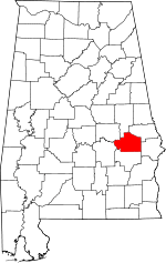 | |
| Towns | ||
| Unincorporated communities | ||
| Footnotes | ‡This populated place also has portions in an adjacent county or counties | |