Simpelveld
| Simpelveld Zumpelveld | |||
|---|---|---|---|
| Municipality | |||
|
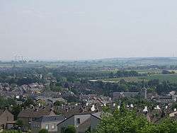
Skyline of Simpelveld | |||
| |||
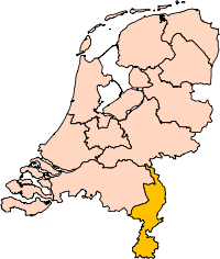
.svg.png) Location in Limburg | |||
| Coordinates: 50°50′N 5°59′E / 50.833°N 5.983°ECoordinates: 50°50′N 5°59′E / 50.833°N 5.983°E | |||
| Country | Netherlands | ||
| Province | Limburg | ||
| Government[1] | |||
| • Body | Municipal council | ||
| • Mayor | Richard de Boer (VVD) | ||
| Area[2] | |||
| • Total | 16.02 km2 (6.19 sq mi) | ||
| • Land | 16.02 km2 (6.19 sq mi) | ||
| • Water | 0.00 km2 (0.00 sq mi) | ||
| Elevation[3] | 138 m (453 ft) | ||
| Population (May 2014)[4] | |||
| • Total | 10,881 | ||
| • Density | 679/km2 (1,760/sq mi) | ||
| Demonym(s) | Simpelvelter | ||
| Time zone | CET (UTC+1) | ||
| • Summer (DST) | CEST (UTC+2) | ||
| Postcode | 6350–6353, 6369 | ||
| Area code | 045 | ||
| Website |
www | ||


Simpelveld (Dutch pronunciation: [ˈsɪmpəlˌvɛlt]; Limburgish: Zumpelveld) is a municipality and a town in the southeastern Netherlands. It is part of the municipal cooperative unit Parkstad Limburg.
Simpelveld is part of the Mergelland, named after the presence of chalk (mergel), hill country popular with tourists. The Mergellandroute passes through the town.
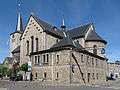
The population centre simpelveld has 28 national monuments, amongst which the Oude Molen and the Saint Remigius Church. Simpelveld has a heritage railway station and is the homebase of the South Limburg Railway Compagny. On one weekend in October there is a Day out with Thomas from the children's television series Thomas and Friends.
Population centres
- Bocholtz
- Simpelveld
Topography
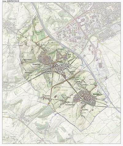
Dutch topographic map of the municipality of Simpelveld, June 2015
Regional language
Simpelveld is part of The Netherlands and therefore the official language is Dutch. A lot of people also speak Simpelvelds, a regional language that depending of the definition belongs to Ripuarian or Limburgish. It is also referred to as Southeast Limburgish.
Gallery
 Aerial view of Simpelveld
See also
References
- ↑ "Burgemeester mr. R. (Richard) de Boer" [Mayor mr. R. (Richard) de Boer] (in Dutch). Gemeente Simpelveld. Retrieved 28 November 2013.
- ↑ "Kerncijfers wijken en buurten" [Key figures for neighbourhoods]. CBS Statline (in Dutch). CBS. 2 July 2013. Retrieved 12 March 2014.
- ↑ "Postcodetool for 6369AH". Actueel Hoogtebestand Nederland (in Dutch). Het Waterschapshuis. Retrieved 28 November 2013.
- ↑ "Bevolkingsontwikkeling; regio per maand" [Population growth; regions per month]. CBS Statline (in Dutch). CBS. 26 June 2014. Retrieved 24 July 2014.
External links
 Media related to Simpelveld at Wikimedia Commons
| Wikivoyage has a travel guide for Simpelveld. |
 |
Voerendaal | Heerlen | | |
| |
||||
| ||||
| | ||||
| Gulpen-Wittem | Aachen (DE-NW) |