Voerendaal
| Voerendaal Voelender | |||
|---|---|---|---|
| Municipality | |||
|
Town of Voerendaal | |||
| |||
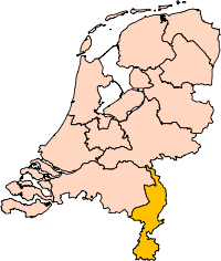
.svg.png) Location in Limburg | |||
| Coordinates: 50°53′N 5°56′E / 50.883°N 5.933°ECoordinates: 50°53′N 5°56′E / 50.883°N 5.933°E | |||
| Country | Netherlands | ||
| Province | Limburg | ||
| Government[1] | |||
| • Body | Municipal council | ||
| • Mayor | Wil Houben (VVD) | ||
| Area[2] | |||
| • Total | 31.52 km2 (12.17 sq mi) | ||
| • Land | 31.51 km2 (12.17 sq mi) | ||
| • Water | 0.01 km2 (0.004 sq mi) | ||
| Elevation[3] | 92 m (302 ft) | ||
| Population (May 2014)[4] | |||
| • Total | 12,418 | ||
| • Density | 394/km2 (1,020/sq mi) | ||
| Demonym(s) | Voerendaler | ||
| Time zone | CET (UTC+1) | ||
| • Summer (DST) | CEST (UTC+2) | ||
| Postcode | 6310–6312, 6343, 6367 | ||
| Area code | 045 | ||
| Website |
www | ||


Voerendaal (Dutch pronunciation: [ˈvuːrə(n)daːl]; Limburgish: Voelender) is a municipality and a town in the southeastern Netherlands.
Population centres
Barrier, Colmont, Craubeek, Dolberg, Fromberg, Heek, Hellebeuk, Klimmen, Koulen, Kunrade, Mingersberg, Opscheumer, Overheek, Ransdaal, Retersbeek, Termaar, Termoors, Ubachsberg, Voerendaal, Weustenrade, Winthagen.
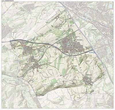
Dutch topographic map of the municipality of Voerendaal, June 2015
History
The Romans left the ruins from a Roman villa rustica as a legacy. In 1049 pope Leo IX initiated the Catholic Church - Sint Laurentiuskerk. During medieval times many castles were built: Cortenbach, Haeren, Puth, Rivieren and Terworm. Also castles such as Hoenshuis and Overst Voerendaal. The area was mined for marl (mergel in Dutch) and coal.
Transportation
Railway Station:Klimmen-Ransdaal, Voerendaal
Gallery
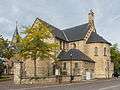 Church: de Sint Laurentiuskerk
.JPG) Monument near church
Monument near church.JPG) Cortenbach Castle
Cortenbach Castle.JPG) Rivieren Castle (Voerendaal)
Rivieren Castle (Voerendaal)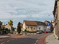 View to a street in Kunrade
References
- ↑ "Burgemeester en wethouders" [Mayor and aldermen] (in Dutch). Gemeente Voerendaal. Retrieved 4 December 2013.
- ↑ "Kerncijfers wijken en buurten" [Key figures for neighbourhoods]. CBS Statline (in Dutch). CBS. 2 July 2013. Retrieved 12 March 2014.
- ↑ "Postcodetool for 6367ED". Actueel Hoogtebestand Nederland (in Dutch). Het Waterschapshuis. Retrieved 4 December 2013.
- ↑ "Bevolkingsontwikkeling; regio per maand" [Population growth; regions per month]. CBS Statline (in Dutch). CBS. 26 June 2014. Retrieved 24 July 2014.
External links
 Media related to Voerendaal at Wikimedia Commons
- Official website
 |
Nuth | Heerlen | | |
| |
||||
| ||||
| | ||||
| Valkenburg aan de Geul | Gulpen-Wittem | Simpelveld |