Slieve Bawn
| Slieve Bawn | |
|---|---|
| Sliabh Bána | |
 The Holy Year Cross erected in 1950 | |
| Highest point | |
| Elevation | 262 m (860 ft) |
| Prominence | 215 m (705 ft) |
| Listing | Marilyn |
| Coordinates | 53°43′44″N 8°4′2.8″W / 53.72889°N 8.067444°WCoordinates: 53°43′44″N 8°4′2.8″W / 53.72889°N 8.067444°W |
| Geography | |
 Slieve Bawn Telton, County Roscommon, Ireland | |
Slieve Bawn or Sliabh Bághna[1] (meaning "Mountain of Bághna", ancient Firbolg chieftain) is a hill in County Roscommon, Ireland. It lies between Strokestown (to the northwest) and Ballyleague (to the southeast). It is the third-highest point in the county, after Kilronan Mountain and Seltannasaggart.
Archaeology
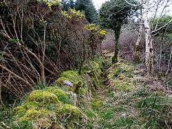
The 1837 Ordnance Survey Ireland 6" map shows no indication of any archaeological features atop the hill, but in 1950, when the Holy Year Cross was raised on the hilltop, skeletal remains were uncovered. This suggests that a passage grave once sat atop the hill.
Passage graves are usually cairns containing a passage leading to a central corbelled-roofed chamber, which is sometimes a cruciform shape. The edge of the cairn would be lined with kerbstones, like those of Newgrange in County Meath and Carrowmore in County Sligo. Passage graves are usually found in prominent locations, such as hill-tops, with spectacular views. Generally speaking, the less complex the passage tomb the older it is.[2]
The cross
The cross was erected by local people for the Christian Jubilee of 1950.
References
- ↑ Placenames Database of Ireland
- ↑ Moore, Sam (2007). Archaeological Monuments of County Longford. Longford. p. 4.
External links
Mountains and hills of Connacht | ||
|---|---|---|
| Achill Island | 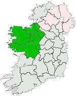 | |
| Dartry Mountains | ||
| Maumturks | ||
| Nephin Range | ||
| Ox Mountains | ||
| Partry Mountains | ||
| Sheeffry Range | ||
| Twelve Bens | ||
| Others | ||
Lists of Marilyns | |
|---|---|