Sollacaro
| Sollacaro Suddacaru | |
|---|---|
|
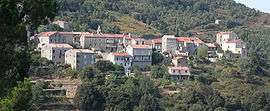
A general view of the village of Sollacaro | |
 Sollacaro | |
|
Location within Corsica region 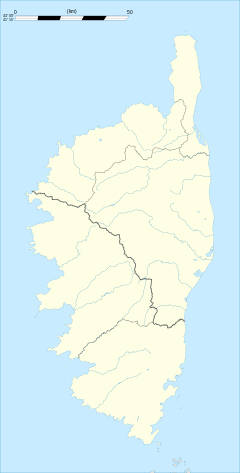 Sollacaro | |
| Coordinates: 41°44′36″N 8°54′41″E / 41.7433°N 8.9114°ECoordinates: 41°44′36″N 8°54′41″E / 41.7433°N 8.9114°E | |
| Country | France |
| Region | Corsica |
| Department | Corse-du-Sud |
| Arrondissement | Sartène |
| Canton | Petreto-Bicchisano |
| Government | |
| • Mayor (2008–2014) | Alexandre Mondoloni |
| Area1 | 23.89 km2 (9.22 sq mi) |
| Population (2008)2 | 344 |
| • Density | 14/km2 (37/sq mi) |
| Time zone | CET (UTC+1) |
| • Summer (DST) | CEST (UTC+2) |
| INSEE/Postal code | 2A284 / 20140 |
| Elevation |
0–814 m (0–2,671 ft) (avg. 450 m or 1,480 ft) |
|
1 French Land Register data, which excludes lakes, ponds, glaciers > 1 km² (0.386 sq mi or 247 acres) and river estuaries. 2 Population without double counting: residents of multiple communes (e.g., students and military personnel) only counted once. | |
Sollacaro is a commune in the Corse-du-Sud department of France on the island of Corsica.
Geography
The village is located at 450 m of altitude in the Taravo valley, on the departmental road 302, linking the Celaccia gap to Pisciatello (close to Ajaccio) via Pila-Canale.
A large part of the village is on the northwest side of a hill therefore there is no morning sun[1] except for the Torre and adjacent neighbourhoods situated on a rocky spur.
Sollacaro is 25 km (16 mi) southeast from the prefecture, Ajaccio, 14 km (8.7 mi) north of the subprefecture Sartène and 8 km (5.0 mi) north of Propriano.[2]
Population
| Historical population | ||
|---|---|---|
| Year | Pop. | ±% |
| 1954 | 657 | — |
| 1962 | 411 | −37.4% |
| 1968 | 448 | +9.0% |
| 1975 | 355 | −20.8% |
| 1982 | 290 | −18.3% |
| 1990 | 324 | +11.7% |
| 1999 | 326 | +0.6% |
| 2008 | 344 | +5.5% |
See also
References
- ↑ Satellite photo
- ↑ As the crow flies distance http://www.lion1906.com/ : , et
| Wikimedia Commons has media related to Sollacaro. |
This article is issued from Wikipedia - version of the 1/28/2015. The text is available under the Creative Commons Attribution/Share Alike but additional terms may apply for the media files.