Ota, Corse-du-Sud
| Ota | |
|---|---|
|
The village of Ota | |
 Ota | |
|
Location within Corsica region 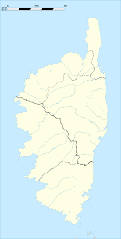 Ota | |
| Coordinates: 42°15′32″N 8°44′39″E / 42.2589°N 8.7442°ECoordinates: 42°15′32″N 8°44′39″E / 42.2589°N 8.7442°E | |
| Country | France |
| Region | Corsica |
| Department | Corse-du-Sud |
| Arrondissement | Ajaccio |
| Canton | Les Deux-Sevi |
| Government | |
| • Mayor (2008–2014) | Pierre Paul de Pianelli |
| Area1 | 38.16 km2 (14.73 sq mi) |
| Population (2008)2 | 540 |
| • Density | 14/km2 (37/sq mi) |
| Time zone | CET (UTC+1) |
| • Summer (DST) | CEST (UTC+2) |
| INSEE/Postal code | 2A198 / 20150 |
| Elevation |
0–1,326 m (0–4,350 ft) (avg. 320 m or 1,050 ft) |
|
1 French Land Register data, which excludes lakes, ponds, glaciers > 1 km² (0.386 sq mi or 247 acres) and river estuaries. 2 Population without double counting: residents of multiple communes (e.g., students and military personnel) only counted once. | |

Ota is a commune in the Corse-du-Sud department of France on the island of Corsica.
Population
| Historical population | ||
|---|---|---|
| Year | Pop. | ±% |
| 1962 | 364 | — |
| 1968 | 444 | +22.0% |
| 1975 | 367 | −17.3% |
| 1982 | 408 | +11.2% |
| 1990 | 460 | +12.7% |
| 1999 | 452 | −1.7% |
| 2008 | 540 | +19.5% |
Sights
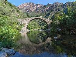
Ota, the Pianella bridge.
- Pianella bridge, a Genoese bridge from the 15th century
- Torra di Portu
Notable Citizens
- Pasquino Corso ( Ota, ? - Rome, 15 July 1532), Condottiero.
See also
References
| Wikimedia Commons has media related to Ota, Corse-du-Sud. |
This article is issued from Wikipedia - version of the 1/28/2015. The text is available under the Creative Commons Attribution/Share Alike but additional terms may apply for the media files.