South Amherst, Massachusetts
| South Amherst, Massachusetts | |
|---|---|
| CDP | |
|
South Amherst Common | |
| Coordinates: 42°20′23″N 72°31′21″W / 42.33972°N 72.52250°WCoordinates: 42°20′23″N 72°31′21″W / 42.33972°N 72.52250°W | |
| Country | United States |
| State | Massachusetts |
| County | Hampshire |
| Area | |
| • Total | 4.2 sq mi (11.0 km2) |
| • Land | 4.2 sq mi (11.0 km2) |
| • Water | 0.0 sq mi (0.0 km2) |
| Elevation | 230 ft (70 m) |
| Population (2000) | |
| • Total | 5,039 |
| • Density | 1,187.2/sq mi (458.4/km2) |
| Time zone | Eastern (EST) (UTC-5) |
| • Summer (DST) | EDT (UTC-4) |
| ZIP code | 01002 |
| Area code(s) | 413 |
| FIPS code | 25-62675 |
| GNIS feature ID | 0609086 |

South Amherst is a census-designated place (CDP) in the town of Amherst in Hampshire County, Massachusetts, United States. The population was 5,039 at the 2000 census. There are two centers of development in South Amherst: Amherst Woods (a community of expensive single-family mostly owner-occupied homes) and the Mill Valley apartment complexes (The Brook, The Boulders, Mill Valley, Southpoint; mostly rental apartments). These two communities have, respectively, the most and least expensive housing in Amherst. Also of significant population density is the Elf Hill area (also mostly owner-occupied single-family homes).
South Amherst is part of the Springfield, Massachusetts Metropolitan Statistical Area.
Geography
South Amherst is located at 42°20′23″N 72°31′21″W / 42.33972°N 72.52250°W (42.339586, -72.522426).[1]
According to the United States Census Bureau, the CDP has a total area of 11.0 km² (4.2 mi²), all land.
Demographics
At the 2000 census,[2] there were 5,039 people, 1,500 households and 870 families residing in the CDP. The population density was 458.9/km² (1,187.2/mi²). There were 1,530 housing units at an average density of 139.3/km² (360.5/mi²). The racial makeup of the CDP was 71.66% White, 7.01% African American, 0.22% Native American, 10.82% Asian, 0.12% Pacific Islander, 5.40% from other races, and 4.78% from two or more races. Hispanic or Latino were 9.82% of the population.
There were 1,500 households of which 34.5% had children under the age of 18 living with them, 37.5% were married couples living together, 17.0% had a female householder with no husband present, and 42.0% were non-families. 18.3% of all households were made up of individuals and 4.3% had someone living alone who was 65 years of age or older. The average household size was 2.68 and the average family size was 3.12.
19.8% of the population were under the age of 18, 37.4% from 18 to 24, 21.6% from 25 to 44, 15.4% from 45 to 64, and 5.7% who were 65 years of age or older. The median age was 23 years. For every 100 females there were 90.8 males. For every 100 females age 18 and over, there were 88.1 males.
The median household income was $44,628 and the median family income was $58,438. Males had a median income of $43,793 compared with $35,288 for females. The per capita income for the CDP was $17,191. About 8.3% of families and 17.4% of the population were below the poverty line, including 3.1% of those under age 18 and none of those age 65 or over.
References
- ↑ "US Gazetteer files: 2010, 2000, and 1990". United States Census Bureau. 2011-02-12. Retrieved 2011-04-23.
- ↑ "American FactFinder". United States Census Bureau. Retrieved 2008-01-31.
External links
Municipalities and communities of Hampshire County, Massachusetts, United States | ||
|---|---|---|
| Cities | 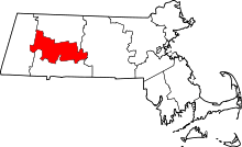 | |
| Towns | ||
| CDPs | ||
| Other villages | ||
| Footnotes | ‡This populated place also has portions in an adjacent county or counties | |