Westhampton, Massachusetts
| Westhampton, Massachusetts | ||
|---|---|---|
| Town | ||
|
Westhampton Town Hall | ||
| ||
 Location in Hampshire County in Massachusetts | ||
| Coordinates: 42°18′10″N 72°46′30″W / 42.30278°N 72.77500°WCoordinates: 42°18′10″N 72°46′30″W / 42.30278°N 72.77500°W | ||
| Country | United States | |
| State | Massachusetts | |
| County | Hampshire | |
| Settled | 1762 | |
| Incorporated | 1778 | |
| Government | ||
| • Type | Open town meeting | |
| Area | ||
| • Total | 27.3 sq mi (70.8 km2) | |
| • Land | 27.1 sq mi (70.3 km2) | |
| • Water | 0.2 sq mi (0.5 km2) | |
| Elevation | 730 ft (223 m) | |
| Population (2000) | ||
| • Total | 1,468 | |
| • Density | 54.1/sq mi (20.9/km2) | |
| Time zone | Eastern (UTC-5) | |
| • Summer (DST) | Eastern (UTC-4) | |
| ZIP code | 01027 | |
| Area code(s) | 413 | |
| FIPS code | 25-76380 | |
| GNIS feature ID | 0618210 | |


Westhampton is a town in Hampshire County, Massachusetts, United States. The population was 1,607 at the 2010 census. It is part of the Springfield, Massachusetts Metropolitan Statistical Area.
History
Westhampton was first settled in 1762. Originally part of Northampton, Westhampton was officially incorporated on September 29, 1778. The first town meeting was held on November 19, 1778, at which the Reverend Enoch Hale, brother of American spy Nathan Hale, was chosen to be the town's first minister[1] Westhampton is one of 8 "dry" towns in the Commonwealth, meaning that the sale of alcoholic beverages is prohibited within its boundaries.[2]
The town is home to the five-town Hampshire Regional High School.
Geography
According to the United States Census Bureau the town has a total area of 27.3 square miles (70.7 km2), of which 27.1 square miles (70.2 km2) is land and 0.2 square miles (0.5 km2) is water. Westhampton is bordered by Southampton to the south, Huntington to the west, Chesterfield to the northwest, Williamsburg to the northeast, Northampton to the east, and Easthampton to the southeast.
Demographics
| Historical population | ||
|---|---|---|
| Year | Pop. | ±% |
| 1870 | 587 | — |
| 1880 | 563 | −4.1% |
| 1890 | 477 | −15.3% |
| 1900 | 469 | −1.7% |
| 1910 | 423 | −9.8% |
| 1920 | 305 | −27.9% |
| 1930 | 374 | +22.6% |
| 1940 | 403 | +7.8% |
| 1950 | 452 | +12.2% |
| 1960 | 583 | +29.0% |
| 1970 | 793 | +36.0% |
| 1980 | 1,137 | +43.4% |
| 1990 | 1,327 | +16.7% |
| 2000 | 1,468 | +10.6% |
| 2010 | 1,607 | +9.5% |
| * = population estimate. Source: United States Census records and Population Estimates Program data.[3][4][5][6][7][8][9][10] | ||
As of the census[11] of 2000, there were 1,468 people, 542 households, and 422 families residing in the town. The population density was 54.1 people per square mile (20.9/km²). There were 623 housing units at an average density of 23.0 per square mile (8.9/km²). The racial makeup of the town was 98.50% White, 0.34% Native American, 0.14% Asian, 0.27% from other races, and 0.75% from two or more races. Hispanic or Latino of any race were 0.54% of the population.
There were 542 households out of which 34.3% had children under the age of 18 living with them, 69.0% were married couples living together, 5.9% had a female householder with no husband present, and 22.1% were non-families. 15.9% of all households were made up of individuals and 5.2% had someone living alone who was 65 years of age or older. The average household size was 2.71 and the average family size was 3.07.
In the town the population was spread out with 25.4% under the age of 18, 5.0% from 18 to 24, 31.0% from 25 to 44, 29.4% from 45 to 64, and 9.2% who were 65 years of age or older. The median age was 40 years. For every 100 females there were 98.4 males. For every 100 females age 18 and over, there were 97.3 males.
The median income for a household in the town was $60,089, and the median income for a family was $66,625. Males had a median income of $42,200 versus $35,809 for females. The per capita income for the town was $25,360. About 1.9% of families and 3.5% of the population were below the poverty line, including 4.0% of those under age 18 and 4.3% of those age 65 or over.
The 2008 Presidential election was held solely at the Westhampton Town Hall. Of the 1,095 votes cast, 62% were for Sen. Barack Obama, in contrast to the 37% of votes that were cast for Sen. John McCain.
Notable residents
- Adam Dutkiewicz, guitarist of metalcore band Killswitch Engage.
- Mordicai Gerstein, children's book illustrator
- Sylvester Judd, Transcendentalist author of 1845's *Margaret*, friend of Ralph Waldo Emerson and Margaret Fuller
Notes
- ↑ LaFrance, et al. "Local Color: Stories of Westhampton's First 225 Years' Gazette Printing Company, 2003
- ↑
- ↑ "TOTAL POPULATION (P1), 2010 Census Summary File 1, All County Subdivisions within Massachusetts". United States Census Bureau. Retrieved September 13, 2011.
- ↑ "Massachusetts by Place and County Subdivision - GCT-T1. Population Estimates". United States Census Bureau. Retrieved July 12, 2011.
- ↑ "1990 Census of Population, General Population Characteristics: Massachusetts" (PDF). US Census Bureau. December 1990. Table 76: General Characteristics of Persons, Households, and Families: 1990. 1990 CP-1-23. Retrieved July 12, 2011.
- ↑ "1980 Census of the Population, Number of Inhabitants: Massachusetts" (PDF). US Census Bureau. December 1981. Table 4. Populations of County Subdivisions: 1960 to 1980. PC80-1-A23. Retrieved July 12, 2011.
- ↑ "1950 Census of Population" (PDF). 1: Number of Inhabitants. Bureau of the Census. 1952. Section 6, Pages 21-10 and 21-11, Massachusetts Table 6. Population of Counties by Minor Civil Divisions: 1930 to 1950. Retrieved July 12, 2011.
- ↑ "1920 Census of Population" (PDF). Bureau of the Census. Number of Inhabitants, by Counties and Minor Civil Divisions. Pages 21-5 through 21-7. Massachusetts Table 2. Population of Counties by Minor Civil Divisions: 1920, 1910, and 1920. Retrieved July 12, 2011.
- ↑ "1890 Census of the Population" (PDF). Department of the Interior, Census Office. Pages 179 through 182. Massachusetts Table 5. Population of States and Territories by Minor Civil Divisions: 1880 and 1890. Retrieved July 12, 2011.
- ↑ "1870 Census of the Population" (PDF). Department of the Interior, Census Office. 1872. Pages 217 through 220. Table IX. Population of Minor Civil Divisions, &c. Massachusetts. Retrieved July 12, 2011.
- ↑ "American FactFinder". United States Census Bureau. Retrieved 2008-01-31.
External links
- MHC Survey Reconnaissance Town Report: Westhampton Massachusetts Historical Commission, 1982.
Municipalities and communities of Hampshire County, Massachusetts, United States | ||
|---|---|---|
| Cities | 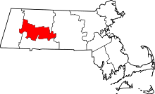 | |
| Towns | ||
| CDPs | ||
| Other villages | ||
| Footnotes | ‡This populated place also has portions in an adjacent county or counties | |