Ponoka County
| Ponoka County | |
|---|---|
| Municipal district | |
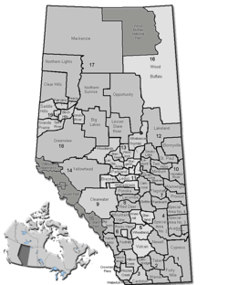 Location of Ponoka County in Alberta | |
| Coordinates: 52°40′32″N 113°34′49″W / 52.67556°N 113.58028°WCoordinates: 52°40′32″N 113°34′49″W / 52.67556°N 113.58028°W | |
| Country |
|
| Province |
|
| Region | Central Alberta |
| Census division | No. 8 |
| Established | 1944 |
| Incorporated | 1952 |
| Government[1] | |
| • Reeve | Paul McLauchlin |
| • Governing body |
Ponoka County Council
|
| • CAO | Charlie Cutforth |
| • Office location | Ponoka |
| Area (2011)[2] | |
| • Total | 2,807.94 km2 (1,084.15 sq mi) |
| Population (2011)[2] | |
| • Total | 8,856 |
| • Density | 3.2/km2 (8/sq mi) |
| • Dwellings | 3,330 |
| Time zone | MST (UTC−7) |
| • Summer (DST) | MDT (UTC−6) |
| Website |
ponokacounty |
Ponoka County is a municipal district in Alberta, Canada. It covers 721,396 acres (2,919 km2) and it claims to "embody the essence of rural Alberta".[3]
Demographics
In the 2011 Census, Ponoka County had a population of 8,856 living in 3,172 of its 3,669 total dwellings, a 2.5% change from its 2006 population of 8,640. With a land area of 2,807.94 km2 (1,084.15 sq mi), it had a population density of 3.2/km2 (8.2/sq mi) in 2011.[2] Following Ponoka’s 2011 annexation, Statistics Canada adjusted Ponoka County's 2011 population downward by 5 people to 8,851.[4]
In 2006, Ponoka County had a population of 8,640 living in 3,330 dwellings, a 1.7% decrease from 2001. The county has a land area of 2,807.94 km2 (1,084.15 sq mi) and a population density of 3.1/km2 (8.0/sq mi).[5]
In 2001, the population of Ponoka County was 8,806 residents[6]

Government
The Chief Administrative Officer (CAO) of the county is Charlie Cutforth.[1] The five members of council, Nancy Hartford, Bryce Liddle, Mark Matejka, Paul McLauchlin, and Doug Weir, where elected October 21, 2013.[1] Councillor Paul McLauchlin, from electoral division 4, was selected the reeve in a 2013 organizational meeting.[7]
History
Ponoka County was founded on January 1, 1952.[8] The county's first public officials were Mr. Bruce Ramsey, who directed municipal affairs, Mr. Peter McDonald as secretary-treasurer, and Mr. L.G. Saunders was head of the school system. The town gets its name from the Blackfoot word for Elk.
Communities and localities
|
The following urban municipalities are surrounded by Ponoka County:[9]
|
The following localities are located within Ponoka County:[11]
|
See also
References
- 1 2 3 "Municipal Officials Search". Alberta Municipal Affairs. December 16, 2016. Retrieved December 18, 2016.
- 1 2 3 "Population and dwelling counts, for Canada, provinces and territories, and census subdivisions (municipalities), 2011 and 2006 censuses (Alberta)". Statistics Canada. 2012-02-08. Retrieved 2012-02-08.
- ↑ Ponoka County official site
- ↑ "Interim List of Changes to Municipal Boundaries, Status, and Names From January 2, 2011, to January 1, 2012 (Table 1 – Changes to census subdivisions in alphabetical order by province and territory)" (XLSX). Statistics Canada. November 14, 2012. Retrieved August 17, 2013.
- ↑ Statistics Canada. "Canada 2006 Census: Ponoka County - Community Profile". Retrieved 2007-06-11.
- ↑ Ponoka County Community Profile - Statistics Canada. 2002. 2001 Community Profiles. Released June 27, 2002. Last modified: 2005-11-30. Statistics Canada Catalogue no. 93F0053XIE
- ↑ "Council". Ponoka County. Retrieved January 5, 2013.
- ↑ Municipal Profile - Alberta Municipal Affairs
- 1 2 "Specialized and Rural Municipalities and Their Communities" (PDF) (PDF). Alberta Municipal Affairs. December 31, 2013. p. 13. Retrieved January 1, 2014.
- ↑ "County Council Meeting (minutes)" (PDF). Ponoka County. September 3, 2013. p. 2. Retrieved January 1, 2014.
- ↑ "Standard Geographical Classification (SGC) 2006, Economic Regions: 4808038 - Ponoka County, geographical codes and localities, 2006". Statistics Canada. 2010-03-05. Retrieved 2012-08-12.
External links
 |
County of Wetaskiwin No. 10 | County of Wetaskiwin No. 10 | Camrose County | |
| Clearwater County | |
Camrose County | ||
| ||||
| | ||||
| Clearwater County | Lacombe County | Camrose County |