Stanečka Vas
| Stanečka Vas | |
|---|---|
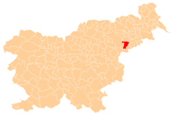
 Stanečka Vas Location in Slovenia | |
| Coordinates: 46°20′22.37″N 15°44′43.9″E / 46.3395472°N 15.745528°ECoordinates: 46°20′22.37″N 15°44′43.9″E / 46.3395472°N 15.745528°E | |
| Country |
|
| Traditional region | Styria |
| Statistical region | Drava |
| Municipality | Majšperk |
| Area | |
| • Total | 0.78 km2 (0.30 sq mi) |
| Elevation | 240.1 m (787.7 ft) |
| Population (2002) | |
| • Total | 96 |
| [1] | |
Stanečka Vas (pronounced [ˈstaːnɛtʃka ˈʋaːs] or [staˈneːtʃka ˈʋaːs]; Slovene: Stanečka vas) is a settlement in the Municipality of Majšperk in northeastern Slovenia. It lies on the left bank of the Dravinja River on the regional road leading from Majšperk to Jurovci. The area is part of the traditional region of Styria. It is now included with the rest of the municipality in the Drava Statistical Region.[2]
References
External links
| Settlement | Administrative centre: Majšperk
|  | ||||||
|---|---|---|---|---|---|---|---|---|
| Landmarks |
| |||||||
This article is issued from Wikipedia - version of the 4/21/2016. The text is available under the Creative Commons Attribution/Share Alike but additional terms may apply for the media files.