Stockton, New York
| Stockton, New York | |
|---|---|
| Town | |
 Location within Chautauqua County and New York | |
 Stockton Location within the state of New York | |
| Coordinates: 42°18′9″N 79°21′5″W / 42.30250°N 79.35139°W | |
| Country | United States |
| State | New York |
| County | Chautauqua |
| Government | |
| • Type | Town Council |
| • Town Supervisor | David J. Wilson |
| • Town Council |
Members' List
|
| Area | |
| • Total | 47.6 sq mi (123.4 km2) |
| • Land | 47.1 sq mi (122.1 km2) |
| • Water | 0.5 sq mi (1.3 km2) |
| Elevation | 1,293 ft (394 m) |
| Population (2010) | |
| • Total | 2,248 |
| • Density | 48/sq mi (18.4/km2) |
| Time zone | Eastern (EST) (UTC-5) |
| • Summer (DST) | EDT (UTC-4) |
| ZIP code | 14784, 14718 |
| Area code(s) | 716 |
| FIPS code | 36-71476 |
| GNIS feature ID | 0979530 |
Stockton is a town in Chautauqua County, New York, United States. The population was 2,248 at the 2010 census.[1] The town is named after Richard Stockton, who signed the Declaration of Independence.
History
The area was first settled around 1810. The town of Stockton was formed in 1821 from territory taken from the town of Chautauqua. Predation by wolves was a more severe problem in this town than neighboring communities. In 1850, the town was increased in size by territory from the town of Ellery.
Geography
According to the United States Census Bureau, Stockton has a total area of 47.6 square miles (123.4 km2), of which 47.1 square miles (122.1 km2) is land and 0.50 square miles (1.3 km2), or 1.03%, is water.[1] New York State Route 60 is a major north-south highway in the eastern part of the town.
Notable people
- Forrest Crissey, writer
- Ralph "Bucky" Phillips, notable ex-fugitive
Adjacent towns and areas
Demographics
| Historical population | |||
|---|---|---|---|
| Census | Pop. | %± | |
| 1830 | 1,604 | — | |
| 1840 | 2,078 | 29.6% | |
| 1850 | 1,640 | −21.1% | |
| 1860 | 1,887 | 15.1% | |
| 1870 | 1,639 | −13.1% | |
| 1880 | 1,868 | 14.0% | |
| 1890 | 1,730 | −7.4% | |
| 1900 | 1,852 | 7.1% | |
| 1910 | 1,781 | −3.8% | |
| 1920 | 1,674 | −6.0% | |
| 1930 | 1,574 | −6.0% | |
| 1940 | 1,651 | 4.9% | |
| 1950 | 1,889 | 14.4% | |
| 1960 | 2,156 | 14.1% | |
| 1970 | 2,213 | 2.6% | |
| 1980 | 2,331 | 5.3% | |
| 1990 | 2,515 | 7.9% | |
| 2000 | 2,331 | −7.3% | |
| 2010 | 2,248 | −3.6% | |
| Est. 2014 | 2,179 | [2] | −3.1% |
As of the census[4] of 2000, there were 2,331 people, 859 households, and 649 families residing in the town. The population density was 49.3 people per square mile (19.0/km²). There were 1,054 housing units at an average density of 22.3 per square mile (8.6/km²). The racial makeup of the town was 97.60% White, 0.09% African American, 0.21% Native American, 0.30% Asian, 0.51% from other races, and 1.29% from two or more races. Hispanic or Latino of any race were 1.54% of the population.
There were 859 households out of which 33.2% had children under the age of 18 living with them, 63.9% were married couples living together, 7.1% had a female householder with no husband present, and 24.4% were non-families. 20.7% of all households were made up of individuals and 10.4% had someone living alone who was 65 years of age or older. The average household size was 2.71 and the average family size was 3.14.
In the town the population was spread out with 27.2% under the age of 18, 6.8% from 18 to 24, 28.3% from 25 to 44, 24.4% from 45 to 64, and 13.3% who were 65 years of age or older. The median age was 38 years. For every 100 females there were 96.4 males. For every 100 females age 18 and over, there were 99.4 males.
The median income for a household in the town was $39,423, and the median income for a family was $44,146. Males had a median income of $32,880 versus $21,667 for females. The per capita income for the town was $17,717. About 7.7% of families and 9.9% of the population were below the poverty line, including 13.3% of those under age 18 and 3.0% of those age 65 or over.
As of the census of 2010, there were 2,248 people (decrease of 83 people, or 3.56%), and 897 households (increase of 38, or 4.42%). The population density of the town was 47.5 people per square mile (18.3/km²). The racial makeup of the town was: 97.46% white (2191 people), 0.45% African American (10 people), 0.27% Asian (6 people), 0.13% Native American or Alaskan (3 people), 0.49% other (11 people), and 1.20% from two or more races (27 people). Also, 1.42% of people (32 people) stated they were Hispanic/Latino.
There were 897 households out of which 32.2% had children under the age of 18 living with them.
In the town, the population was spread out with 23.3% (524 people) of the population under the age of 18, 3.1% (69 people) ages 18 and 19, 4.63% (104 people) ages 20–24, 9.88% (222 people) ages 25–34, 21.44% (482 people) ages 35–49, 22.69% (510 people) ages 50–64, and 14.99% (337 people) over the age of 65. 49.6% of the population was male (1,115 people) while 50.4% of the population was female (1,133 people).[5]
Communities and locations in Stockton
- Bear Lake Outlet – A stream that flows south through the town past Kelly Corners and Stockton and enters Cassadaga Creek near Kabob.
- Burnhams – A hamlet west of Cassadaga village on County Road 58 and at the south end of Cassadaga Lake that was annexed by the village of Cassadaga in the early 1920s.
- Cassadaga – The village of Cassadaga is in the northeast part of the town on NY Route 60, at the southern end and outlet of Cassadaga Lake. Cassadaga village is adjacent to the community of Lily Dale to the north in the town of Pomfret.
- Cassadaga Creek – A stream that flows from Cassadaga Lake and out of the southeast corner of the town past the community of South Stockton. It is a tributary of Conewango Creek, which flows south to the Allegheny River and subsequently the Ohio and Mississippi rivers.
- Cassadaga Lake – A lake partly in the northeast part of the town.
- Centralia – A hamlet on County Road 380 near the south town line.
- Coes Corners – A location on County Road 58 in the western part of the town
- Dentons Corners – A location on County Road 54 in the southwest part of the town.
- Kabob – A hamlet on County Road 71 near the eastern town line.
- Kelly Corners – A hamlet on County Road 380 in the western part of the town.
- Moons or Moons Station – A hamlet on the eastern town border, east of Kabob and south of Cassadaga village on Route 60, named for DC Moon, a primary supporter of and contributor of land in the area for the Dunkirk, Allegheny Valley and Pittsburgh Railroad.
- Pleasantville – A hamlet on County Road 54 in the southwest corner of the town.
- South Stockton – A hamlet in the southeast corner of the town on County Road 380.
- Stockton - The hamlet of Stockton on County Road 380 west of Cassadaga; formerly known as Delanti
Businesses
Stockton has a few small businesses within its borders. Within Stockton hamlet, Storer's Container Service located on Route 380 near Cummings Road employs a few local residents. A Triple L Glass Service located on the four corners supplies local residents with auto and residential glass service. It was established in 2007. Within Cassadaga, Nordy's Pizza employs local teens. It was established in 2003 and has a couple of signature foods. Cassadaga Kwik/Denison's also employs a few local residents. Recently two ice cream shops opened, The Ice Cream Factory located by Nordy's Pizza, and King Kone located by the Kwik Fill. The Whisky Hill, the local bar, is located on the four corners of Cassadaga and has daily specials, the most famous being Monday Wing Night.
Fire service
The Stockton Volunteer Fire Company and Cassadaga Volunteer Fire Department provide emergency services within the township. The Cassadaga VFD covers emergency calls within the village of Cassadaga and most of the town of Arkwright to the northeast. The Stockton Volunteer Fire Company covers the rest of the township. Before the Stockton Volunteer Fire Company obtained an ambulance in the early 1990s, Cassadaga would cover all EMS calls.
List of Stockton Volunteer Fire Company equipment:
- A-181, Ambulance (BLS)
- R-181, Heavy Rescue
- E-181, Pumper-Tanker (1800 Gallons)
- E-182, Pumper-Rescue (1500 Gallons and holds the jaws of life)
- T-181, Tanker/Tender (2650 Gallons)
- ATV-181, Off-Road rescue vehicle with rescue sled/trailer. During the Summer, it holds water tanks for wild fires.
List of Cassadaga Volunteer Fire Department
- A-101, Ambulance
- M-101, Miscellaneous Vehicle
- E-101
- E-102
- T-101, Tanker/Tender
- Gator-101, Off-Road Rescue Vehicle
Fundraisers held by the Stockton Volunteer Fire Company include a Gun Raffle, Turkey Parties, Pig Roast, Boot Drive, Fund Drive, Snowmobile Luncheons, Chicken BBQ's, and the 110 Club. A long-term fundraiser since the mid-1990s is the local post office. SVFC rents the building to USPS. Fundraisers held by the Cassadaga Volunteer Fire Department include Turkey Parties, Fund Drive, Chicken BBQ's and a huge Gun Raffle where 50 guns are raffled off easily.
References
- 1 2 "Geographic Identifiers: 2010 Demographic Profile Data (G001): Stockton town, Chautauqua County, New York". U.S. Census Bureau, American Factfinder. Retrieved November 7, 2014.
- ↑ "Annual Estimates of the Resident Population for Incorporated Places: April 1, 2010 to July 1, 2014". Retrieved June 4, 2015.
- ↑ "Census of Population and Housing". Census.gov. Archived from the original on May 11, 2015. Retrieved June 4, 2015.
- ↑ "American FactFinder". United States Census Bureau. Archived from the original on September 11, 2013. Retrieved 2008-01-31.
- ↑ "2010 U.S. Census". Archived from the original on September 15, 2012. Retrieved 12 September 2012.
External links
Municipalities and communities of Chautauqua County, New York, United States | ||
|---|---|---|
| Cities | 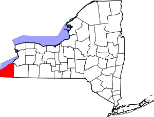 | |
| Towns | ||
| Villages | ||
| CDPs | ||
| Other hamlets | ||
| Indian reservation | ||
Coordinates: 42°19′03″N 79°21′21″W / 42.31750°N 79.35583°W