Sugar Creek Township, Clinton County, Illinois
| Sugar Creek Township | |
|---|---|
| Township | |
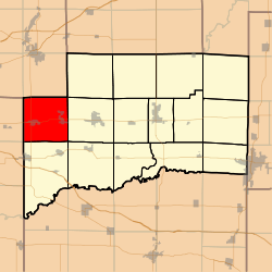 Location in Clinton County | |
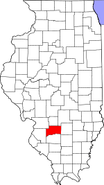 Clinton County's location in Illinois | |
| Coordinates: 38°36′56″N 89°39′08″W / 38.61556°N 89.65222°WCoordinates: 38°36′56″N 89°39′08″W / 38.61556°N 89.65222°W | |
| Country | United States |
| State | Illinois |
| County | Clinton |
| Established | November 4, 1873 |
| Area | |
| • Total | 36.57 sq mi (94.7 km2) |
| • Land | 36.54 sq mi (94.6 km2) |
| • Water | 0.03 sq mi (0.08 km2) 0.08% |
| Elevation | 482 ft (147 m) |
| Population (2010) | |
| • Total | 6,184 |
| • Density | 169.3/sq mi (65.4/km2) |
| Time zone | CST (UTC-6) |
| • Summer (DST) | CDT (UTC-5) |
| ZIP codes | 62216, 62230, 62245, 62293 |
| GNIS feature ID | 0429808 |
Sugar Creek Township is one of fifteen townships in Clinton County, Illinois, USA. As of the 2010 census, its population was 6,184 and it contained 2,506 housing units.[1] The township's name changed from Trenton Township on June 1, 1874.
Geography
According to the 2010 census, the township has a total area of 36.57 square miles (94.7 km2), of which 36.54 square miles (94.6 km2) (or 99.92%) is land and 0.03 square miles (0.078 km2) (or 0.08%) is water.[1]
Cities, towns, villages
Cemeteries
The township contains these three cemeteries: Saint Francis, Saint Marys and Trenton.
Major highways
Lakes
- Sportsman Lake
Landmarks
- Cemetery
School districts
- Wesclin Community Unit School District 3
Political districts
- Illinois' 19th congressional district
- State House District 102
- State Senate District 51
References
- "Sugar Creek Township, Clinton County, Illinois". Geographic Names Information System. United States Geological Survey. Retrieved 2010-01-10.
- United States Census Bureau 2007 TIGER/Line Shapefiles
- United States National Atlas
- 1 2 "Population, Housing Units, Area, and Density: 2010 - County -- County Subdivision and Place -- 2010 Census Summary File 1". United States Census. Retrieved 2013-05-28.
External links

Municipalities and communities of Clinton County, Illinois, United States | ||
|---|---|---|
| Cities | ||
| Villages | ||
| Townships | ||
| Unincorporated communities | ||
| Ghost town | ||
| Footnotes | ‡This populated place also has portions in an adjacent county or counties | |
This article is issued from Wikipedia - version of the 12/4/2013. The text is available under the Creative Commons Attribution/Share Alike but additional terms may apply for the media files.