Wheatfield Township, Clinton County, Illinois
| Wheatfield Township | |
|---|---|
| Township | |
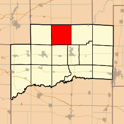 Location in Clinton County | |
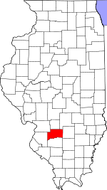 Clinton County's location in Illinois | |
| Coordinates: 38°41′38″N 89°25′40″W / 38.69389°N 89.42778°WCoordinates: 38°41′38″N 89°25′40″W / 38.69389°N 89.42778°W | |
| Country | United States |
| State | Illinois |
| County | Clinton |
| Established | November 4, 1873 |
| Area | |
| • Total | 35.42 sq mi (91.7 km2) |
| • Land | 35.42 sq mi (91.7 km2) |
| • Water | 0 sq mi (0 km2) 0% |
| Elevation | 446 ft (136 m) |
| Population (2010) | |
| • Total | 478 |
| • Density | 13.5/sq mi (5.2/km2) |
| Time zone | CST (UTC-6) |
| • Summer (DST) | CDT (UTC-5) |
| ZIP code | 62231 |
| GNIS feature ID | 0429923 |
Wheatfield Township is one of fifteen townships in Clinton County, Illinois, USA. As of the 2010 census, its population was 478 and it contained 207 housing units.[1]
Geography
According to the 2010 census, the township has a total area of 35.42 square miles (91.7 km2), all land.[1]
Unincorporated towns
- Stolletown
(This list is based on USGS data and may include former settlements.)
Cemeteries
The township contains these four cemeteries: Rudolph, Saint Felicitas, Saint Peter and Yingst.
School districts
- Carlyle Community Unit School District 1
- Breese District 12
- Central Community High School
Political districts
- Illinois' 19th congressional district
- State House District 102
- State Senate District 51
References
- "Wheatfield Township, Clinton County, Illinois". Geographic Names Information System. United States Geological Survey. Retrieved 2010-01-10.
- United States Census Bureau 2007 TIGER/Line Shapefiles
- United States National Atlas
- 1 2 "Population, Housing Units, Area, and Density: 2010 - County -- County Subdivision and Place -- 2010 Census Summary File 1". United States Census. Retrieved 2013-05-28.
External links
 |
Burgess Township, Bond County | Mills Township, Bond County | Tamalco Township, Bond County | |
| Saint Rose Township | |
Irishtown Township | ||
| ||||
| | ||||
| Breese Township | Wade Township | Carlyle Township |
Municipalities and communities of Clinton County, Illinois, United States | ||
|---|---|---|
| Cities | ||
| Villages | ||
| Townships | ||
| Unincorporated communities | ||
| Ghost town | ||
| Footnotes | ‡This populated place also has portions in an adjacent county or counties | |
This article is issued from Wikipedia - version of the 10/10/2015. The text is available under the Creative Commons Attribution/Share Alike but additional terms may apply for the media files.