Triplett, Missouri
| Triplett, Missouri | |
|---|---|
| City | |
 Location of Triplett, Missouri | |
| Coordinates: 39°29′55″N 93°11′35″W / 39.49861°N 93.19306°WCoordinates: 39°29′55″N 93°11′35″W / 39.49861°N 93.19306°W | |
| Country | United States |
| State | Missouri |
| County | Chariton |
| Area[1] | |
| • Total | 0.23 sq mi (0.60 km2) |
| • Land | 0.23 sq mi (0.60 km2) |
| • Water | 0 sq mi (0 km2) |
| Elevation | 659 ft (201 m) |
| Population (2010)[2] | |
| • Total | 41 |
| • Estimate (2012[3]) | 40 |
| • Density | 178.3/sq mi (68.8/km2) |
| Time zone | Central (CST) (UTC-6) |
| • Summer (DST) | CDT (UTC-5) |
| ZIP code | 65286 |
| Area code(s) | 660 |
| FIPS code | 29-73870[4] |
| GNIS feature ID | 0735889[5] |
Triplett is a city in Chariton County, Missouri, United States. The population was 41 at the 2010 census.
History
Triplett was founded in 1870 when the railroad was extended to that point.[6] The community was named after J. E. M. Triplett, a first settler.[7] A post office called Triplett was established in 1875, and remained in operation until 2001.[8]
Geography
Triplett is located at 39°29′55″N 93°11′35″W / 39.498626°N 93.193091°W.[9]
According to the United States Census Bureau, the city has a total area of 0.23 square miles (0.60 km2), all of it land.[1]
Demographics
| Historical population | |||
|---|---|---|---|
| Census | Pop. | %± | |
| 1880 | 203 | — | |
| 1890 | 813 | 300.5% | |
| 1900 | 342 | −57.9% | |
| 1910 | 473 | 38.3% | |
| 1920 | 337 | −28.8% | |
| 1930 | 350 | 3.9% | |
| 1940 | 340 | −2.9% | |
| 1950 | 301 | −11.5% | |
| 1960 | 231 | −23.3% | |
| 1970 | 191 | −17.3% | |
| 1980 | 137 | −28.3% | |
| 1990 | 58 | −57.7% | |
| 2000 | 64 | 10.3% | |
| 2010 | 41 | −35.9% | |
| Est. 2015 | 40 | [10] | −2.4% |
2010 census
As of the census[2] of 2010, there were 41 people, 21 households, and 10 families residing in the city. The population density was 178.3 inhabitants per square mile (68.8/km2). There were 32 housing units at an average density of 139.1 per square mile (53.7/km2). The racial makeup of the city was 92.7% White and 7.3% African American.
There were 21 households of which 4.8% had children under the age of 18 living with them, 42.9% were married couples living together, 4.8% had a male householder with no wife present, and 52.4% were non-families. 33.3% of all households were made up of individuals and 23.8% had someone living alone who was 65 years of age or older. The average household size was 1.95 and the average family size was 2.50.
The median age in the city was 53.5 years. 4.9% of residents were under the age of 18; 7.2% were between the ages of 18 and 24; 14.6% were from 25 to 44; 43.9% were from 45 to 64; and 29.3% were 65 years of age or older. The gender makeup of the city was 51.2% male and 48.8% female.
2000 census
As of the census[4] of 2000, there were 64 people, 27 households, and 18 families residing in the city. The population density was 279.9 people per square mile (107.4/km²). There were 35 housing units at an average density of 153.1 per square mile (58.8/km²). The racial makeup of the city was 87.50% White, 7.81% African American, 1.56% Native American, 1.56% Asian, and 1.56% from two or more races.
There were 27 households out of which 29.6% had children under the age of 18 living with them, 55.6% were married couples living together, 7.4% had a female householder with no husband present, and 33.3% were non-families. 33.3% of all households were made up of individuals and 18.5% had someone living alone who was 65 years of age or older. The average household size was 2.37 and the average family size was 3.00.
In the city the population was spread out with 21.9% under the age of 18, 7.8% from 18 to 24, 29.7% from 25 to 44, 28.1% from 45 to 64, and 12.5% who were 65 years of age or older. The median age was 42 years. For every 100 females there were 100.0 males. For every 100 females age 18 and over, there were 100.0 males.
The median income for a household in the city was $18,750, and the median income for a family was $33,750. Males had a median income of $26,875 versus $12,500 for females. The per capita income for the city was $12,773. There were 30.8% of families and 47.7% of the population living below the poverty line, including 75.0% of under eighteens and 77.8% of those over 64.
References
- 1 2 "US Gazetteer files 2010". United States Census Bureau. Retrieved 2012-07-08.
- 1 2 "American FactFinder". United States Census Bureau. Retrieved 2012-07-08.
- ↑ "Population Estimates". United States Census Bureau. Retrieved 2013-05-30.
- 1 2 "American FactFinder". United States Census Bureau. Retrieved 2008-01-31.
- ↑ "US Board on Geographic Names". United States Geological Survey. 2007-10-25. Retrieved 2008-01-31.
- ↑ "Chariton County Place Names, 1928–1945 (archived)". The State Historical Society of Missouri. Retrieved 17 September 2016.
- ↑ Eaton, David Wolfe (1916). How Missouri Counties, Towns and Streams Were Named. The State Historical Society of Missouri. p. 274.
- ↑ "Post Offices". Jim Forte Postal History. Retrieved 17 September 2016.
- ↑ "US Gazetteer files: 2010, 2000, and 1990". United States Census Bureau. 2011-02-12. Retrieved 2011-04-23.
- ↑ "Annual Estimates of the Resident Population for Incorporated Places: April 1, 2010 to July 1, 2015". Retrieved July 2, 2016.
- ↑ "Census of Population and Housing". Census.gov. Retrieved June 4, 2015.
Municipalities and communities of Chariton County, Missouri, United States | ||
|---|---|---|
| Cities | 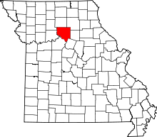 | |
| Villages | ||
| Townships | ||
| Unincorporated communities | ||
| Footnotes | ‡This populated place also has portions in an adjacent county or counties | |