Turrella, New South Wales
| Turrella Sydney, New South Wales | |||||||||||||
|---|---|---|---|---|---|---|---|---|---|---|---|---|---|
 | |||||||||||||
| Population | 1,600 (2011 census)[1] | ||||||||||||
| Postcode(s) | 2205 | ||||||||||||
| Location | 10 km (6 mi) south of Sydney CBD | ||||||||||||
| LGA(s) | Bayside Council | ||||||||||||
| State electorate(s) | Rockdale | ||||||||||||
| Federal Division(s) | Barton | ||||||||||||
| |||||||||||||

Turrella is a suburb in southern Sydney, in the state of New South Wales, Australia. Turrella is located 10 km south of the Sydney central business district on the southern bank of Wolli Creek. Turrella is in the local government area of the Bayside Council and is part of the St George area.
Turrella is a mostly residential area. Some light industrial developments are located around Turrella railway station and north along the railway line. A footbridge over Wolli Creek links Henderson Street to Earlwood. The footbridge was closed in 2012 by Canterbury Council after it was deemed to be structurally unsound. The footbridge was eventually repaired and re-opened in November 2013.
History
In 1842 William Favell and his wife Eleanor were farming a property named Hillside on this site. Their neighbours were the families of Thomas Curtis and Henry Blackwell, who were orchardists and gardeners. The farms and orchards were subdivided when the railway came through. The railway station opened on 21 September 1931. The light industrial buildings were built close to the railway line and one of the biggest factories in the area was the Streets Ice Cream factory, which has since closed.
The post office was originally known as West Arncliffe when it opened on 26 April 1933 but in January 1948 became known as Arncliffe West. It became Turrella in August 1952 but closed on 21 December 1970.[2]
Wolli Creek and Bardwell Valley
Turrella borders a piece of remnant bushland, the Wolli Creek Valley, beside Wolli Creek. There have been active movements fighting for its preservation in the face of demands for land. The most successful of these prevented the building of the M5 South Western Motorway through the valley, resulting in the road being built as a tunnel under the valley known as the M5 East. Nevertheless, community concern remains over plans to extend the M5 at Bexley.
Schools
Arncliffe West Infants School is located in Loftus Street and Cairnsfoot Special School is located opposite. The original Cairnsfoot building is heritage listed. One well known headmistress of the school was Miss Knight who served there in the 1950s and 1960s.
Transport
Turrella railway station is on the Airport, Inner West & South Line of the Sydney Trains network. Turrella is also serviced by the 473 State Transit Authority route which runs from Rockdale, Bardwell Valley, Arncliffe, Turrella, Bardwell Park station, Earlwood, Clemton Park, and on to Campsie.
The M5 South Western Motorway runs beneath parts of Turrella, in a 4 km tunnel. The nearest entrances to travel south-west towards Beverly Hills and Liverpool are located at Arncliffe and Bexley North. The nearest entrances to travel north-east towards Botany and the city are located at Arncliffe.
 Turrella railway bridge
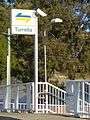 Turrella railway station entrance
Population
According to the 2011 Australian Bureau of Statistics Census of Population, there were 1,600 people usually resident in Turrella. 42.3% stated they were born overseas with the top countries of birth being Lebanon 9.4%, Macedonia 5.6% and China 5.7%. English was stated as the only language spoken at home by 35.8% of residents and the most common other languages spoken were Arabic 29.6%, Macedonian 9.3%, Cantonese 4.2%, Mandarin 3.2% and Italian 2.1%. The most common responses for religious affiliation were Islam 33.4%, Catholic 19.8% and Orthodox 13.2%.[3]
According to the 2006 Australian Bureau of Statistics Census of Population, there were 1,011 people usually resident in Turrella. 39.4% stated they were born overseas with the top countries of birth being Lebanon 10.8%, Macedonia 7.5% and China 2.6%. English was stated as the only language spoken at home by 41.8% of residents and the most common other languages spoken were Arabic 28.7%, Macedonian 12.7% and Italian 4.3%. The most common responses for religious affiliation were Islam 27.0%, Catholic 20.7% and Orthodox 15.4%.[4]
Former notable residents
- Chris Flannery notorious hitman in the Sydney underworld in the 1980s. An attempt on Flannery's life in January 1985 at his home was recreated at the actual house in Turrella Street in the 1995 television series Blue Murder, with the bullet marks still being present.[5]
References
- ↑ Australian Bureau of Statistics (31 October 2012). "Turrella". 2011 Census QuickStats. Retrieved 2012-11-13.
- ↑ The Book of Sydney Suburbs, Compiled by Frances Pollon, Angus & Robertson Publishers, 1990, Published in Australia ISBN 0-207-14495-8, Page 257
- ↑ http://www.censusdata.abs.gov.au/census_services/getproduct/census/2011/quickstat/SSC12330?opendocument&navpos=220
- ↑ http://info.id.com.au/dosydney/default.aspx?pg=1&gid=5960
- ↑ Goodsir, Darren (1995). Line of Fire. Crows Nest: Allen & Unwin. pp. 168–170. ISBN 978-1-86448-002-3.
| Wikimedia Commons has media related to Turrella, New South Wales. |
Coordinates: 33°55′59″S 151°08′27″E / 33.93297°S 151.14079°E