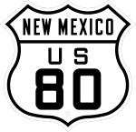
U.S. Route 80 in New Mexico
| ||||
|---|---|---|---|---|
.svg.png) | ||||
| Route information | ||||
| Maintained by NMDOT | ||||
| Length: | 191 mi[1] (307 km) | |||
| Existed: | November 11, 1926 – October 12, 1991 | |||
| Major intersections (in 1956)[2] | ||||
| West end: |
| |||
| ||||
| East end: |
| |||
| Location | ||||
| Counties: | Hidalgo, Grant, Luna, Doña Ana[2] | |||
| Highway system | ||||
| ||||

U.S. Route 80 (US 80) was a major transcontinental highway in the U.S. state of New Mexico from November 11, 1926, to October 12, 1991.[3][4] Nationally, US 80 stretched from San Diego, California to Tybee Island, Georgia, going through southern New Mexico from El Paso, Texas, through the towns of Las Cruces, Deming and Lordsburg before entering Arizona. US 80 was a modest 191 miles (307 km) long (compared to US 80 in Arizona which was almost 500 miles (800 km) long) and was eventually replaced by Interstate 10, US 70 and child route US 180, leading to the complete removal of US 80 in New Mexico.[5][1] State Road 80 is a remnant of this route.[6]
History
Beginning in 1909, New Mexico started using a numbering system for its highways. The first of these was Route 1.[7] Known as the El Camino Real, Route 1 ran from the Texas state line in Anthony north to the Colorado state line near Raton. Further to the west, Route 4 ran from the Arizona state line near Rodeo to a junction with Route 1 in Las Cruces.[8] In 1920, the western end of Route 4 was truncated to Lordsburg. The route between Lordsburg and Rodeo was taken over by Route 42.[9] In 1917, the Dixie Overland Highway was established from San Diego, California to Savannah, Georgia, extending through New Mexico. This auto trail entered New Mexico from the east through Texas, going through Roswell back into Texas to El Paso, before heading back into New Mexico through Las Cruces, Deming and Lordsburg before aiming southwest into Arizona towards Douglas.[10] Between 1920 and 1923, the Dixie Overland was joined by the Bankhead and Old Spanish Trail highways west of El Paso. By 1925, the Joint Board on Interstate Highways under the Secretary of Agriculture and American Association of State Highway Officials (AASHO), proposed a numbered transcontinental highway system across the country.[3] This was approved by Congress on November 11, 1926.[4] All of Route 4, part of Route 42, the southernmost section of Route 1, most of the Dixie Overland Highway, Old Spanish Trail and Bankhead Highway within New Mexico became U.S. Route 80. Child route US 180 was established between US 80 in Arizona and US 85 in Caballo. US 80 and US 85 ran concurrent together south of Las Cruces into Texas.[10][1] The state highway system within New Mexico was renumbered and reworked extensively to accommodate the new U.S. Highway System by 1927 into well marked State Roads.[7]
Changes to the routing of US 80 began in 1926. An older routing to Cambray via Aden from Mesilla Park was abandoned in favor of a route through Las Cruces. From 1934 to 1935, the route was slightly altered between Arizona and Road Forks, eliminating an exceptionally long curve over the railroad tracks in Rodeo for a more modest curve into town. The route between Cambray and Deming was also straightened out. US 80 was moved onto a newer road further south from the railroad tracks and straightened out between Road Forks and Deming. Later changes included the bypassing of the route through Cambray between Deming and Las Cruces and the older alignment from Gage to Deming. In the 1950s, a new section of US 80 was constructed around the older route between Anthony and Las Cruces, bypassing many of the towns along the Rio Grande. This older route was for a while marked as Alternate US 80.[11][1]
Changes to the U.S. Highway system after 1926 somewhat affected US 80. Between 1932 and 1935, US 70 was realigned heavily due to the extension of US 60 into New Mexico. The re-routing made US 70 concurrent with US 80 between Lordsburg and Las Cruces and eliminated the original US 180. US 260 was established along part the earlier route of US 70 and NM 11 to US 80 in Deming.[12][1] In 1944, US 180 was re-established heading west through part of New Mexico along US 62 to US 80 in El Paso. In 1961, US 180 was extended over US 80 from El Paso to Deming and replaced US 260.
The establishment of the Interstate Highway system marked the beginning of the end of US 80.[1] By 1965, Interstate 10 had replaced large section sections of US 80.[11] Between 1964 and 1969, US 80 was removed entirely from California. Arizona followed by retiring most of its portion of US 80 on October 28, 1977. On October 6, 1989, the AASHTO approved Arizona and New Mexico's request to remove US 80 from Arizona and most of New Mexico. US 80 had its western terminus truncated to Anthony near the Texas border. In 1991, both New Mexico and Texas requested the removal of US 80 between Anthony and Dallas, citing US 80 as being un-needed, due to being consistently multiplexed with I-10, I-20 and I-30. On October 12, 1991, the AASHTO agreed to this proposal and truncated US 80 to its current western terminus at I-30 in Dallas, Texas.[3]
Route description
US 80 entered New Mexico at the Texas state line in Anthony. Prior to 1956, US 80 used the current routing of SH 20 and NM 478. From there, US 80 continued north through Berino and Vado into Las Cruces. After 1956, US 80 followed present day NM 460 and the western I-10 frontage road, before rejoining the older alignment in Las Cruces.[11]
Originally, US 80 continued north on Main Street through the heart of downtown Las Cruces. For a while, the city made Main Street into a Pedestrian street. As of 2016, Main Street is no longer pedestrian only and is now passable by car. From Main, US 80 used Las Cruces Avenue, Hadley Avenue, Valley Drive and Picacho Avenue (US 70) to head west out of Las Cruces. At later dates, US 80 bypassed this route and took Main Street straight to Picacho Avenue. US 80 continued west on Picacho Avenue to I-10. Airport Road, the north frontage road was part of US 80. Past Exit 127, US 80 took I-10's current routing to Exit 116.[13][11]
The older routing took NM 549 west. NM 549 passes over a railroad at the ghost town of Cambray before running into I-10. NM 549 curves along the southern end of the Interstate, while the original alignment of US 80 took a different path. This bisected road is still accessible by crossing I-10 at Exit 102. US 80 continued west on the I-10 Business Loop and US 180 into Deming, New Mexico. In 1926, US 80 used Doña Ana Road, De Baca Road and NM 377 before rejoining NM 549. The later routing of US 80 used I-10 from Exit 116 to the I-10 Business Loop.[11]

Though US 80 later took Pine Street through town and followed I-10 west towards Lordsburg, New Mexico. The roadbed of this route sometimes appears as frontage roads on the northern and southern sides of the Interstate. The older alignment followed Spruce Street west then took NM 418 out of town to Exit 62. Along I-10 heading west to Lordsburg, sections of old US 80 are sometimes visible on the northern side of the Interstate next to the railroad tracks. In Lordsburg, US 80 took Motel Drive through town before returning to the route of I-10. There are some old motels and businesses from the era of US 80 left within Lordsburg. An older abandoned US 80 is still visible between I-10 and the railroad tracks west of town.[11]
In Road Forks, I-10 splits away from US 80 which headed south. I-10 between Road Forks and Arizona was once NM 14, which along with SR 86 in Arizona, created a time saving bypass around US 80 between Road Forks and Benson, Arizona.[8] Today, what was US 80 between Arizona and Road Forks is now known as NM 80. Older sections of highway can be viewed alongside the current road, including an old gradual curve in Rodeo. South of Rodeo, US 80 travelled across the Arizona state line and continued west along SR 80 to Douglas.[11]
Major intersections
This list follows the 1951 alignment.[5]
| County | Location | mi[5] | km | Destinations | Notes |
|---|---|---|---|---|---|
| Hidalgo | Rodeo | 0 | 0.0 | Arizona state line | |
| 8 | 13 | ||||
| Road Forks | 32 | 51 | NM 14 continued into Arizona as | ||
| Lordsburg | 49 | 79 | |||
| 49 | 79 | Western terminus of concurrency with US 70 | |||
| Grant | | 75 | 121 | ||
| Luna | Deming | 109 | 175 | ||
| 109 | 175 | ||||
| Doña Ana | Las Cruces | 168 | 270 | Eastern terminus of concurrency with US 70 | |
| 168 | 270 | Northern terminus of concurrency with US 85 | |||
| 169 | 272 | ||||
| Anthony | 192 | 309 | Texas state line | ||
| 1.000 mi = 1.609 km; 1.000 km = 0.621 mi | |||||
See also
References
- 1 2 3 4 5 6 Riner, Steve (May 21, 2010). "U.S. and Interstate Highways in New Mexico". New Mexico Highways. Retrieved April 16, 2015.
- 1 2 Shell Oil Company; H.M. Gousha Company (1956). Shell Highway Map of New Mexico (Map). 1:1,393,920. Chicago: Shell Oil Company. Retrieved April 16, 2015 – via David Rumsey Map Collection.
- 1 2 3 Weingroff, Richard F. (October 17, 2013). "U.S. Route 80: The Dixie Overland Highway". Highway History. Federal Highway Administration. Retrieved April 1, 2015.
- 1 2 Droz, Robert V. (June 29, 1998). "1927 U.S. Numbered Highways (RVD)". U.S. Highways. Retrieved April 16, 2015.
- 1 2 3 Shell Oil Company; H.M. Gousha Company (1951). Shell Highway Map of Arizona and New Mexico (Map). 1:1,774,080. Chicago: Shell Oil Company. Retrieved April 1, 2015 – via David Rumsey Map Collection.
- ↑ Riner, Steve (May 21, 2009). "Details of New Mexico State Routes 76-100". New Mexico Highways. Retrieved April 18, 2015.
- 1 2 "Road-Related Information for New Mexico". New Mexico Highways. May 28, 2010. Retrieved April 18, 2015.
- 1 2 Riner, Steve (May 21, 2009). "Details of New Mexico Routes 1-25". New Mexico Highways. Retrieved April 18, 2015.
- ↑ Riner, Steve (December 11, 2010). "Details of New Mexico State Routes 26-50". New Mexico Highways. Retrieved April 18, 2015.
- 1 2 Varner, Stephen C. "Dixie Overland Highway". American Roads. Retrieved April 1, 2015.
- 1 2 3 4 5 6 7 Jensen, Jeff. "Drive NM 80!". Bygone Byways. Retrieved April 15, 2015.
- ↑ "End of US highway 260". Dale Sanderson. Retrieved March 24, 2015.
- ↑ Google (April 16, 2015). "Las Cruces, NM" (Map). Google Maps. Google. Retrieved April 16, 2015.
External links
- Map of US 80 in New Mexico circa 1935 - OpenStreetMap
- Map of US 80 in New Mexico circa 1965 - OpenStreetMap
- U.S. Highway 80 at American Roads
- Bygone Byways - Includes several resources related to US 80 in New Mexico
| Previous state: Arizona |
New Mexico | Next state: Texas |