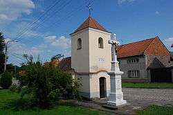
Věrovany
| Věrovany | |||
|---|---|---|---|
| Municipality | |||
 | |||
| |||
 Věrovany | |||
| Coordinates: 49°27′39″N 17°17′42″E / 49.46083°N 17.29500°ECoordinates: 49°27′39″N 17°17′42″E / 49.46083°N 17.29500°E | |||
| Country |
| ||
| Region | Olomouc | ||
| District | Olomouc | ||
| Area | |||
| • Total | 17.81 km2 (6.88 sq mi) | ||
| Elevation | 206 m (676 ft) | ||
| Population (2012) | |||
| • Total | 1,394 | ||
| • Density | 78/km2 (200/sq mi) | ||
| Postal code | 783 76 | ||
| Website | http://www.verovany.cz | ||


Věrovany is a village and municipality (obec) in Olomouc District in the Olomouc Region of the Czech Republic.
The municipality covers an area of 17.81 square kilometres (6.88 sq mi), and has a population of 1,341 (as at 3 July 2006).
Věrovany lies approximately 16 kilometres (10 mi) south of Olomouc and 218 km (135 mi) east of Prague.
References
| Wikimedia Commons has media related to Věrovany. |
This article is issued from Wikipedia - version of the 4/7/2016. The text is available under the Creative Commons Attribution/Share Alike but additional terms may apply for the media files.