Van Buren County, Arkansas
| Van Buren County, Arkansas | |
|---|---|
 Location in the U.S. state of Arkansas | |
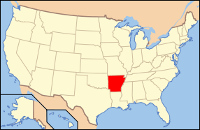 Arkansas's location in the U.S. | |
| Founded | November 11, 1833 |
| Named for | Martin Van Buren |
| Seat | Clinton |
| Largest city | Clinton |
| Area | |
| • Total | 724 sq mi (1,875 km2) |
| • Land | 708 sq mi (1,834 km2) |
| • Water | 16 sq mi (41 km2), 2.2% |
| Population (est.) | |
| • (2015) | 16,771 |
| • Density | 24/sq mi (9/km²) |
| Congressional district | 2nd |
| Time zone | Central: UTC-6/-5 |
| Website |
www |
Van Buren County is a county located in the U.S. state of Arkansas. As of the 2010 census, the population was 17,295.[1] The county seat is Clinton.[2] The county was formed on November 11, 1833, and named for Martin Van Buren, President of the United States, who was Vice President at the time of the county's formation. It is an alcohol prohibition or dry county.
Van Buren County should not be confused with the city of Van Buren, which is located approximately 100 miles to the west in Crawford County just north of Fort Smith.
Geography
According to the U.S. Census Bureau, the county has a total area of 724 square miles (1,880 km2), of which 708 square miles (1,830 km2) is land and 16 square miles (41 km2) (2.2%) is water.[3]
Major highways
Adjacent counties
- Searcy County (north)
- Stone County (northeast)
- Cleburne County (east)
- Faulkner County (southeast)
- Conway County (southwest)
- Pope County (west)
National protected area
- Ozark National Forest (part)
Demographics
| Historical population | |||
|---|---|---|---|
| Census | Pop. | %± | |
| 1840 | 1,518 | — | |
| 1850 | 2,864 | 88.7% | |
| 1860 | 5,357 | 87.0% | |
| 1870 | 5,107 | −4.7% | |
| 1880 | 9,565 | 87.3% | |
| 1890 | 8,567 | −10.4% | |
| 1900 | 11,220 | 31.0% | |
| 1910 | 13,509 | 20.4% | |
| 1920 | 13,666 | 1.2% | |
| 1930 | 11,962 | −12.5% | |
| 1940 | 12,518 | 4.6% | |
| 1950 | 9,687 | −22.6% | |
| 1960 | 7,228 | −25.4% | |
| 1970 | 8,275 | 14.5% | |
| 1980 | 13,357 | 61.4% | |
| 1990 | 14,008 | 4.9% | |
| 2000 | 16,192 | 15.6% | |
| 2010 | 17,295 | 6.8% | |
| Est. 2015 | 16,771 | [4] | −3.0% |
| U.S. Decennial Census[5] 1790–1960[6] 1900–1990[7] 1990–2000[8] 2010–2015[1] | |||

As of the 2000 United States Census,[10] there were 16,192 people, 6,825 households, and 4,804 families residing in the county. The population density was 23 people per square mile (9/km²). There were 9,164 housing units at an average density of 13 per square mile (5/km²). The racial makeup of the county was 96.79% White, 0.31% Black or African American, 0.75% Native American, 0.25% Asian, 0.04% Pacific Islander, 0.37% from other races, and 1.48% from two or more races. 1.33% of the population were Hispanic or Latino of any race, but the percentage could increased 3 or 4 times by seasonal migrant laborers in the county's shiitake mushroom harvest and hospitality jobs provided by the Fairfield Bay resort hotel.
There were 6,825 households out of which 25.20% had children under the age of 18 living with them, 59.10% were married couples living together, 7.70% had a female householder with no husband present, and 29.60% were non-families. 26.40% of all households were made up of individuals and 14.40% had someone living alone who was 65 years of age or older. The average household size was 2.33 and the average family size was 2.79.
In the county the population was spread out with 21.50% under the age of 18, 6.60% from 18 to 24, 23.00% from 25 to 44, 25.50% from 45 to 64, and 23.30% who were 65 years of age or older. The median age was 44 years. For every 100 females there were 96.70 males. For every 100 females age 18 and over, there were 93.00 males.
The median income for a household in the county was $27,004, and the median income for a family was $32,284. Males had a median income of $25,821 versus $18,862 for females. The per capita income for the county was $16,603. About 11.60% of families and 15.40% of the population were below the poverty line, including 21.90% of those under age 18 and 10.60% of those age 65 or over.
Communities
Cities
- Clinton (county seat)
- Fairfield Bay
Towns
Unincorporated communities
- Alread
- Archey Valley
- Austin
- Bee Branch
- Botkinburg
- Chimes
- Choctaw
- Choctaw Pines
- Claude
- Copeland
- Crabtree
- Culpepper
- Dabney
- Dennard
- Eglantine
- Elba
- Fairbanks
- Formosa
- Gravesville
- Gravel Hill
- Green Tree
- Half Moon
- Morganton
- Old Botkinburg
- Palisades
- Pee Dee
- Plant
- Pleasant Grove
- Rabbit Ridge
- Rex
- Rocky Hill
- Rumley
- Rupert
- Scotland
- Southside
- Stumptoe
- Sulphur Springs
- Walnut Grove
- Whipple
- Woodlum
- Zion Hill
Townships

Townships in Arkansas are the divisions of a county. Each township includes unincorporated areas; some may have incorporated cities or towns within part of their boundaries. Arkansas townships have limited purposes in modern times. However, the United States Census does list Arkansas population based on townships (sometimes referred to as "county subdivisions" or "minor civil divisions"). Townships are also of value for historical purposes in terms of genealogical research. Each town or city is within one or more townships in an Arkansas county based on census maps and publications. The townships of Van Buren County are listed below; listed in parentheses are the cities, towns, and/or census-designated places that are fully or partially inside the township. [11][12]
| Township | FIPS code | ANSI code (GNIS ID) |
Population center(s) |
Pop. (2010) |
Pop. density (/mi²) |
Pop. density (/km²) |
Total area (mi²) |
Total area (km²) |
Land area (mi²) |
Land area (km²) |
Water area (mi²) |
Water area (km²) |
Geographic coordinates |
|---|---|---|---|---|---|---|---|---|---|---|---|---|---|
| Archey Valley | 05-90054 | 00069759 | 144 | 6.40 | 2.47 | 22.532 | 58.36 | 22.492 | 58.25 | 0.040 | 0.1036 | 35°42′32″N 92°44′51″W / 35.708846°N 92.747601°W | |
| Barnett | 05-90117 | 00069760 | Damascus | 786 | 32.49 | 12.54 | 24.204 | 62.69 | 24.192 | 62.66 | 0.012 | 0.03108 | 35°23′06″N 92°24′08″W / 35.384917°N 92.402125°W |
| Bradley | 05-90444 | 00069761 | 1,237 | 32.83 | 12.68 | 37.744 | 97.76 | 37.674 | 97.58 | 0.070 | 0.1813 | 35°26′58″N 92°24′31″W / 35.449518°N 92.408575°W | |
| Cadron | 05-90603 | 00069762 | 160 | 8.92 | 3.44 | 17.952 | 46.50 | 17.942 | 46.47 | 0.010 | 0.02590 | 35°25′32″N 92°17′29″W / 35.425448°N 92.291417°W | |
| Cargile | 05-90660 | 00069763 | 395 | 26.72 | 10.32 | 14.783 | 38.29 | 14.783 | 38.29 | 0 | 0.000 | 35°23′12″N 92°17′46″W / 35.386683°N 92.296239°W | |
| Choctaw | 05-90789 | 00069764 | Clinton (small part) | 1,226 | 58.20 | 22.47 | 23.244 | 60.20 | 21.066 | 54.56 | 2.178 | 5.641 | 35°31′01″N 92°24′43″W / 35.516962°N 92.411879°W |
| Craig | 05-90951 | 00069765 | 739 | 15.19 | 5.87 | 48.926 | 126.7 | 48.655 | 126.0 | 0.271 | 0.7019 | 35°31′57″N 92°35′45″W / 35.532364°N 92.595865°W | |
| Culpepper | 05-90987 | 00069766 | 362 | 17.65 | 6.82 | 20.653 | 53.49 | 20.506 | 53.11 | 0.147 | 0.3807 | 35°32′02″N 92°30′05″W / 35.533776°N 92.501491°W | |
| Davis | 05-91035 | 00069767 | 892 | 24.70 | 9.54 | 36.497 | 94.53 | 36.113 | 93.53 | 0.384 | 0.9946 | 35°30′18″N 92°19′17″W / 35.505081°N 92.321515°W | |
| East Griggs | 05-91200 | 01986408 | Clinton | 1,544 | 66.04 | 25.50 | 25.579 | 66.25 | 23.381 | 60.56 | 2.198 | 5.693 | 35°35′21″N 92°24′52″W / 35.589205°N 92.414398°W |
| Formosa | 05-91318 | 01986409 | 675 | 33.13 | 12.79 | 20.576 | 53.29 | 20.377 | 52.78 | 0.199 | 0.5154 | 35°29′00″N 92°30′48″W / 35.483299°N 92.513431°W | |
| Holly Mountain | 05-91750 | 01986410 | 523 | 18.21 | 9.91 | 28.764 | 74.50 | 28.721 | 74.39 | 0.043 | 0.1114 | 35°40′34″N 92°23′34″W / 35.676084°N 92.392866°W | |
| Indian Rock | 05-91830 | 00069771 | Fairfield Bay | 2,227 | 160.85 | 62.10 | 13.914 | 36.04 | 13.845 | 35.86 | 0.069 | 0.1787 | 35°36′20″N 92°16′18″W / 35.605484°N 92.271560°W |
| Liberty | 05-92190 | 00069772 | 240 | 2.47 | 0.95 | 97.551 | 252.7 | 97.076 | 251.4 | 0.475 | 1.230 | 35°31′10″N 92°44′04″W / 35.519567°N 92.734438°W | |
| Linn Creek | 05-92214 | 00069773 | 655 | 19.35 | 7.47 | 33.982 | 88.01 | 33.847 | 87.66 | 0.135 | 0.3496 | 35°43′40″N 92°26′42″W / 35.727767°N 92.445080°W | |
| Mountain | 05-92610 | 00069774 | 390 | 8.30 | 3.20 | 47.047 | 121.9 | 46.979 | 121.7 | 0.068 | 0.1761 | 35°38′39″N 92°36′37″W / 35.644145°N 92.610209°W | |
| Red River | 05-93093 | 00069775 | 447 | 40.90 | 15.80 | 19.664 | 50.93 | 10.928 | 28.30 | 8.736 | 22.63 | 35°34′04″N 92°19′23″W / 35.567744°N 92.323027°W | |
| Union | 05-93729 | 00069776 | Shirley | 1,497 | 33.68 | 13.01 | 45.153 | 116.9 | 44.448 | 115.1 | 0.705 | 1.826 | 35°39′32″N 92°18′28″W / 35.658887°N 92.307660°W |
| Washington | 05-93933 | 00069777 | Dennard | 850 | 13.82 | 5.34 | 61.634 | 159.6 | 61.484 | 159.2 | 0.150 | 0.3885 | 35°43′51″N 92°33′33″W / 35.730788°N 92.559088°W |
| West Griggs | 05-93970 | 01986411 | Clinton | 1,970 | 67.78 | 26.17 | 29.271 | 75.81 | 29.069 | 75.29 | 0.202 | 0.5232 | 35°36′03″N 92°30′09″W / 35.600847°N 92.502416°W |
| Wheeler | 05-93984 | 00069778 | 336 | 6.16 | 2.38 | 54.614 | 141.4 | 54.566 | 141.3 | 0.048 | 0.1243 | 35°37′28″N 92°43′15″W / 35.624497°N 92.720771°W | |
| Source: U.S. Census Bureau[13][14] | |||||||||||||
See also
References
- 1 2 "State & County QuickFacts". United States Census Bureau. Retrieved May 19, 2014.
- ↑ "Find a County". National Association of Counties. Retrieved 2011-06-07.
- ↑ "2010 Census Gazetteer Files". United States Census Bureau. August 22, 2012. Retrieved August 27, 2015.
- ↑ "County Totals Dataset: Population, Population Change and Estimated Components of Population Change: April 1, 2010 to July 1, 2015". Retrieved July 2, 2016.
- ↑ "U.S. Decennial Census". United States Census Bureau. Retrieved August 27, 2015.
- ↑ "Historical Census Browser". University of Virginia Library. Retrieved August 27, 2015.
- ↑ Forstall, Richard L., ed. (March 27, 1995). "Population of Counties by Decennial Census: 1900 to 1990". United States Census Bureau. Retrieved August 27, 2015.
- ↑ "Census 2000 PHC-T-4. Ranking Tables for Counties: 1990 and 2000" (PDF). United States Census Bureau. April 2, 2001. Retrieved August 27, 2015.
- ↑ Based on 2000 census data
- ↑ "American FactFinder". United States Census Bureau. Retrieved 2011-05-14.
- ↑ 2011 Boundary and Annexation Survey (BAS): Van Buren County, AR (PDF) (Map). U. S. Census Bureau. Retrieved 2011-07-26.
- ↑ "Arkansas: 2010 Census Block Maps - County Subdivision". United States Census Bureau. Retrieved June 28, 2014.
- ↑ "County Subdivisions: Arkansas" (TXT). Census 2010 U.S. Gazetteer Files. United States Census Bureau.
- ↑ "Census 2010 U.S. Gazetteer Files". United States Census Bureau.
External links
 |
Searcy County | Stone County | | |
| Pope County | |
Cleburne County | ||
| ||||
| | ||||
| Conway County | Faulkner County |
Municipalities and communities of Van Buren County, Arkansas, United States | ||
|---|---|---|
| Cities | | |
| Towns | ||
| CDP | ||
| Townships |
| |
| Unincorporated communities | ||
| Ghost town | ||
| Footnotes | ‡This populated place also has portions in an adjacent county or counties | |
Coordinates: 35°36′01″N 92°29′28″W / 35.60028°N 92.49111°W