Vimy
| Vimy | |
|---|---|
|
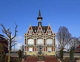
Vimy city hall | |
 Vimy | |
|
Location within Hauts-de-France region  Vimy | |
| Coordinates: 50°22′24″N 2°48′41″E / 50.3733°N 2.8114°ECoordinates: 50°22′24″N 2°48′41″E / 50.3733°N 2.8114°E | |
| Country | France |
| Region | Hauts-de-France |
| Department | Pas-de-Calais |
| Arrondissement | Arras |
| Canton | Vimy |
| Intercommunality | Lens-Liévin |
| Government | |
| • Mayor (2008–2014) | Lionel Lancry |
| Area1 | 11.33 km2 (4.37 sq mi) |
| Population (2006)2 | 4,602 |
| • Density | 410/km2 (1,100/sq mi) |
| Time zone | CET (UTC+1) |
| • Summer (DST) | CEST (UTC+2) |
| INSEE/Postal code | 62861 / 62580 |
| Elevation |
49–146 m (161–479 ft) (avg. 71 m or 233 ft) |
|
1 French Land Register data, which excludes lakes, ponds, glaciers > 1 km² (0.386 sq mi or 247 acres) and river estuaries. 2 Population without double counting: residents of multiple communes (e.g., students and military personnel) only counted once. | |
Vimy (/ˈviːmi/ or /ˈvɪmi/; French pronunciation: [vimi]) is a commune in the Pas-de-Calais department in the Hauts-de-France region of France.
Geography and history
Vimy is a farming town, situated some 10 kilometres (6 miles) north of Arras, at the junction of the D51 and the N17 roads. It is situated on the crest of Vimy Ridge, a prominent feature overlooking the Artois region.
The town was first mentioned in 1183 as Viniarcum and was the scene of much fighting during the fourteenth, seventeenth and eighteenth centuries among the French, English, Dutch and Spanish forces.
The ridge was the scene of fierce fighting in the First World War. Seized by the Germans in 1914, it was the subject of a French assault in 1915. In 1917 the Battle of Vimy Ridge took place southeast of Vimy and was an important battle of the First World War for Canadian military history. The town was practically destroyed during the fighting in the area.
Places of interest
Canadian National Vimy Memorial Park
_cropped.jpg)
Set on the highest point of Vimy Ridge is the Canadian National Vimy Memorial, the largest of Canada's war monuments. In 1922, use of the land for the battlefield park which contains the memorial was granted, in perpetuity, by the French nation to the people of Canada in recognition of Canada's war efforts.[1] 100 hectares (250 acres) of the former Vimy Ridge battlefield is preserved as part of the memorial park which surrounds the monument. The grounds of the site are still honeycombed with wartime tunnels, trenches and craters, closed off for public safety.
The memorial took eleven years and $1.5 million to build and was unveiled on 26 July 1936 by King Edward VIII (prior to his abdication and in his capacity as King of Canada), in the presence of President Albert Lebrun of France and 50,000 or more Canadian and French veterans and their families.
The memorial site is tended by Veterans Affairs Canada.
Town of Vimy
- The church of St.Martin, rebuilt, along with much of the village, after World War I.
- The remains of a thirteenth-century castle, destroyed in 1833, now the site of the current town hall.
Population
| Year | 1962 | 1968 | 1975 | 1982 | 1990 | 1999 | 2006 |
|---|---|---|---|---|---|---|---|
| Population | 3009 | 3272 | 3316 | 3621 | 4581 | 4675 | 4602 |
| From the year 1962 on: No double counting—residents of multiple communes (e.g. students and military personnel) are counted only once. | |||||||
Twin towns
See also
References
- ↑ "Canada Treaty Information". Department of Foreign Affairs and International Trade. 2002-02-26. Retrieved 2008-01-04.
External links
| Wikimedia Commons has media related to Vimy. |
- Official website of the commune (French)
- Vimy on the Quid website (French)