Washington and Old Dominion Railroad
| Reporting mark | WOD |
|---|---|
| Locale | Virginia |
| Dates of operation | 1912–1968 |
| Track gauge | 4 ft 8 1⁄2 in (1,435 mm) standard gauge |
| Length | 72 miles (116 kilometres) |
| Headquarters | Washington, D.C., Arlington, Virginia |
The Washington and Old Dominion Railroad (colloquially referred to as the W&OD), the successor to the bankrupt Washington and Old Dominion Railway, was an intrastate short-line railroad located in Northern Virginia. Its oldest line extended from Alexandria on the Potomac River northwest to Bluemont at the foot of the Blue Ridge Mountains near Snickers Gap, not far from the boundary line between Virginia and West Virginia. The railroad's route largely paralleled the routes of the Potomac River and the present Virginia State Route 7 (VA Route 7).
The line followed the winding course of Four Mile Run upstream from Alexandria through Arlington to Falls Church. At that point, the railroad was above the fall line and was able to follow a more direct northwesterly course in Virginia through Dunn Loring, Vienna, Sunset Hills (now in Reston), Herndon, Sterling, Ashburn, Leesburg, Paeonian Springs, Hamilton, Purcellville and Round Hill to its terminus at Bluemont, turning sharply to the west only after passing through Clarks Gap in Catoctin Mountain west of Leesburg. A branch connected the line to Rosslyn. The Washington & Old Dominion Railroad Trail (W&OD Trail), the Bluemont Junction Trail and several other trails have replaced much of the railroad's route.
History
Predecessors of the Washington and Old Dominion Railway/Railroad
.jpg)
Originally incorporated as the Alexandria and Harper's Ferry Railroad, construction on the line began in 1855 by the Alexandria, Loudoun and Hampshire (AL&H) Railroad under the presidency of Lewis McKenzie[1] First intended to cross the Blue Ridge Mountains and the Shenandoah River to reach the coal fields in the western part of Hampshire County, Virginia, that are now within Mineral County, West Virginia, the AL&H began operating to Vienna in 1859 from a terminal station near Princess and Fairfax Streets in old town Alexandria.[2] In 1860, the AL&H reached Leesburg in Loudoun County.[3] Because of its proximity to Washington, D.C., the line saw much use and disruption during the Civil War.[4] After the war, the name of the line was changed in 1870 to the Washington and Ohio Railroad.[5] The line was extended from Leesburg to Hamilton in 1870 and to Round Hill in 1874.[6]
Upon acquisition by new owners in the 1880s, the line's name was changed twice: first to the Washington and Western Railroad in 1882 and in the next year to the Washington, Ohio and Western (WO&W) Railroad.[7] However, the line's trains did not serve either Washington, Ohio, or the West.
In 1886, the Richmond and Danville Railroad, whose trunk line travelled between Washington, D.C., and Atlanta with connections to New York City, New Orleans, Mississippi and Florida, leased the WO&W.[8] The Richmond and Danville also acquired a branch that paralleled the WO&W while traveling between Manassas and Strasburg, Virginia, where it connected to railroads in the Shenandoah Valley west of the Blue Ridge that the WO&W did not reach (see: Manassas Gap Railroad).[8] In 1888, the Richmond and Danville began to operate the WO&W's trains between Washington, D.C., and Round Hill.[8]
In 1894, the newly formed Southern Railway absorbed the Richmond and Danville Railroad and acquired the WO&W.[9][10][11] In 1900, the Southern Railway extended the line westward for four miles from Round Hill to Bluemont (formerly Snickersville).[9][10] The Southern Railway designated the line as its Bluemont Branch.[9][10]
By 1908, steam locomotives were hauling Southern Railway passenger trains from the new Union Station in Washington, D.C., to Alexandria Junction (north of old town Alexandria), where they switched to travel westward on the Bluemont Branch.[9] Connecting trains shuttled passengers between Alexandria Junction and the former AL&H terminal in old town Alexandria.[9] On weekends, express trains carried vacationers from Washington to Bluemont and other towns in western Loudoun County in which resorts had developed.[9][10][12]
Meanwhile, in 1906, electric trolleys had begun to run on the Great Falls and Old Dominion Railroad (GF&OD) northwest to Great Falls from Georgetown in Washington, D.C.[13] This line, which John Roll McLean and Stephen Benton Elkins owned at the time, crossed the Potomac River on the old Aqueduct Bridge, passed through Rosslyn, and traveled northwest on a double-tracked line through Arlington and Fairfax County to an amusement park (trolley park) that the railway constructed and operated near the Falls.[14]
Maps
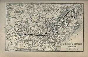 Richmond & Danville Railroad system map, 1891
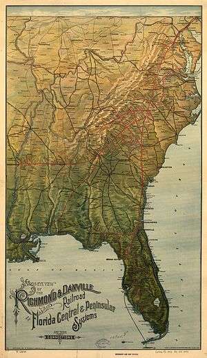 Richmond & Danville Railroad system map, 1893
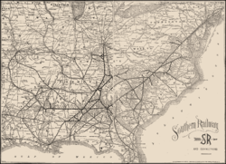 Southern Railway system map, 1895
Washington and Old Dominion Railway

In 1911, McLean and Elkins formed a new corporation, the Washington and Old Dominion Railway.[15] In that year, they concluded negotiations with the Southern Railway to lease the Southern's Bluemont Branch and to take over all service on the branch on July 1, 1912.[16] The lease excluded the portion of the Southern's route that connected Potomac Yard with the former AL&H terminal in old town Alexandria.[16]
In 1912, the GF&OD became the "Great Falls Division" of the W&OD Railway, while the Southern's Bluemont Branch became a part of the W&OD Railway's "Bluemont Division".[17] The W&OD electrified all of its operations over the next four years, becoming an interurban electric trolley system that carried passengers, mail, milk and freight.[18] From that time onward, W&OD trains crossed over Potomac Yard on a long trestle constructed earlier for the Southern Railway.[19] In contrast to the Southern Railway's earlier Bluemont Branch service, the W&OD Railway's Bluemont Division did not serve Washington's Union Station.[20]
To join its two lines, the W&OD Railway constructed in 1912 a double-tracked Bluemont Division connecting line that traveled between two new junctions in Arlington: Bluemont Junction on the Alexandria-Bluemont line and Thrifton Junction on the Georgetown-Great Falls line.[16][21] The connecting line passed through Lacey (near the west end of Ballston), crossing on a through girder bridge over a competing interurban electric trolley line, the Fairfax line of the Washington-Virginia Railway (see Northern Virginia trolleys).[22][23] The rival line carried passengers between Rosslyn, Clarendon, Ballston, Falls Church, Vienna and Fairfax City.[24]
The railway's electrification system distributed 650 volts direct current (DC) to its Bluemont Division cars and trains through overhead catenary lines.[25] Single overhead lines carried the Great Falls Division's electricity over its tracks.[25][26] Stationary and movable electrical substations containing Westinghouse alternating current (AC) to DC converters were located at various points along the railway's routes.[25][27]
The W&OD's main passenger line ran from Georgetown and Rosslyn through Thrifton Junction, Bluemont Junction and westward to Bluemont.[28] However, after crossing the Potomac River from Georgetown, many W&OD passengers transferred in Rosslyn to the trolleys of the competing Washington-Virginia Railway.[29] Most of the W&OD's freight trains ran between Potomac Yard, Bluemont Junction and either Rosslyn or various locations along the Bluemont Division.[28]
In 1923, the W&OD Railway ceased operating from Georgetown when the federal government replaced the aging Aqueduct Bridge with the new Francis Scott Key Bridge.[30] At the same time, the railroad constructed a new passenger station in Rosslyn which became its "Washington" terminal.[30]
The W&OD Railway fell upon hard times in the 1930s during the Great Depression.[31] In 1932, the railway went into bankruptcy and was placed in receivership.[32] In 1934, the railway abandoned operations on the Great Falls Division between Thrifton Junction and Great Falls.[30][33][34]
Washington and Old Dominion Railroad
In 1936, the Washington and Old Dominion Railroad, a new corporation that Davis Elkins (the son of Stephen Benton Elkins) had created, assumed operation of the remnants of the W&OD Railway, which consisted only of the Railway's Bluemont Division and the portion of the former Great Falls Division that had remained between Rosslyn and Thrifton (which was no longer a junction).[35][36] Shortly thereafter, in 1939, the railroad abandoned the western end of its line, which had connected the towns of Purcellville and Bluemont.[35]
In 1945, the W&OD Railroad acquired ownership of the section of line between Potomac Yard and Purcellville that the W&OD Railway had earlier leased from the Southern Railway.[37] The Southern Railway retained ownership of the easternmost section of the railroad's route, which still connected Potomac Yard to the Southern's freight and passenger stations in old town Alexandria.
During the 1940s, the W&OD Railroad converted all of its lines' operations from electric to diesel or gasoline power.[36][38] During that decade, the railroad discontinued its electrified passenger service in 1941, but temporarily resumed passenger service during the Second World War using gas-electric motor cars and cars pulled by diesel-electric locomotives.[39] Passenger and mail service finally ended in 1951; thereafter, the railroad carried only freight.[40]
The Chesapeake and Ohio Railway (C&O) purchased the W&OD Railroad in 1956, but did not change the railroad's name.[41] In 1963, the C&O abandoned the segment of its line that traveled between Rosslyn, Thrifton and Lacey.[42] The Virginia Department of Highways then purchased this segment to acquire a right-of-way for the planned route of Interstate 66 (I-66).[42]
Five years later, in 1968, the railroad, which by that time operated only between Potomac Yard and Purcellville, ceased operations.[43] Shortly thereafter, the C&O sold the railroad's route to the Virginia Department of Highways.[44] The Highway Department then sold most of the route to the Virginia Electric and Power Company (VEPCO) (now Dominion Virginia Power), whose transmission lines had run along the railroad's right-of-way.[44] The Highway Department retained a portion of the route in Arlington immediately east of Falls Church, on which it built I-66, and the section of the route which crossed the Henry G. Shirley Memorial Highway (presently part of Interstate 395 (I-395)) along the Arlington-Alexandria boundary.[45]
Bluemont Division, Alexandria-Bluemont Line
Most of the Bluemont Division's passenger cars or trains ran on the W&OD Railway's Great Falls Division's line from Georgetown over the Aqueduct Bridge through Rosslyn to Thrifton Junction. From Thrifton Junction, the trains ran on the Bluemont Division's connecting line to Bluemont Junction, where they met other Bluemont Division passenger cars or trains that ran from Alexandria, following Four Mile Run in Arlington. Some of the Bluemont Division cars or trains then continued their trips through Falls Church, Vienna, Herndon, Sterling, Ashburn, Leesburg, Clarkes Gap and Purcellville to terminate in Bluemont, Virginia, at the base of the Blue Ridge Mountains, following a route that was similar to that of Virginia State Route 7.[46]
The Norfolk Southern Railway now operates a spur between the Alexandria waterfront and a north-south route that had traveled through Potomac Yard before the Yard closed.[47] The spur formerly served trains traveling from the eastern end of the Bluemont Division to the Southern Railway's freight and passenger stations in old town Alexandria.[47] As the Southern Railway owned and operated the spur and the stations, this section of track remained in operation after the W&OD closed.[47]
A paved trail in Alexandria's linear Mt. Jefferson Park has replaced part of the Bluemont Division's course through that city.[48] The Northern Virginia Regional Park Authority's W&OD Trail travels in the Washington & Old Dominion Railroad Regional Park within the Bluemont Division's former right-of-way from the Alexandria/Arlington boundary through Bluemont Junction to Purcellville.[49] The section of the Bluemont Division between Purcellville and Bluemont has not become a part of any trail, as the W&OD Railroad abandoned this section in 1938, thirty years before the remainder of its line closed.
Stations
The stations on the Alexandria-Bluemont line of the W&OD's Bluemont Division (with locations of sites in 2008) were:
| Station[50] | Location | Coordinates | Jurisdiction | W&OD Trail Mile[51] | Side of Tracks | Photo | Notes |
|---|---|---|---|---|---|---|---|
| Alexandria Passenger Terminal[52][53] | Northeast corner of Princess Street and N. Fairfax Street | 38°48′29″N 77°02′30″W / 38.808041°N 77.041572°W | City of Alexandria | ---------- | West | Operated by Southern Railway | |
| Alexandria Freight House[53][54] | Northwest corner of Princess Street and N. Lee Street | 38°48′29″N 77°02′27″W / 38.808024°N 77.040972°W | City of Alexandria | ---------- | East | Operated by Southern Railway | |
| W&OD locomotive maintenance shed[48] | Northwest of intersection of Massey Lane and Hunting Creek Drive | 38°49′21″N 77°02′46″W / 38.8224781°N 77.0460114°W | City of Alexandria | ---------- | Northeast | East end of W&OD Railroad; Northeast of Southern Railway junction on east side of Potomac Yard | |
| Alexandria Junction[48][55] | Mt. Jefferson Park, between Calvert Avenue and Stewart Avenue, west of Jefferson Davis Highway (U.S. Route 1) | 38°49′46″N 77°03′16″W / 38.8294239°N 77.0544899°W | City of Alexandria | ---------- | Southwest | circa 1918 | Site of track connecting to Washington & Ohio Junction on Washington and Alexandria Railway (Southern Railway main line).[56] Connecting track removed in 1912.[57] Historical markers near site:[58][59] 1) The Bluemont Line 2) St. Asaph Racetrack |
| St. Elmo[48][60] | Commonwealth Avenue (northwest side) at intersection with Ashby Street near northwest end of Mt. Jefferson Park and Greenway | 38°50′00″N 77°03′32″W / 38.833237°N 77.058899°W | City of Alexandria | ---------- | Southwest | 1932 1932 |
Crossing of Washington-Mt. Vernon line of Washington-Virginia Railway[48] Historical marker near site: [58][59][61]The Electric Railway |
| Cowdon[60] | Opposite side (east side) of S. Shirlington Road from Mile Zero of W&OD Trail (0.1 mile west of Henry G. Shirley Memorial Highway (I-395)) | 38°50′39″N 77°05′08″W / 38.8441553°N 77.0854908°W | Arlington County[62] | 0[63] | South | Also named Nauck Station.[64] Historical markers near site:[65] 1) Washington and Old Dominion Trail 2) Tracks Into History: The Washington & Old Dominion Railroad 3) Nauck: A Neighborhood History | |
| Barcroft[66] | Columbia Pike (VA Route 244) (south side) & W&OD Trail | 38°51′23″N 77°06′34″W / 38.8563063°N 77.109569°W | Arlington County | 1.6[67] | Southwest | circa 1910 | Formerly Arlington Mill station |
| Barcroft Freight House | Columbia Pike (VA Route 244) (northwest side) & W&OD Trail | 38°51′24″N 77°06′36″W / 38.856686°N 77.109947°W | Arlington County | 1.6[67] | Northeast | circa 1967 | |
| Glencarlyn[68] | W&OD Trail in Glencarlyn Park (near north side of Arlington Boulevard (U.S. Route 50) overpass) | 38°52′01″N 77°07′29″W / 38.866845°N 77.124667°W | Arlington County | 2.7[67] | Southwest | 1896–1912 1918 |
Agency station. Formerly Carlin Springs station. Historical marker at site.[69] |
| Bluemont Junction[68][70] | W&OD Trail between Wilson Boulevard and Bluemont Junction Trail | 38°52′22″N 77°07′57″W / 38.872834°N 77.1325073°W | Arlington County | 3.4[71] | Northeast | 1934 (aerial) 1950s |
Junction with Thrifton-Bluemont Junction connecting line Wye on east side of tracks.[70] Station and electrical substation within wye[70] Station near south side of electrical substation in 1916.[70] Station adjacent to south side of electrical substation after 1918 Historical markers at site:[65] 1) Bluemont Junction 2) The Great Falls Line 3) Rosslyn Station 4) Bluemont Junction, c. 1934 Historical marker near site:[65] Tracks into History: The Washington & Old Dominion Railroad |
| Torrison[68] | Wilson Boulevard (northwest side) & W&OD Trail | 38°52′30″N 77°08′02″W / 38.875115°N 77.133958°W | Arlington County | 3.6[71] | Northeast | ||
| Fostoria[72] | North Ohio Street (west side) & W&OD Trail | 38°52′55″N 77°08′46″W / 38.8820761°N 77.1462268°W | Arlington County | 4.4[71] | Southwest | Historical marker near site:[73] Brandymore Castle | |
| Falls Church (East Falls Church)[72] | Lee Highway (U.S. Route 29) (northwest side) & W&OD Trail | 38°53′14″N 77°09′45″W / 38.887358°N 77.162583°W | Arlington County | 5.6[71] | Southwest | 1951 Undated Undated circa 1966 |
Agency station Historical marker at site:[65] East Falls Church Station Historical marker near site:[74] East Falls Church Three stations near site[75] |
| Rothsay[72] | W&OD Trail southeast of Oak Street | 38°53′26″N 77°10′36″W / 38.890611°N 77.176551°W | City of Falls Church | 6.5[76] | Northeast | Historical marker near site:[65] Train Wrecks | |
| West Falls Church (West End)[77] | W. Broad Street (VA Route 7) (east side) & W&OD Trail | 38°53′30″N 77°11′07″W / 38.891653°N 77.185282°W | City of Falls Church | 7.0[76] | South | 1890s undated |
Historical marker at site:[65] West Falls Church Station Historical marker near site:[65] Tracks into History: The Washington & Old Dominion Railroad |
| Evans | W&OD Trail near Fowler Street | 38°53′30″N 77°11′35″W / 38.8915798°N 77.1931091°W | Fairfax County | 7.4[76] | |||
| Green | Northern Virginia Regional Park Authority right-of-way near Interstate 66 and Avon Lane; 0.4 miles south of W&OD Trail | 38°53′21″N 77°12′47″W / 38.8892103°N 77.2130942°W | Fairfax County | ---------- | |||
| Dunn Loring[78] | Sandburg Street (west side) & W&OD Trail | 38°53′30″N 77°13′21″W / 38.891734°N 77.222471°W | Fairfax County | 9.1[79] | North | 1950s | Agency station. Historical markers at site:[65] 1) Dunn Loring Station 2) Camp Alger 3) Tracks into History: The Washington & Old Dominion Railroad |
| Wedderburn[78] | W&OD Trail, 0.2 miles west of Cedar Lane | 38°53′46″N 77°14′23″W / 38.8962268°N 77.239755°W | Fairfax County | 10.1[79] | South | Undated | |
| Franklin | W&OD Trail, between Owaissa Road SE and Adahi Road SE (0.1 mile southeast of bridge abutment of Fairfax line of Washington-Virginia Railway on north side of W&OD Trail) | 38°53′56″N 77°14′40″W / 38.8988987°N 77.2443151°W | Town of Vienna | 10.3[79] | |||
| Park Street | Park St. SE & W&OD Trail | 38°54′04″N 77°15′34″W / 38.901013°N 77.259515°W | Town of Vienna | 11.3[79] | West of site of Civil War Battle of Vienna, Virginia Historical markers near site:[65] 1) "Civil War Action at Vienna". 2) Electric Trains on the W&OD 3) The Great Falls Line | ||
| Church Street | Church Street NE & W&OD Trail | 38°54′12″N 77°15′56″W / 38.903232°N 77.265419°W | Town of Vienna | 11.7[79] | Adjacent to Vienna Station of Washington-Virginia Railway | ||
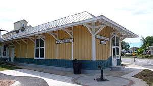
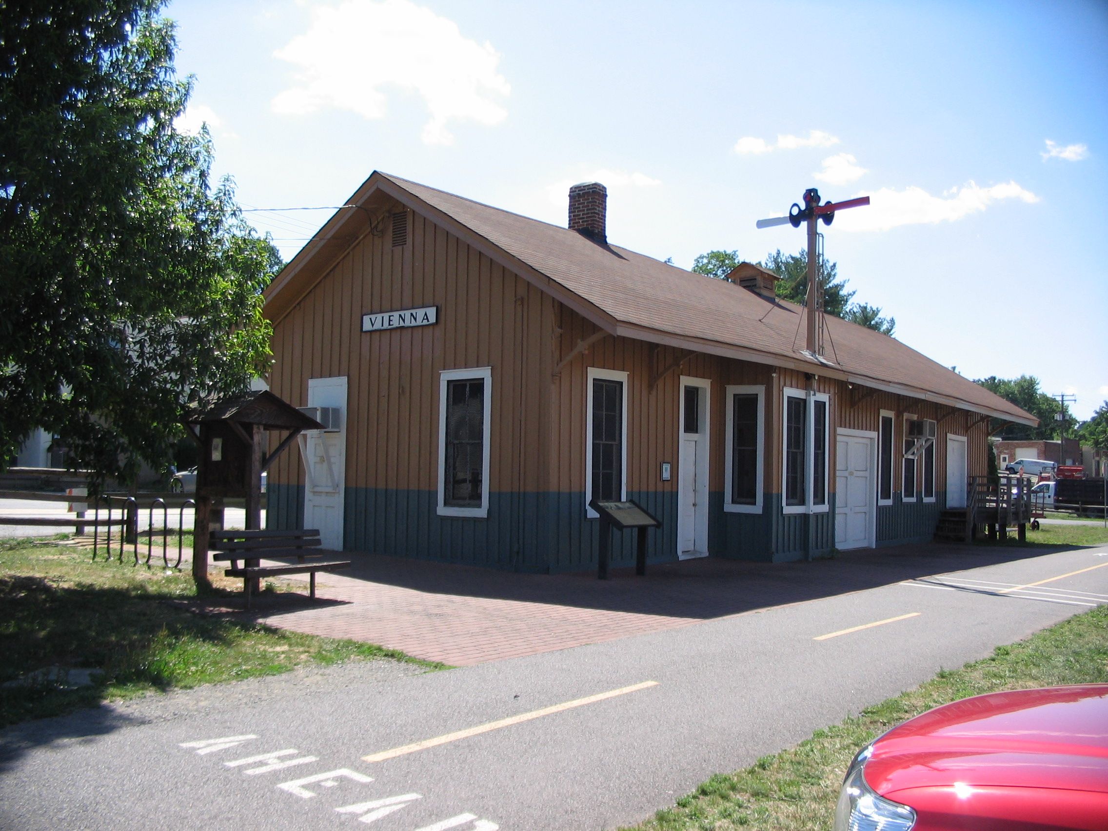
| Vienna[80] | 231 Dominion Road NE at Ayr Hill Avenue NE (southeast side) & W&OD Trail | 38°54′15″N 77°16′01″W / 38.904142°N 77.266974°W | Town of Vienna | 11.8[81] | Southwest | 1894–1912 undated |
Agency station. National Register of Historic Places nomination form for station prepared in 2002[82] Historical marker at site:[65] Tracks into History: The Washington & Old Dominion Railroad Historical markers near site:[65] 1) Vienna Station 2) Vienna Centennial Park |
| Clarks Crossing[83] | Clarks Crossing Road (southwest side) & W&OD Trail | 38°55′16″N 77°17′09″W / 38.921097°N 77.285804°W | Fairfax County | 13.3[81] | Northeast | ||
| Piney | Piney Branch & W&OD Trail (northwest of Peppermill Place) | 38°55′32″N 77°17′18″W / 38.925563°N 77.288336°W | Fairfax County | 13.7[81] | Historical marker near site:[65] Terror by the Tracks | ||
| Lowland | Lowland Station Road & W&OD Trail | 38°55′42″N 77°17′34″W / 38.928382°N 77.292686°W | Fairfax County | 14.0[81] | |||
| Hunters[84] | Hunter Mill Road (VA Route 674) (east side) & W&OD Trail | 38°55′57″N 77°18′18″W / 38.9325737°N 77.3049277°W | Fairfax County | 14.7[85] | Southwest | before 1912 circa 1950 |
Historical markers near site:[65] 1) Hunter Station Circa 1900 2) Hunter Station 3) Strategic Junction: Hunter Mill Road and the AL&H Railroad 4) Crossroads to War |
| Pinecrest | W&OD Trail near Michael Faraday Court | 38°56′58″N 77°19′57″W / 38.949535°N 77.33245°W | Fairfax County | 16.7[85] | |||
| Soapstone Siding | W&OD Trail | Fairfax County | |||||
| Sunset Hills[86] | Old Reston Avenue (northwest side) & W&OD Trail | 38°57′21″N 77°21′06″W / 38.955869°N 77.351789°W | Fairfax County | 17.7[87] | Northeast | 1966 | Agency station. Formerly Wiehle station. Historical markers near site:[65] 1) Sunset Hills Station 2) Train Wrecks |
| Thornton | W&OD Trail east of Town Center Parkway | 38°57′23″N 77°21′41″W / 38.956330°N 77.361367°W | Fairfax County | 18.4[87] | |||
| Jackson | Sugarland Run & W&OD Trail, between Fairfax County Parkway and Herndon Parkway E | 38°57′34″N 77°22′16″W / 38.959511°N 77.371025°W | Fairfax County | 18.8[87] | |||
| Coral[88] | Coral Road (northeast side) & W&OD Trail | 38°57′57″N 77°22′47″W / 38.9657322°N 77.3796594°W | Town of Herndon | 19.6[87] | Southwest | ||
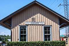
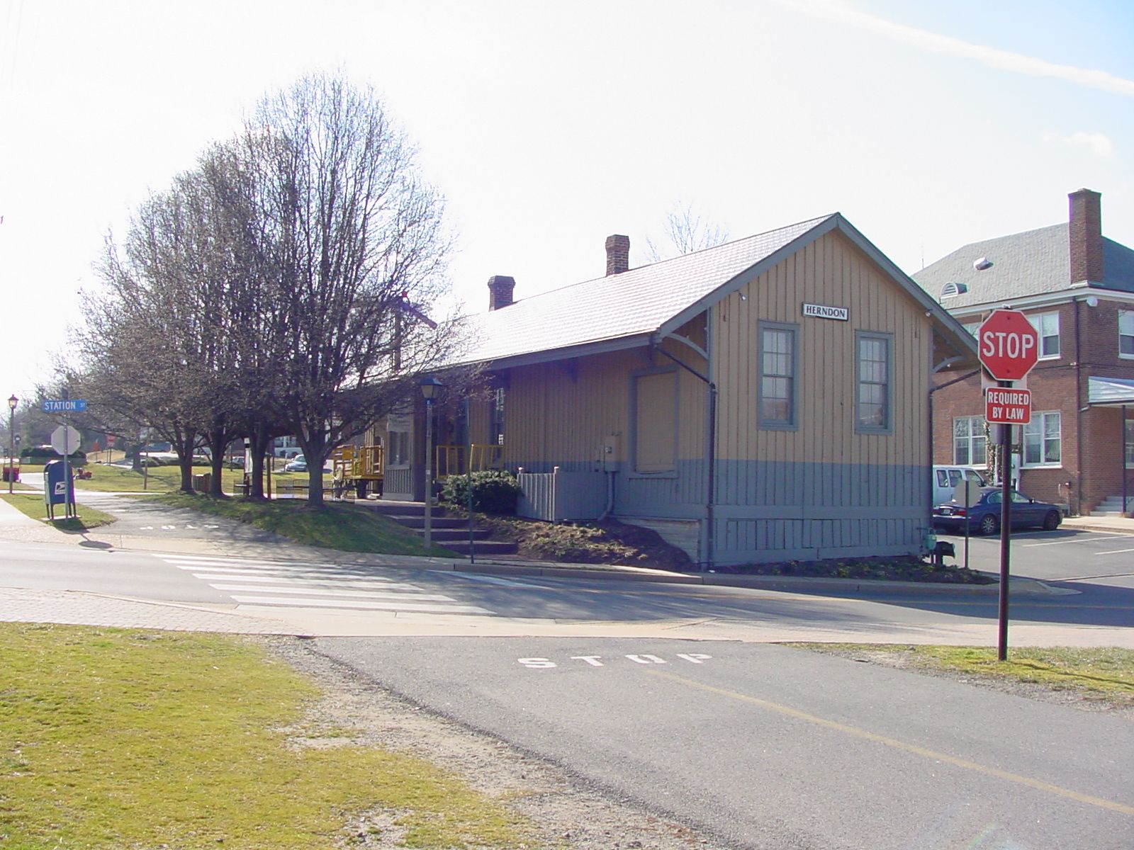
| Herndon[88][89] | 717 Lynn Street at Station Street (south side) & W&OD Trail | 38°58′13″N 77°23′09″W / 38.970170°N 77.385700°W | Town of Herndon | 19.9[87] | Southwest | 1890; | Agency station. Wye northwest of station (northeast side of tracks).[88] Electrical substation attached to southeast side of station.[88] Station listed on National Register of Historic Places in 1979.[90][91] Historical markers near site:[65] 1) Herndon Station 2) Mosby’s Herndon Station Raid 3) Tracks into History: The Washington & Old Dominion Railroad 4) The Rail Strike of 1916 |
| Herndon Heights[92] | Crestview Drive (northwest side) & W&OD Trail | 38°58′48″N 77°23′56″W / 38.9800163°N 77.3988855°W | Town of Herndon | 20.9[93] | Northeast | ||
| Oak Grove | Locust Lane & W&OD Trail (near Dominion Lane) | 38°59′02″N 77°24′14″W / 38.983871°N 77.403995°W | Loudoun County | 21.3[93] | |||
| Lynn | W&OD Trail | 38°59′17″N 77°24′29″W / 38.988077°N 77.408059°W | Loudoun County | 21.6[93] | |||
| Buchanan | Warwick Court & W&OD Trail | 38°59′46″N 77°25′17″W / 38.996040°N 77.421470°W | Loudoun County | 22.6[93] | |||
| Sterling[94] | W&OD Trail, north of Ruritan Circle (Old Church Road) (VA Route 859) | 39°00′25″N 77°25′44″W / 39.006996°N 77.4289852°W | Loudoun County | 23.4[95] | West | 1927 | Agency station. Formerly Guilford station. Historical marker at site:[65] Sterling Station |
| Smiths[96] | W&OD Trail; 0.4 miles southeast of crossing of Smith's Switch Road and W&OD Trail | 39°01′25″N 77°27′13″W / 39.0236389°N 77.453565°W | Loudoun County | 25.1[95] | Historical marker near site:[65] Rails to Dulles Airport | ||
| Normans (Smith's)[97] | 0.1 mile northwest of crossing of Smith's Switch Road and W&OD Trail; 0.03 miles northwest of W&OD Trail rest stop. | 39°01′41″N 77°27′39″W / 39.0279918°N 77.4607506°W | Loudoun County | 25.7[98] | Northeast | 1920s | Historical markers near site: 1) Norman's Station[65] 2) Tracks into History: The Washington and Old Dominion Railroad[99] |
| Ashburn[100] | Ashburn Road (VA Route 641) (east side) & W&OD Trail | 39°02′38″N 77°29′14″W / 39.043974°N 77.487305°W | Loudoun County | 27.5[98] | Northeast | 1967 | Agency station. Formerly Farmwell station.[101] Historical marker at site:[65] Ashburn Station |
| Graves | W&OD Trail (west of west end of Graves Lane) | 39°03′00″N 77°29′52″W / 39.050115°N 77.497644°W | Loudoun County | 28.1[98] | |||
| Belmont Park[89] | Belmont Ridge Road (VA Route 659) & W&OD Trail | 39°03′49″N 77°30′40″W / 39.063594°N 77.511082°W | Loudoun County | 29.4[102] | Historical marker near site: Belmont[103] | ||
| Trap Rock | Luck Stone Quarry & W&OD Trail (0.5 miles west of Belmont Ridge Road (VA Route 659)) | 39°03′49″N 77°30′40″W / 39.063594°N 77.511082°W | Loudoun County | 29.9[102] | North | Served Trap Rock Quarry (now Leesburg plant of Luck Stone Corp.). Historical marker near site:[65] Diesel Trains on the W&OD | |
| Compher | Cochrane Mill Road & W&OD Trail | 39°04′26″N 77°31′42″W / 39.073773°N 77.528232°W | Loudoun County | 30.6[102] | |||
| Pleasant View | W&OD Trail (west of intersection of Trailview Boulevard and Breakstone Drive) | 39°04′52″N 77°31′57″W / 39.081007°N 77.532438°W | Loudoun County | 31.2[104] | |||
| Lawson[105] | Lawson Road SE (southeast side) & W&OD Trail | 39°05′59″N 77°32′47″W / 39.0997139°N 77.5464445°W | Town of Leesburg | 32.7[104] | Northeast | ||
| Leesburg Freight House[105] | Harrison Street SE (west side) & W&OD Trail | 39°06′40″N 77°33′50″W / 39.1111031°N 77.5640023°W | Town of Leesburg | 34.2[106] | Northeast | 1966 | Wye on northeast side of tracks Freight House inside of wye Historical marker at site:[65] Leesburg Freight Station Historical markers near site:[65] 1) The Leesburg Lime Company 2) Stationmaster's House 3) The Depot 4) Norman-Harding Barn (The "Wharf") 5) McKimmey's Mill |
| Leesburg Passenger Station[105] | S. King Street (U.S. Route 15) (west side) & W&OD Trail | 39°06′44″N 77°33′58″W / 39.112156°N 77.566164°W | Town of Leesburg | 34.4[106] | Northeast | 1906 | Agency station. Historical marker at site:[65] Leesburg Passenger Station Historical markers near site:[65] 1) Electric Trains on the W&OD 2) The Great Falls Line |
| Dry Mill | W&OD Trail, north of intersection of Dry Mill Road and Woodburn Road | 39°06′42″N 77°35′34″W / 39.111715°N 77.592852°W | Loudoun County | 35.8[106] | |||
| Clarkes Gap[107] | Dry Mill Road (northwest side) & W&OD Trail | 39°08′16″N 77°36′35″W / 39.1378331°N 77.6096374°W | Loudoun County | 38.0[108] | Northeast | 1930 | Agency station. Historical marker at site:[65] Clarkes Gap |
| Paeonian Springs[107] | Simpson Circle (west side) & W&OD Trail | 39°08′52″N 77°37′10″W / 39.147768°N 77.619438°W | Loudoun County | 39.2[66] | South | 1920s | Agency station. Historical marker at site:[65] Paeonian Springs Station |
| Hamilton[109] | Hamilton Station Road (east side) & W&OD Trail | 39°08′39″N 77°39′05″W / 39.144091°N 77.651303°W | Loudoun County | 40.9[110] | South | Before 1912 |
Agency station. Historical markers at site:[65] 1) Hamilton Station 2) Tracks into History: The Washington & Old Dominion Railroad |
| Ivandale[111] | Ivandale Road (east side) & W&OD Trail | 39°08′47″N 77°40′12″W / 39.1463955°N 77.6699495°W | Loudoun County | 42.0[110] | North | ||
| Florance | N. Maple Avenue (VA Route 722) & W&OD Trail | 39°08′28″N 77°42′12″W / 39.141012°N 77.703284°W | Town of Purcellville | 43.8[112] | Historical marker near site:[65] Electric Trains on the W&OD | ||
| Purcellville[113] | N. 21st Street (northeast side) and W&OD Trail | 39°08′19″N 77°42′58″W / 39.1384821°N 77.7161211°W | Town of Purcellville | 44.8[112]
(End) |
South | undated 1940 1951 |
Agency station. Listed on National Register of Historic Places in 2010.[114][115] Historical markers at site:[65] 1) Purcellville Station 2) Beyond Purcellville Historical marker near site:[65] Tracks into History: The Washington & Old Dominion Railroad |
| Simmons | ---------- | ||||||
| Round Hill Passenger Station[116] | 35 Main Street (southeast side of Main street) | 39°08′10″N 77°46′08″W / 39.1360397°N 77.7688479°W | Town of Round Hill | ---------- | South | circa 1912 looking south circa 1912 looking west |
Agency station. Electrical substation adjacent to south side of station. |
| Round Hill Freight House[116] | 34 Main Street (northwest side of Main Street) | 39°08′10″N 77°46′09″W / 39.1360668°N 77.7692932°W | Town of Round Hill | ---------- | North | circa 1912 looking west | |
| Scotland Heights[117] | Scotland Heights Road (northeast side) | Loudoun County | ---------- | Southwest | |||
| Homestead | ---------- | ||||||
| Bluemont Terminal[118] | Railroad Street (VA Route 753), north of Snickersville Turnpike (VA Route 734) | 39°06′40″N 77°49′56″W / 39.111066°N 77.832169°W | Town of Bluemont | ---------- | Northwest | circa 1905 circa 1912 1939 |
Agency station. Wye on southeast side of tracks, opposite station. Original station constructed circa 1900; later burned. Replaced by smaller station. |
Existing remnants of Bluemont Division, Alexandria-Bluemont Line
The following remnants of the Alexandria-Bluemont Line existed in 2000 and later.[119] Some were photographed in 1997 or in subsequent years:
Stations
| Station | Location | Coordinates | Jurisdiction | Operator | Present use | Photo | Notes |
|---|---|---|---|---|---|---|---|
| Vienna | 231 Dominion Road NE at Ayr Hill Avenue NE (southeast side) & W&OD Trail | 38°54′15″N 77°16′01″W / 38.904142°N 77.266974°W | Town of Vienna | Northern Virginia Model Railroaders, Inc.[120] | Museum and model railroad layout | 2007[121] | Nomination form for National Register of Historic Places prepared in 2002.[82] |
| Sunset Hills | Old Reston Avenue (west side) & W&OD Trail | 38°57′21″N 77°21′06″W / 38.955869°N 77.351789°W | Fairfax County | Northern Virginia Regional Park Authority | Vacant | 2009[122] | Former headquarters office of Washington and Old Dominion Railroad Regional Park. |
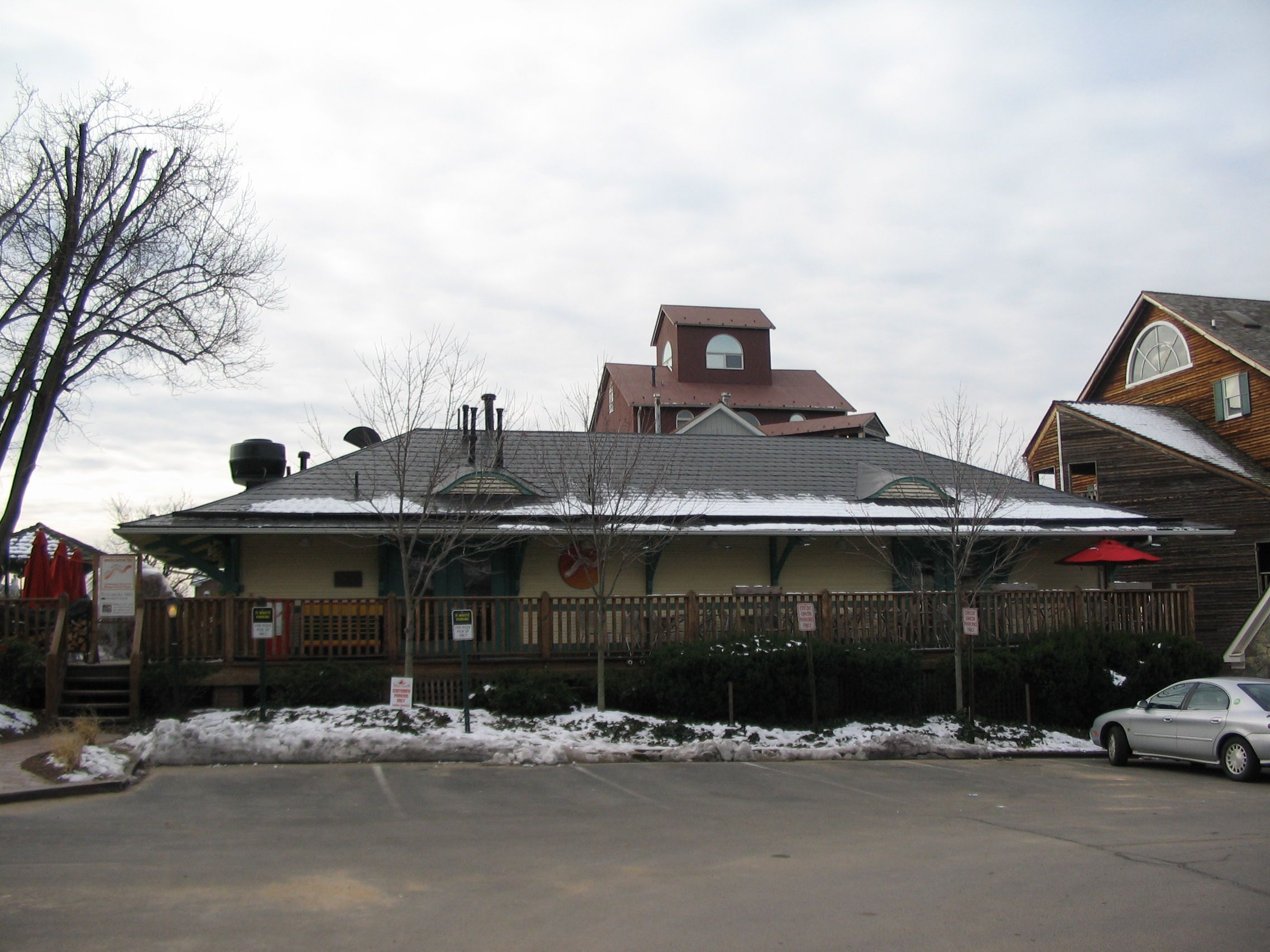
| Herndon | 717 Lynn Street at Station Street (south side) & W&OD Trail | 38°58′13″N 77°23′09″W / 38.970170°N 77.385700°W | Town of Herndon | Herndon Historical Society[123] | Herndon Depot Museum and visitor center | video | Listed on National Register of Historic Places in 1979.[90][91] |
| Leesburg Freight House | Market Station[125] at Harrison Street SE (west side) and Royal Street SE (201 Harrison Street SE) | 39°06′46″N 77°33′46″W / 39.112851°N 77.562854°W | Town of Leesburg | Metro Management Services[126] | Pizza restaurant[127] | 2008[128] | Moved two blocks north of original location in 1984.[129] Historical marker on building: The Depot |
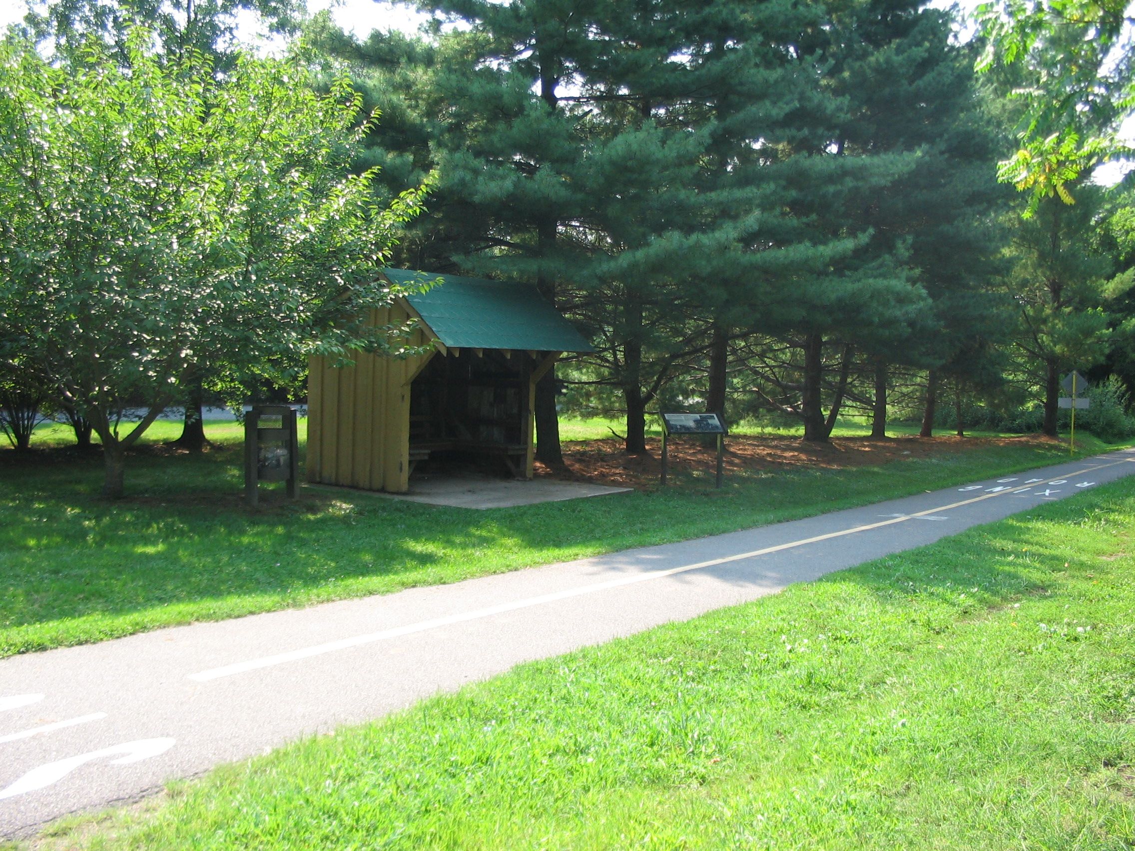
| Clarkes Gap Passenger Shelter | Simpson Circle (west side) & W&OD Trail | 39°08′52″N 77°37′10″W / 39.147768°N 77.619438°W | Loudoun County | Northern Virginia Regional Park Authority | Trailside shelter | 2007[130] | Replaced burned Clarkes Gap station. Preserved by former W&OD Railroad employee. Relocated to former site of Paeonian Springs station by Northern Virginia Regional Parks Authority.[131] |
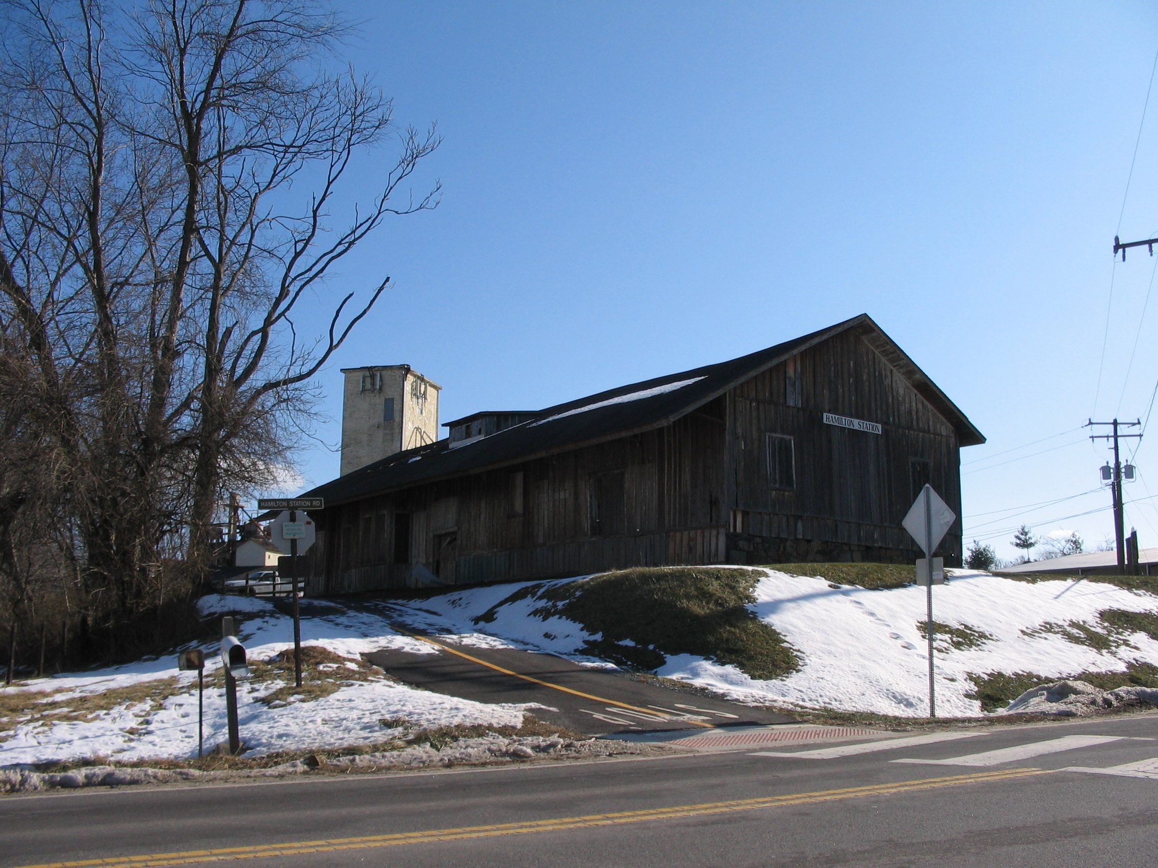
| Hamilton | Hamilton Station Road (east side) & W&OD Trail | 39°08′36″N 77°39′02″W / 39.143375°N 77.650509°W | Loudoun County | Loudoun County Milling Company | Mill equipment storage | undated 2010[132] |
|
| Purcellville | 21st Street N (east side) and W&OD Trail | 39°08′19″N 77°42′58″W / 39.1384821°N 77.7161211°W | Town of Purcellville | Town of Purcellville[133] | Loudoun Visitors Center.[134] Public meeting space |
undated 2009[135] 2009[136] |
Preserved and restored by Purcellville Preservation Association.[137] Listed on National Register of Historic Places in 2010.[114][115] |
| Round Hill Passenger Station | 35 Main Street (south side of Main Street) | 39°08′10″N 77°46′08″W / 39.1360397°N 77.7688479°W | Town of Round Hill | Private property owner | Residence | 1997 | |
| Round Hill Freight House | 34 Main Street (northwest side of Main Street) | 39°08′10″N 77°46′09″W / 39.1360668°N 77.7692932°W | Town of Round Hill | Private property owner |
Bridges
| Crossing | Location | Coordinates | Jurisdiction | W&OD Trail Mile | Remnant | Photo |
|---|---|---|---|---|---|---|
| Russell Road | Russell Road (west side) between W. Glebe Road and Kentucky Avenue | 38°50′17″N 77°03′53″W / 38.838109°N 77.064588°W | City of Alexandria | ------------ | Abutment of former railroad bridge | undated |
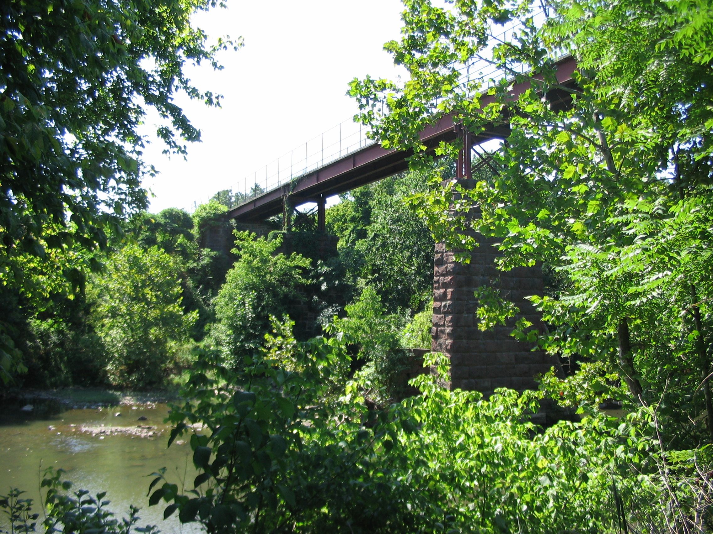
| Four Mile Run | W&OD Trail between Columbia Pike and Arlington Boulevard (U.S. Route 50) | 38°51′51″N 77°07′07″W / 38.864051°N 77.118632°W | Arlington County | 2.3[67] | Abutments under trail bridge | |
| Four Mile Run | W&OD Trail between Arlington Boulevard (U.S. Route 50) and N. Carlin Springs Road | 38°52′03″N 77°07′34″W / 38.86762°N 77.125987°W | Arlington County | 2.8[67] | Abutments under trail bridge | |
| Four Mile Run | W&OD Trail between N. Carlin Springs Road and Wilson Boulevard | 38°52′25″N 77°07′59″W / 38.873653°N 77.133143°W | Arlington County | 3.4[71] | Abutments under trail bridge | |
| Four Mile Run | W&OD Trail between Wilson Boulevard and N. Patrick Henry Drive | 38°52′42″N 77°08′16″W / 38.878464°N 77.137713°W | Arlington County | 3.9[71] | Abutments under trail bridge | |
| Four Mile Run | W&OD Trail between Lee Highway (U.S. Route 29) and Little Falls Street | 38°53′17″N 77°09′55″W / 38.888191°N 77.165407°W | Arlington County | 5.9[76] | Abutments under trail bridge | |
| Piney Branch | W&OD Trail between Ayr Hill Avenue NE and Hunter Mill Road | 38°55′32″N 77°17′18″W / 38.925642°N 77.288381°W | Fairfax County | 13.6[81] | Abutments under trail bridge | 2010[138] |
| Difficult Run | W&OD Trail between Ayr Hill Avenue NE and Hunter Mill Road | 38°55′51″N 77°17′54″W / 38.930942°N 77.29834°W | Fairfax County | 14.3[81] | Abutments under trail bridge | 2009[139] |
| Broad Run | W&OD Trail between Sully Road and Panorama Parkway | 39°01′06″N 77°26′42″W / 39.01845°N 77.444923°W | Loudoun County | 24.6[95] | Abutments under trail bridge | undated |
| Beaverdam Run | W&OD Trail between Smiths Switch Road and Ashburn Village Boulevard | 39°01′55″N 77°28′02″W / 39.031905°N 77.467293°W | Loudoun County | 26.2[98] | Abutments under trail bridge | |
| Goose Creek | W&OD Trail between Belmont Ridge Road and Cochrane Mill Road | 39°04′10″N 77°31′10″W / 39.0694962°N 77.5195634°W | Loudoun County | 30.1[102] | Abutments and piers supporting trail bridge | 2007[140] undated |
| Sycolin Creek | W&OD Trail between Belmont Ridge Road and Cochrane Mill Road | 39°04′20″N 77°31′29″W / 39.0723241°N 77.5247133°W | Loudoun County | 30.4[102] | Span, abutments and pier of railroad bridge (now trail bridge). | undated |
| Tuscarora Creek | W&OD Trail between Cochran Mill Road and Lawson Road SE | 39°05′44″N 77°32′32″W / 39.0955841°N 77.5422603°W | Town of Leesburg | 32.3[104] | Abutments and piers of railroad bridge south of W&OD Trail | |
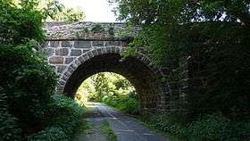
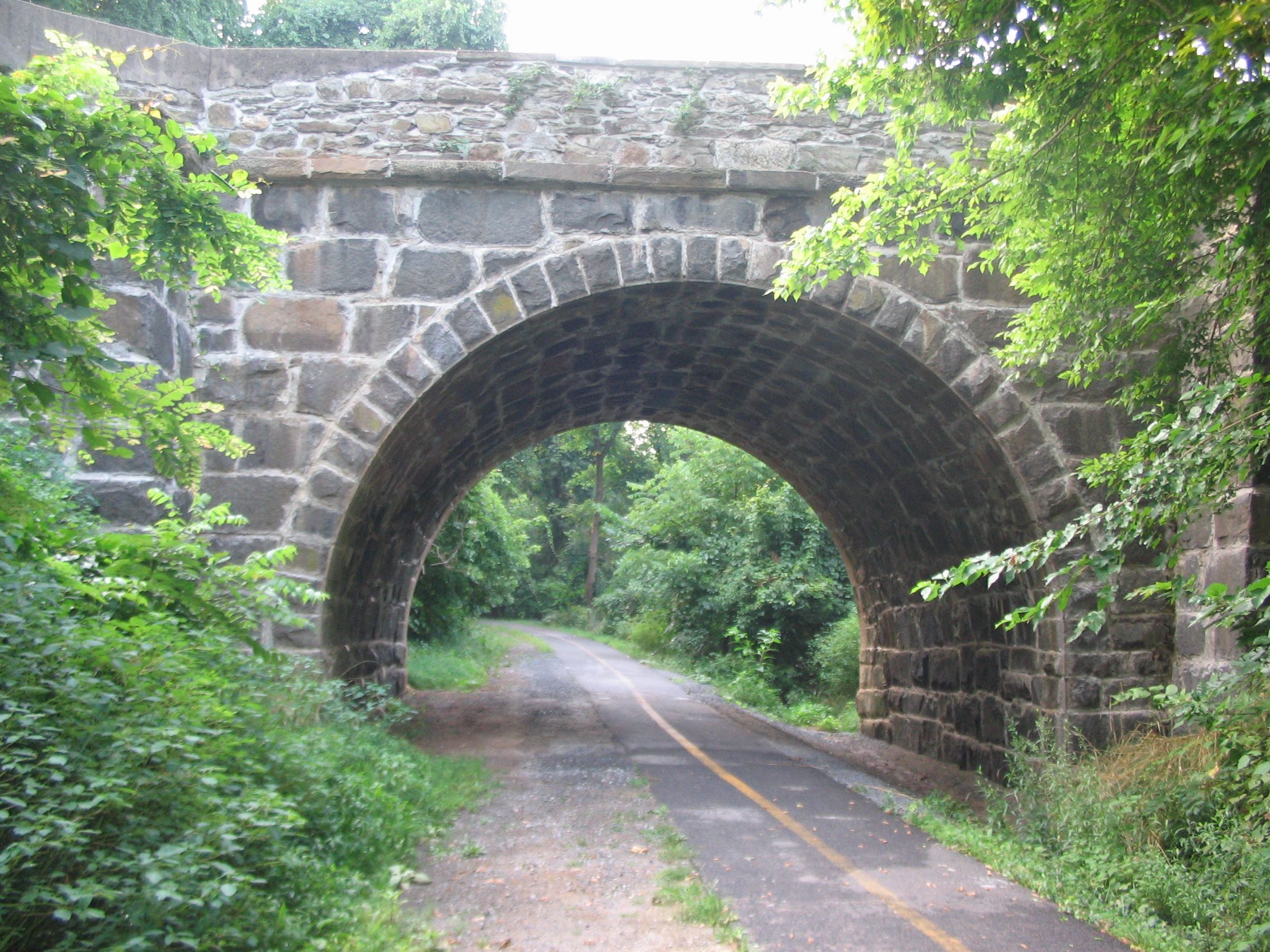
| Clarke's Gap | W&OD Trail and Dry Mill Road | 39°08′22″N 77°36′39″W / 39.1395702°N 77.6109248°W | Loudoun County | 38.2[108] | Stone arch above former W&OD line. | 2007[141] |
| Unnamed stream | W&OD Trail west of Simpson Circle | 39°08′53″N 77°37′19″W / 39.148105°N 77.622067°W | Loudoun County | 39.4[108] | Stone arch culvert under former W&OD line (now under W&OD Trail) | undated |
Other remnants
| Remnant | Location | Coordinates | Jurisdiction | W&OD Trail Mile | Side of W&OD Trail | Photo | Notes |
|---|---|---|---|---|---|---|---|
| Norfolk Southern Railway spur | Tracks between Pendleton Street (east of intersection with N. Fairfax St.) and CSX main line near Slaters Lane | 38°49′01″N 77°02′22″W / 38.81694°N 77.039523°W | City of Alexandria | ------------ | ------------ | ------------ | Operating railroad; formerly owned by Southern Railway |
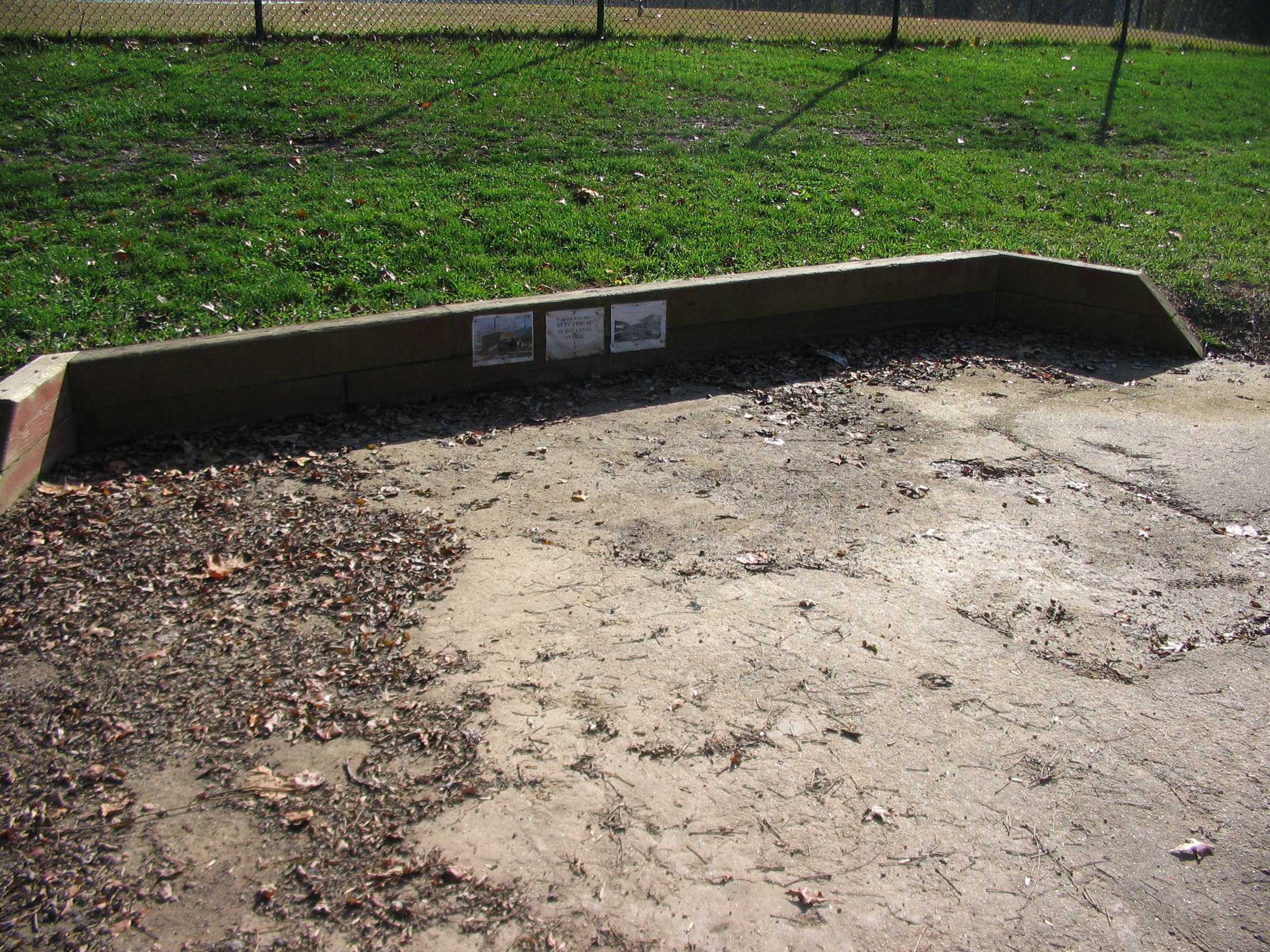
| Floor of electrical substation at Bluemont Junction | Between soccer field and 1971 Southern Railway caboose east of W&OD Trail in Bluemont Junction Park (between Bluemont Junction Trail and Wilson Boulevard) | 38°52′23″N 77°07′57″W / 38.872955°N 77.132521°W | Arlington County | 3.4[71] | East | 2009[142] | In Bluemont Junction Historical Railroad Display[143] in Bluemont Junction Park[144] |
| Coal trestle with rails and ties[145] | 0.05 mile west of Lee Highway (U.S. Route 29); south of W&OD Trail | 38°53′15″N 77°09′48″W / 38.8875844°N 77.1634462°W | Arlington County | 5.6[71] | South | 2007[146] | Formerly used to unload coal from hopper cars and fuel oil from tank cars[147] Partially demolished in June 2014. Designated as local historic district in September 2014.[148] |
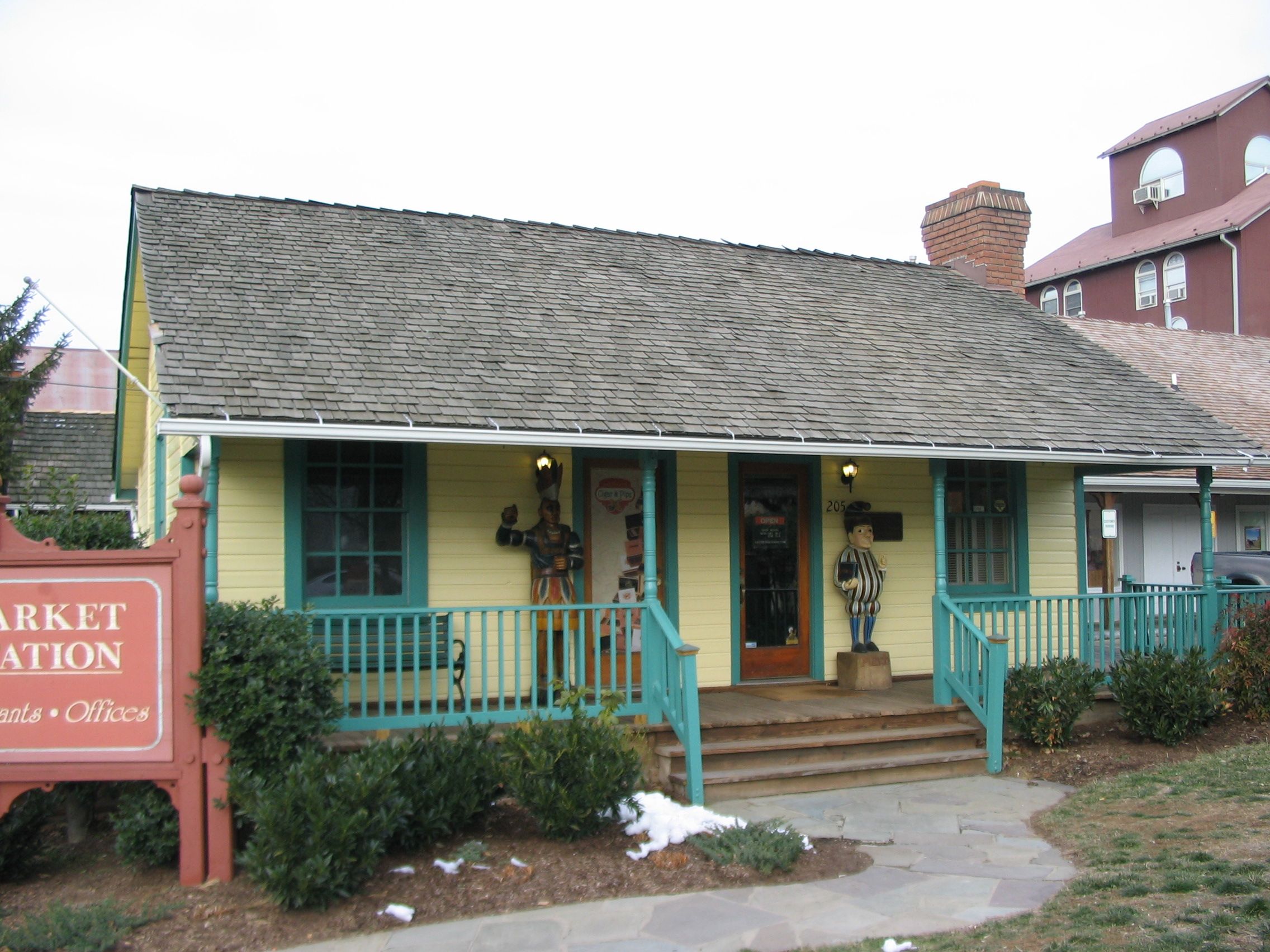
| Leesburg Stationmaster's House | Market Station[126] at Harrison Street SE (west side) and South Street SE (205 Harrison Street SE) | 39°06′44″N 77°33′47″W / 39.1123206°N 77.563042°W | Town of Leesburg | ------------ | ------------ | 2008[149] Undated[150] |
Moved to Market Station[126] (south of relocated freight station). Used as cigar and pipe store.[150] Historical marker on building: Stationmaster's House |
| Round Hill Electrical Substation | Adjacent to south side of former passenger station at 35 Main Street (southeast side of Main Street) | 39°08′09″N 77°46′08″W / 39.1359357°N 77.7688774°W | Town of Round Hill | ------------ | ------------ | 1997[151] | Private residence Enclosed by house |
Existing trails and parks along railroad route
Rail trails
- Trail in Mt. Jefferson Park and Greenway between Jefferson Davis Highway and Commonwealth Avenue, Alexandria[152]
- Washington & Old Dominion Railroad Trail (W&OD Trail)
Other trails
- Unpaved trail connecting Russell Road and Landover Street, Alexandria.[153]
- Section of Mount Vernon Trail adjacent to Norfolk Southern Railway spur between Pendleton Street and E. Abingdon Drive, Alexandria[154]
Linear parks
- Mt. Jefferson Park and Greenway, Alexandria[48][155]
- Washington & Old Dominion Railroad Regional Park
Great Falls Division
Stations
The stations on the Great Falls Division of the W&OD (with locations of sites in 2008) were:
| Station[156] | Location | Coordinates | Jurisdiction | Side of Tracks[157] | Photo | Notes |
|---|---|---|---|---|---|---|
| Georgetown[158] | M Street, N.W., between 35th and 37th Streets, N.W. | 38°54′19″N 77°04′13″W / 38.90519°N 77.070293°W | District of Columbia | West | Terminal station of GF&OD and W&OD until 1923. Adjacent to Georgetown Car Barn, which served Washington's electric street cars. | |
| Rosslyn | Passenger Terminal: Fort Myer Drive (west side) between George Washington Memorial Parkway and Lee Highway | 38°53′58″N 77°04′18″W / 38.89957°N 77.071785°W | Arlington County | West | undated colorized postcard & 1923 interior photo of passenger terminal | The GF&OD and W&OD stopped at a passenger shelter from 1904 to 1923. The W&OD terminated behind a passenger station on Fort Myer Drive from 1923 to 1938 and in the present route of I-66 from 1938 to 1968. All of the stations and termini were near the present site of the Key Bridge Marriott Hotel. Historical Marker: Rosslyn Station[159] |
| Colonial[158] | I-66 at N. Nash Street | 38°53′55″N 77°04′25″W / 38.89866°N 77.07374°W | Arlington County | South | ||
| Rosslyn Freight House[158] | I-66 near N. Oak Street | 38°53′55″N 77°04′32″W / 38.898682°N 77.075433°W | Arlington County | North | ||
| Mackeys[158] | I-66 at N. Quinn Street | 38°53′52″N 77°04′44″W / 38.8978717°N 77.078914°W | Arlington County | Northwest | ||
| Park Lane[158] | I-66 east of N. Uhle Street; north of Lee Highway | 38°53′50″N 77°05′04″W / 38.89709°N 77.084509°W | Arlington County | Southwest | ||
| Pearce[158] | I-66 near N. Adams Street | 38°53′54″N 77°05′22″W / 38.89823°N 77.089466°W | Arlington County | South | ||
| Clark[158] | I-66 near N. Calvert Street | 38°53′52″N 77°05′35″W / 38.89782°N 77.092985°W | Arlington County | South | Near east side of Spout Run. | |
| Thrifton[158] | I-66 between Lee Highway and Spout Run Parkway | 38°53′47″N 77°05′54″W / 38.89646°N 77.098306°W | Arlington County | South | North of Lyon Village shopping center. Named for Hugh A. Thrift. East of junction with Thrifton – Bluemont Junction connecting line. | |
| Dominion Heights[160] | Lee Highway (between traffic lanes) at N. Monroe Street (east side) | 38°53′46″N 77°06′15″W / 38.8960055°N 77.1040356°W | Arlington County | South | ||
| Cherrydale[160] | Intersection of Lee Highway and Old Dominion Drive at Military Road (east side) | 38°53′49″N 77°06′30″W / 38.8969741°N 77.1083701°W | Arlington County | Southwest | circa 1908 | |
| Harrison[160] | Old Dominion Drive at N. Thomas Street | 38°53′58″N 77°06′51″W / 38.89947°N 77.114174°W | Arlington County | South | ||
| Greenwood[160] | Old Dominion Drive at Lorcom Lane (northwest side); east of N. Vermont Street | 38°53′57″N 77°07′01″W / 38.8991534°N 77.1170604°W | Arlington County | South | ||
| Maplewood[160] | Old Dominion Drive between traffic lanes north of Lee Highway; west of N. Abingdon Street | 38°53′55″N 77°07′17″W / 38.89867°N 77.12139°W | Arlington County | South | ||
| Livingston[160] | Old Dominion Drive at 24th Street N. (north side) | 38°54′03″N 77°07′28″W / 38.90073°N 77.124431°W | Arlington County | Southwest | 24th Street N. was Livingstone Street prior to 1932 (named for Colin H. Livingstone) | |
| Lyonhurst[160] | Old Dominion Drive at 25th Street N. | 38°54′07″N 77°07′33″W / 38.90189°N 77.125799°W | Arlington County | Southwest | Named for the nearby estate of Frank Lyon (now Missionhurst) | |
| Summit[160] | Old Dominion Drive at 26th Street N. (southeast side) | 38°54′10″N 77°07′38″W / 38.902907°N 77.127108°W | Arlington County | Southwest | ||
| Rixey[160] | Old Dominion Drive at N. Glebe Road (east side) | 38°54′15″N 77°07′43″W / 38.9042925°N 77.1286476°W | Arlington County | Northeast | undated | Named for the nearby estate of Dr. Presley Marion Rixey. Marymount University now occupies the Rixey estate. Later station on southwest side of tracks.[161] |
| Jewell[162] | Old Dominion Drive at Rock Spring Road (north side) | 38°54′28″N 77°07′58″W / 38.90781°N 77.132692°W | Arlington County | Southwest | undated | Named for Charles Jewell |
| Vanderwerken[162] | Old Dominion Drive at Little Falls Road (northwest side) | 38°54′35″N 77°08′13″W / 38.90980°N 77.136987°W | Arlington County | North | Named for Gilbert Vanderwerken | |
| Franklyn Park[162] | Old Dominion Drive at Franklin Park Road | 38°54′55″N 77°08′54″W / 38.91540°N 77.148453°W | Fairfax County | Northeast | undated | |
| Rockwell[162] | Old Dominion Drive near Dominion Crest Lane | 38°55′06″N 77°09′00″W / 38.9183177°N 77.1500731°W | Fairfax County | Southwest | ||
| Chesterbrook[162] | Old Dominion Drive at Kirby Road (northwest side) | 38°55′18″N 77°09′13″W / 38.9215898°N 77.1535599°W | Fairfax County | Northeast | ||
| El Nido[163] | Old Dominion Drive at Birch Road | 38°55′26″N 77°09′42″W / 38.92394°N 77.161762°W | Fairfax County | North | ||
| Selva[163] | Old Dominion Drive at 6th Place | 38°55′35″N 77°09′57″W / 38.92639°N 77.165893°W | Fairfax County | Southwest | ||
| Viresco[163] | Old Dominion Drive between Pimmit Run and Linway Terrace | 38°55′44″N 77°10′04″W / 38.928889°N 77.1678776°W | Fairfax County | Northeast | Southeast side of B&O Railroad right-of-way[72][164] | |
| Lawnvale[163] | Old Dominion Drive near Holmes Place | 38°55′51″N 77°10′22″W / 38.9309379°N 77.1728396°W | Fairfax County | Southwest | ||
| McLean[163] | Old Dominion Drive at Chain Bridge Road (northwest side) | 38°56′03″N 77°10′40″W / 38.93404°N 77.177692°W | Fairfax County | Northeast | Named for John Roll McLean | |
| Ingleside[163] | Old Dominion Drive at Ingleside Avenue | 38°56′09″N 77°10′59″W / 38.93582°N 77.182946°W | Fairfax County | Northeast | ||
| Balls Hill[165] | Old Dominion Drive at Balls Hill Road (east side) | 38°56′30″N 77°11′39″W / 38.94159°N 77.19419°W | Fairfax County | West | ||
| Hitaffer[165] | Old Dominion Drive at Swinks Mill Road (south side) | 38°56′48″N 77°12′41″W / 38.9466559°N 77.2114956°W | Fairfax County | Northeast | ||
| Jackson[165] | Old Dominion Drive northwest of Swinks Mill Road | 38°56′51″N 77°12′50″W / 38.9474402°N 77.2139579°W | Fairfax County | Southwest | undated | |
| Spring Hill[166] | Old Dominion Drive at Spring Hill Road (east side) | 38°57′10″N 77°13′35″W / 38.95275°N 77.226382°W | Fairfax County | Northeast | ||
| Prospect Hill[166] | Old Dominion Drive at Bellview Place | 38°57′30″N 77°14′11″W / 38.95836°N 77.236467°W | Fairfax County | Northeast | undated | |
| Belleview[166] | Old Dominion Drive at Bellview Road | 38°57′40″N 77°14′25″W / 38.96098°N 77.240308°W | Fairfax County | Southwest | undated | |
| Glendale[167] | Old Dominion Drive at Towlston Road | 38°58′12″N 77°14′58″W / 38.96998°N 77.249559°W | Fairfax County | Southwest | ||
| Peacock[167] | Old Dominion Drive at Peacock Station Road (east side) | 38°58′25″N 77°15′12″W / 38.97348°N 77.253223°W | Fairfax County | Southwest | undated | |
| Fairview[167] | Old Dominion Drive at Falls Run Road | 38°58′40″N 77°15′26″W / 38.97777°N 77.257141°W | Fairfax County | West | ||
| Elkins[167] | Old Dominion Drive at Georgetown Pike (north side) | 38°58′54″N 77°15′25″W / 38.98177°N 77.25686°W | Fairfax County | West | undated | Named for Stephen Benton Elkins. |
| Dickeys Road | Old Dominion Drive in Great Falls Park | 38°59′36″N 77°15′20″W / 38.99338°N 77.255688°W | Fairfax County (National Park Service) | Named for Dickey's Inn. Near former site of Matildaville. | ||
| Great Falls[167] | Old Dominion Drive in Great Falls Park | 38°59′48″N 77°15′19″W / 38.99663°N 77.255355°W | Fairfax County (National Park Service) | Inside turnaround | 1. undated postcard 2. undated photo |
Terminal station of GF&OD and Great Falls Division of W&OD. |
Thrifton-Bluemont Junction connecting line
The Thrifton-Bluemont Junction connecting line, a component of the W&OD's Bluemont Division, opened in 1912. The line connected the W&OD's Great Falls Division (formerly the Great Falls and Old Dominion Railroad) with the Bluemont Division's Alexandria-Bluemont line.
The line closed in sections in 1963 and 1968.[42][43][168][169] I-66 and the adjacent Custis Trail replaced the line between Thrifton and Washington Boulevard in Ballston. Arlington County's Bluemont Junction Trail replaced the line between Washington Boulevard and Bluemont Junction.
Bluemont Junction, where the Bluemont Junction Trail now meets the W&OD Trail, presently contains an Arlington County railroad display that features a Southern Railway bay window caboose.[170] The caboose was built in 1971, three years after the W&OD Railroad closed.[171]
The stations on the Thrifton-Bluemont Junction connecting line (with locations of sites in 2008) were:
| Station | Location | Coordinates | Jurisdiction | Side of Tracks | Photo | Notes |
|---|---|---|---|---|---|---|
| Thrifton[172] | I-66 between Lee Highway and Spout Run Parkway | 38°53′49″N 77°05′50″W / 38.8969866°N 77.0972228°W | Arlington County | North of Lyon Village shopping center. Named for Hugh A. Thrift. East of junction with Thrifton – Bluemont Junction connecting line. | ||
| Hayes[172] | N. Lincoln Street (east side) and I-66 | 38°53′26″N 77°06′13″W / 38.890676°N 77.103577°W | Arlington County | South | ||
| Douglas[172] | N. Quincy Street (east side) and I-66 | 38°53′23″N 77°06′29″W / 38.889619°N 77.108164°W | Arlington County | South | ||
| Waverley Hills | N. Stafford Street and I-66 | 38°53′20″N 77°06′41″W / 38.888851°N 77.11128°W | Arlington County | Formerly Clements Avenue Station[172] | ||
| Clarenford[172] | N. Utah Street (east side) and I-66 | 38°53′17″N 77°06′51″W / 38.888162°N 77.114207°W | Arlington County | South | ||
| Lacey[172] | N. Glebe Road (east side) and I-66 | 38°53′12″N 77°07′03″W / 38.886592°N 77.11757°W | Arlington County | Southeast | ||
| Washington Boulevard[173] | Washington Boulevard and I-66 | 38°53′07″N 77°07′08″W / 38.8853499°N 77.1187931°W | Arlington County | |||
| Waycroft | N. Buchanan Street and Bluemont Junction Trail | 38°52′50″N 77°07′09″W / 38.8806°N 77.119198°W | Arlington County | 0.2 mile south of crossing of Fairfax line of Washington-Virginia Railway Historical marker near site: Lacey Car Barn.[23][174] | ||
| Garrison[172] | N. George Mason Drive at Wilson Boulevard (north side) and Bluemont Junction Trail | 38°52′42″N 77°07′15″W / 38.87842°N 77.120832°W | Arlington County | Southeast | Undated | |
| Arlington Avenue[173] | N. Jefferson Street and Bluemont Junction Trail | 38°52′19″N 77°07′35″W / 38.872016°N 77.126295°W | Arlington County | |||
| Bon Air[172] | N. Kensington Street (northeast side) and Bluemont Junction Trail | 38°52′15″N 77°07′41″W / 38.870886°N 77.128151°W | Arlington County | South | ||
| Bluemont Junction[172] | W&OD Trail between Wilson Boulevard and Bluemont Junction Trail | 38°52′22″N 77°07′57″W / 38.872834°N 77.1325073°W | Arlington County | East | 1950s | Junction with Alexandria-Bluemont line Historical markers at site: 1) Bluemont Junction 2) The Great Falls Line 3) Rosslyn Station 4) Bluemont Junction, c. 1934 Historical marker near site: Tracks into History: The Washington & Old Dominion Railroad |
Existing roads, trails and parks along railroad route
Road
I-66 between Lee Highway (U.S. Route 29) and Washington Boulevard.[175]
Rail Trail
Bluemont Junction Trail between Washington Boulevard and Mile 3.3 of Washington & Old Dominion Railroad Trail.[176]
Other Trail
Custis Trail between Lee Highway (U.S. Route 29) and Washington Boulevard.[177]
Linear park
Bluemont Junction Park between Fairfax Drive and W&OD Trail.[144][178]
Surviving Locomotives
At least four locomotives that the W&OD had owned or leased still survived in 2014.
- B&O 8413, a General Motors' (GM) Electro-Motive Corporation (later part of GM's Electro-Motive Division (EMD)) SW1 diesel-electric switcher locomotive assembled in 1940 with construction number 1111, was one of the first SW1s that Electro-Motive built.[179] After acquisition, the Baltimore and Ohio Railroad (B&O) initially numbered the locomotive as No. 213, but subsequently changed the number to 8413.[179] Leased by the W&OD in 1968, B&O 8413 was one of the last locomotives to operate on the W&OD before the railroad closed during the same year.[180] After several transfers of ownership, the locomotive was acquired by Cargill, becoming Cargill No. 6751.[179][181][182] Cargill moved the locomotive to Ogden, Utah in 1993 for use in the company's Globe Mill.[179][182] Following Cargill's donation of the locomotive in 2010, the Utah Central Railway and the Union Pacific Railroad delivered it on May 21, 2011, to the Utah State Railroad Museum for display at Union Station in Ogden.[179][182]
- C&O 5015 is an American Locomotive Company (ALCO) S-2 diesel-electric switcher locomotive that the W&OD leased from the C&O.[180] Built in 1948 with a 1000-horsepower engine, the locomotive was used during the W&OD's final decade of operations.[180] After serving several other railroads, the locomotive became Columbia & Reading Railway No. 2-26 in 2009. In 2014, it was operating on that line in Columbia, Pennsylvania.[183]
- W&OD 47, a General Electric (GE) 44-ton centercab switcher, built and delivered to the W&OD in December 1941 with construction number 15041 and a 380-horsepower engine, was the railroad's first diesel-electric locomotive.[184] It was joined by the similar Nos. 48 and 49, both built in August 1942.[180] Sold to the Fonda, Johnstown & Gloversville Railroad in 1950 and renumbered to 30, the former W&OD 47 went to Cargill in Houston, Texas in 1967.[180][185] Cargill subsequently reassigned it to Denver, Colorado.[186] After serving on the Great Western Railway of Colorado as No. 44, it became the Burlington Junction Railway's first locomotive when that railroad opened in 1985.[185][186][187][188] It was in service in Mount Pleasant, West Burlington and Burlington, Iowa as No. 44 of that railroad from 1985 through 2014.[185][186][187][189]
- W&OD 50 is a 50-ton steeplecab Baldwin-Westinghouse electric locomotive built in October 1920 as Baldwin Locomotive Works (BLW) serial number 53784 and brought to the W&OD Railway during the same year.[190] After retiring the locomotive in 1945, the W&OD Railroad sold it in 1947 to the Cedar Rapids & Iowa City Railway, which renumbered it to 58.[191][192] In 1955 it was sold to the Kansas City, Kaw Valley & Western Railway as No. 507.[191][193] It was sold in 1962 to the Iowa Terminal Railroad and renumbered to 50, becoming No. 50 of the Iowa Traction Railroad in 1987.[191][194] Upon purchase in October 2012, the line was renamed to the Iowa Traction Railway.[195][196] The Iowa Traction Railway was operating the locomotive in Clear Lake, Iowa in 2015, the locomotive's 95th year.[197]
See also
- Great Falls and Old Dominion Railroad
- Washington and Old Dominion Railway
- Northern Virginia trolleys
Notes
- ↑ Williams, p. 3
- ↑ Harwood, pp. 12, 15
- ↑ Williams, p. 4
- ↑ (1) Williams, pp. 8-10
(2) "Photograph of United States Military Railroad locomotive (Clarke) (formerly of the Alexandria, Loudoun & Hampshire Railroad) at roundhouse in Alexandria during the Civil War". Archived from the original on 2015-12-27. - ↑ (1)Harwood, p. 21
(2) Washington and Ohio Railroad Company (1873). "Washington and Ohio Railroad. A Glance at the country through which it passes, between Washington D.C., and the Ohio River, a distance of 325 miles". Philadelphia: Collins, Printer. - ↑ Williams, p. 27
- ↑ Williams, pp. 27-28
- 1 2 3 (1) Harwood, p. 24
(2) Williams, p. 28
(3) 1882 system map of Richmond and Danville Railroad
(4) 1893 system map of Richmond and Danville Railroad - 1 2 3 4 5 6 Williams, pp. 42-43
- 1 2 3 4 Harwood, p. 26
- ↑ 1895 system map of Southern Railway
- ↑ "Complete Schedule Between Washington and Bluemont". Southern Railway Company. May 28, 1911. at Harwood, p. 29
- ↑ (1) Harwood, pp. 33-41
(2) Williams, pp. 44, 71 - ↑ Harwood, pp. 33-41
- ↑ Harwood, p. 45
- 1 2 3 Harwood, p. 46
- ↑ Harwood, pp. 46, 49
- ↑ Williams, pp. 45, 72
- ↑ (1) Harwood, pp. 32, 46-47
(2) "Photo, Virginia Memories: W&OD bridge over Pot Yards". Railroads of Washington, DC, Part 3: The Potomac River and Pot Yard. Florida: SMARTT: Scale Models, Arts, & Technologies, Inc. Archived from the original on 2013-03-31. Retrieved 2013-03-31. External link in|publisher=, |work=(help) - ↑ Williams, pp. 43-44
- ↑ Williams, p. 72
- ↑ Williams, pp. 107, 144, 156
- 1 2 ""Lacey Car Barn" marker". HMdb.org: The Historical Marker Database. Archived from the original on 2014-03-01. Retrieved 2014-02-28.
In 1896, the Washington, Arlington & Falls Church Railway began running electric trolleys from Rosslyn to Falls Church on the present routes of Fairfax Drive and I-66. By 1907, the line linked downtown Washington to Ballston, Vienna, and the Town of Fairfax. In 1910, the railway built at this location a car barn, rail yard, workshop, electrical substation, and general office. In 1912, the rival Washington & Old Dominion Railway began crossing the tracks on a bridge 200 yards west of here, traveling the present route of I-66 from Rosslyn. The line to Fairfax closed in 1939, but Metrorail’s Orange Line follows its route through Arlington.
External link in|publisher=(help) - ↑ Harwood, p. 31, 33
- 1 2 3 Harwood, pp. 48-49
- ↑ Harwood, p. 39
- ↑ Williams, pp. 70-71
- 1 2 Harwood, p. 47
- ↑ Harwood, p. 38
- 1 2 3 (1)Williams, p. 74
(2) Harwood, pp. 68-69 - ↑ (1) Williams, pp. 74, 93
(2) Harwood, pp. 73-79 - ↑ (1) Williams, p. 93
(2) Harwood, p. 73 - ↑ Harwood, pp. 77-78
- ↑ King, 1934 (map)
- 1 2 (1) Harwood, p. 79-80
- 1 2 Williams, p. 91
- ↑ (1) Harwood, p. 90
(2) Williams, p. 94 - ↑ Harwood, pp. 83-84
- ↑ (1) Harwood, p. 81, 83-88, 137-138
(2) Williams, pp. 93-94 - ↑ (1) Harwood, pp. 90-91
(2) Williams, p. 95 - ↑ (1) Harwood, p. 97
(2) Williams, p. 96 - 1 2 3 (1) Harwood, p. 101
(2) Williams, p. 107 - 1 2 (1) Harwood, p. 106
(2) Williams, p. 131 - 1 2 (1) Harwood, p. 106-107
(2) Williams, p. 109 - ↑ Harwood, pp. 106-107
- ↑ Williams, p. 43; Washington and Old Dominion Railway timetables: Bluemont Division, pp. 40, 68; Great Falls Division, p. 67.
- 1 2 3 Harwood, p. 112
- 1 2 3 4 5 6 Stone
- ↑ Harwood, pp. 108-109, 112
- ↑ Locations of stations existing in 1916 according to distances in Harwood, pp. 139-141 and W&OD Railway 1916 ICC Valuation Maps
- ↑ W&OD Trail mileages from detailed maps of portions of trail accessed from "Map of the W&OD". The Friends of the Washington & Old Dominion Trail. Archived from the original on 2010-11-24. Retrieved 2010-09-29.
- ↑ (1) Harwood, p. 9.
- 1 2 "1949 Aerial photograph and 1951 map (T1951) of Alexandria, Virginia". HistoricAerials.com. 2011. Retrieved 2013-07-25.
- ↑ Harwood, p. 10.
- ↑ W&OD Railway 1916 ICC Valuation Map No. 1
- ↑ 1900 map of Del Ray and St. Elmo showing Alexandria Junction and Washington & Ohio Junction in Ness, Leland (2008). "St. Asaph Racetrack historical marker" (PDF). Del Ray and the Town of Potomac: Del Ray Interpretive Signs. City of Alexandria, Virginia. Archived from the original (PDF) on 2015-09-19. Retrieved 2016-01-23.
- ↑ Ness, Leland (2008). "The Bluemont Line historical marker" (PDF). Del Ray and the Town of Potomac: Del Ray Interpretive Signs. City of Alexandria, Virginia. Archived from the original (PDF) on 2015-12-25. Retrieved 2011-05-23.
- 1 2 "Del Ray and the Town of Potomac: Del Ray Interpretive Signs". City of Alexandria, Virginia. 2008. Archived from the original on 2015-12-25. Retrieved 2016-01-23.
- 1 2 Locations and partial texts of markers: alsdmf (2010-05-19). "Del Ray Interpretive Markers". Retrieved 2016-01-23.
- 1 2 W&OD Railway 1916 ICC Valuation Map No. 2
- ↑ Ness, Leland (2008). "The Electric Railway historical marker" (PDF). Del Ray and the Town of Potomac: Del Ray Interpretive Signs. City of Alexandria, Virginia. Archived from the original (PDF) on 2015-09-16. Retrieved 2016-01-23.
- ↑ Johnson, Bert, Arlington County Manager (1967). A History of the Boundaries of Arlington County, Virginia (2nd ed.). Office of the County Manager, Arlington, Virginia. p. 1., describes the Arlington boundary in the area of the Cowdon station as: ".... westwardly, in general along the line of Four Mile Run, without regard to its meanders, intersecting the south right-of-way line of the Washington and Old Dominion Railroad, then 1,858.44 feet to where the center line of Shirlington Road intersects the said south right-of-way line; thence south and slightly east to the center line of Quaker Lane, ....". The Cowdon station was in Arlington County, between the railroad right-of-way's intersection with Four Mile Run and the right of way's intersection with the center line of Shirlington Road. The station was north of the railroad's south right-of-way line.
- ↑ "Map 17: Arlington (mileage marker 0)". Map of the W&OD. The Friends of the Washington & Old Dominion Trail. Archived from the original on 2011-08-07. Retrieved 2010-09-29.
- ↑ Map of Alexandria County, Virginia, for the Virginia Title Company, 1900. In ."Liebertz, John (2016). Boundary Markers of the District of Columbia: Benjamin Banneker (PDF). A Guide to the African American Heritage of Arlington County (2nd ed.). Historic Preservation Program: Department of Community Planning, Housing and Development, Government of Arlington County, Virginia. p. 25. Archived from the original (PDF) on 2016-10-07. Retrieved 2016-10-07.
- 1 2 3 4 5 6 7 8 9 10 11 12 13 14 15 16 17 18 19 20 21 22 23 24 25 26 27 28 29 30 "Historical marker(s) in Washington and Old Dominion Railroad Markers series". HMdb.org: The Historical Marker Database. Retrieved 2010-08-19.
- 1 2 Interstate Commerce Commission (1916-07-01). "W&OD Railway 1916 ICC Valuation Maps". Map No. 3
- 1 2 3 4 5 "Map 16: Arlington (mileage markers 0 to 2.5)". Map of the W&OD. The Friends of the Washington & Old Dominion Trail. Archived from the original on 2011-07-20. Retrieved 2010-09-29.
- 1 2 3 Interstate Commerce Commission (1916-07-01). "W&OD Railway 1916 ICC Valuation Maps". Map No. 4
- ↑ Northern Virginia Regional Park Authority. "Glencarlyn Station" marker. Located northwest of Arlington Boulevard (U.S. Route 50) bridge over W&OD Trail and Four Mile Run and southwest of W&OD Trail at former site of station.
- 1 2 3 4 Interstate Commerce Commission (1916-07-01). "W&OD Railway 1916 ICC Valuation Maps": Bluemont Junction Wye
- 1 2 3 4 5 6 7 8 "Map 15: Falls Church (mileage markers 3 to 5.5)". Map of the W&OD. The Friends of the Washington & Old Dominion Trail. Archived from the original on 2011-07-20. Retrieved 2010-09-29.
- 1 2 3 4 Interstate Commerce Commission (1916-07-01). "W&OD Railway 1916 ICC Valuation Maps". Map No. 5
- ↑ ""Brandymore Castle" marker". Erected by Arlington County, Virginia, 0.4 miles (0.6 km) west of site of Fostoria Station. HMdb.org: The Historical Marker Database. Retrieved 2010-08-23. External link in
|publisher=(help) - ↑ ""East Falls Church" marker" (PDF). Erected by Arlington County, Virginia, 0.1 miles (0.2 km) east of site of Falls Church (East Falls Church) Station. Arlington, Virginia: Arlington County Department of Community Planning and Development. Archived from the original (PDF) on 2012-03-24. Retrieved 2015-12-17.
- ↑ Iekel, John F. "A History of East Falls Church". East Falls Church History: Train Stations. Arlington-East Falls Church Civic Association. Archived from the original (PDF) on 2012-11-10. Retrieved 2012-11-10.
- 1 2 3 4 "Map 14: Falls Church (mileage markers 5.6 to 8.5)". Map of the W&OD. The Friends of the Washington & Old Dominion Trail. Archived from the original on 2011-07-20. Retrieved 2010-09-29.
- ↑ Interstate Commerce Commission (1916-07-01). "W&OD Railway 1916 ICC Valuation Maps". Map No. 6
- 1 2 Interstate Commerce Commission (1916-07-01). "W&OD Railway 1916 ICC Valuation Maps". Map No. 7
- 1 2 3 4 5 "Map 13: Vienna (mileage markers 9 to 11.5)". Map of the W&OD. The Friends of the Washington & Old Dominion Trail. Archived from the original on 2011-03-07. Retrieved 2010-09-29.
- ↑ Interstate Commerce Commission (1916-07-01). "W&OD Railway 1916 ICC Valuation Maps". Map No. 8
- 1 2 3 4 5 6 "Map 12: Vienna (mileage markers 12 to 14)". Map of the W&OD. The Friends of the Washington & Old Dominion Trail. Archived from the original on 2011-02-03. Retrieved 2010-09-29.
- 1 2 Wood, Rebekah K. (2002-05-03). "Vienna Depot: Description and Historical Significance: Vienna, Virginia. Prepared for the nomination of the Vienna Depot to the National Register of Historic Places". Washington & Old Dominion Railroad, 1847 to 1968: A Photographic History, by Paul McCray. Retrieved 2010-09-14. External link in
|work=(help) - ↑ Interstate Commerce Commission (1916-07-01). "W&OD Railway 1916 ICC Valuation Maps". Map No. 9
- ↑ Interstate Commerce Commission (1916-07-01). "W&OD Railway 1916 ICC Valuation Maps". Map No. 10
- 1 2 "Map 11: Reston (mileage markers 14.5 to 17)". Map of the W&OD. The Friends of the Washington & Old Dominion Trail. Archived from the original on 2011-02-03. Retrieved 2010-09-29.
- ↑ Interstate Commerce Commission (1916-07-01). "W&OD Railway 1916 ICC Valuation Maps". Map No. 11
- 1 2 3 4 5 "Map 10: Herndon-Reston (mileage markers 17.5 to 20)". Map of the W&OD. The Friends of the Washington & Old Dominion Trail. Archived from the original on 2011-03-07. Retrieved 2010-09-29.
- 1 2 3 4 Interstate Commerce Commission (1916-07-01). "W&OD Railway 1916 ICC Valuation Maps". Map No. 12
- 1 2 Vetter
- 1 2 David, Elizabeth S. (April 1979). "National Register of Historic Places Inventory Nomination Form: Herndon Depot" (PDF). National Park Service. Retrieved 2010-07-23.
- 1 2 (1) "Herndon Depot". National Register of Historic Places:NPS Focus. National Park Service. June 18, 1979. Retrieved 2010-07-23.
(2) "Herndon Depot". National Register of Historic Places: Virginia – Fairfax County. National Register of Historic Places.com. Archived from the original on 2015-09-06. Retrieved 2015-12-27. - ↑ Interstate Commerce Commission (1916-07-01). "W&OD Railway 1916 ICC Valuation Maps". Map No. 13
- 1 2 3 4 "Map 9: Herndon (mileage markers 20.5 to 22.5)". Map of the W&OD. The Friends of the Washington & Old Dominion Trail. Archived from the original on 2011-03-17. Retrieved 2010-09-29.
- ↑ Interstate Commerce Commission (1916-07-01). "W&OD Railway 1916 ICC Valuation Maps". Map No. 14
- 1 2 3 "Map 8: Sterling (mileage markers 23 to 25)". Map of the W&OD. The Friends of the Washington & Old Dominion Trail. Archived from the original on 2011-03-07. Retrieved 2010-09-29.
- ↑ Identified as Smiths in 1916 list of stations in Harwood (2000), p. 140 and in August 25, 1940, W&OD Railroad timetable; no station at this location in "Interstate Commerce Commission (1916-07-01). "W&OD Railway 1916 ICC Valuation Maps". Map No. 15" (PDF).
- ↑ Identified as Normans in 1916 list of stations in Harwood (2000), p. 140 and in August 25, 1940, W&OD Railroad timetable. Identified as Smith's Station in "Interstate Commerce Commission (1916-07-01). "W&OD Railway 1916 ICC Valuation Maps". Map No. 15" (PDF).
- 1 2 3 4 "Map 7: Ashburn (mileage markers 25.5 to 28)". Map of the W&OD. The Friends of the Washington & Old Dominion Trail. Archived from the original on 2011-03-07. Retrieved 2010-09-29.
- ↑ "Tracks Into History" marker in W&OD Trail rest stop located 0.1 mile northwest of crossing of Smith's Switch Road and W&OD Trail.
- ↑ "Interstate Commerce Commission (1916-07-01). "W&OD Railway 1916 ICC Valuation Maps". Map No. 16" (PDF).
- ↑ ""Ashburn Station" marker". HMdb.org: The Historical Marker Database. Retrieved 2016-09-25.
When the Alexandra, Loudoun & Hampshire Railroad (later the W&OD) arrived in 1860, the aptly named crossroads of Farmwell became one of the many rail stops that served agrarian Loudoun County. In 1896, after an ash tree caught fire and supposedly burned for a week, Farmwell changed its name to Ashburn
- 1 2 3 4 5 "Map 6: Quarry Overlook (mileage markers 28.5 to 30.5)". Map of the W&OD. The Friends of the Washington & Old Dominion Trail. Archived from the original on 2011-03-07. Retrieved 2010-09-29.
- ↑ ""Belmont" historical marker". HMdb.org: The Historical Marker Database. Retrieved 2010-08-19. External link in
|work=(help) - 1 2 3 "Map 5: Leesburg (mileage markers 31.5 to 34)". Map of the W&OD. The Friends of the Washington & Old Dominion Trail. Archived from the original on 2011-03-07. Retrieved 2010-09-29.
- 1 2 3 "Interstate Commerce Commission (1916-07-01). "W&OD Railway 1916 ICC Valuation Maps". Map No. 20" (PDF).
- 1 2 3 "Map 4: Leesburg (mileage markers 34.5 to 37)". Map of the W&OD. The Friends of the Washington & Old Dominion Trail. Archived from the original on 2011-03-09. Retrieved 2010-09-29.
- 1 2 "Interstate Commerce Commission (1916-07-01). "W&OD Railway 1916 ICC Valuation Maps". Map No. 21" (PDF).
- 1 2 3 "Map 3: Paeonian Springs (mileage markers 37 to 40)". Map of the W&OD. The Friends of the Washington & Old Dominion Trail. Archived from the original on 2011-08-07. Retrieved 2010-09-29.
- ↑ "Interstate Commerce Commission (1916-07-01). "W&OD Railway 1916 ICC Valuation Maps". Map No. 22" (PDF).
- 1 2 "Map 2: Vienna (mileage markers 40 to 42.5)". Map of the W&OD. The Friends of the Washington & Old Dominion Trail. Archived from the original on 2011-08-07. Retrieved 2010-09-29.
- ↑ "Interstate Commerce Commission (1916-07-01). "W&OD Railway 1916 ICC Valuation Maps". Map No. 23" (PDF).
- 1 2 "Map 1: Purcellville (mileage markers 43 to 44.5)". Map of the W&OD. The Friends of the Washington & Old Dominion Trail. Retrieved 2010-09-29.
- ↑ "Interstate Commerce Commission (1916-07-01). "W&OD Railway 1916 ICC Valuation Maps". Map No. 24" (PDF).
- 1 2 Kalbian, Maral S; Peters, Margaret T. (2009-11-20). "National Register of Historic Places Registration Form (United States Department of the Interior: National Park Service): Purcellville Train Station" (PDF). Richmond, Virginia: Virginia Department of Historic Resources. Retrieved 2010-09-14. External link in
|publisher=(help) - 1 2 Director, National Park Service (2010-06-04). "Weekly list of actions taken on properties for the National Register of Historic Places: 5/24/10 through 5/28/10". U.S. Department of the Interior: National Park Service. Retrieved 2010-09-14. External link in
|publisher=(help) - 1 2 Washington and Old Dominion Railway (1911). "W&OD Railway Track Plats. Map 8" (PDF). p. 9.
- ↑ Washington and Old Dominion Railway (1911). "W&OD Railway Track Plats. Map 5" (PDF). p. 6.
- ↑ Washington and Old Dominion Railway (1911). "W&OD Railway Track Plats. Map 1" (PDF). p. 2.
- ↑ (1) Harwood, p. 107
(2) Information sheet on interior wall of Bluemont Junction caboose, September 2012. - ↑ "Northern Virginia Model Railroaders, Inc.". Vienna, Virginia: Northern Virginia Model Railroaders, Inc. Archived from the original on 2012-01-05. Retrieved 2013-01-05.
- ↑ Swain, Craig (photographer) (2007-07-02). "Vienna Station". Photograph number 3 in "Vienna Station" marker. HMdb: The Historical Marker Database. Retrieved 2015-12-25.
- ↑ Swain, Craig (photographer) (2009-11-19). "Sunset Hills Station Today". Photograph number 3 in "Sunset Hills Station" marker. HMdb: The Historical Marker Database. Retrieved 2015-12-25.
- ↑ "The Herndon Historical Society". Herndon, Virginia: Herndon Historical Society. Archived from the original on 2013-01-05. Retrieved 2013-01-05.
- ↑ Prats, J.J. (photographer) (2006-03-10). "The Station". Photograph number 3 in "Herndon Station" marker. HMdb: The Historical Marker Database. Retrieved 2015-12-25.
- ↑ "Market Station, Leesburg, Virginia". Archived from the original on 2008-11-18.
- 1 2 3 "Properties: Market Station". Metro Management Services, LLC. Archived from the original on 2013-01-05. Retrieved 2013-01-05. External link in
|work=(help) - ↑ "A Few Words About Us". Fire Works Pizza. Leesburg, Virginia: Fire Works Pizza. 2012. Retrieved 2013-01-05. External link in
|work=(help) - ↑ Swain, Craig (photographer) (2008-01-26). "The Relocated Freight Depot". Photograph number 3 in "Leesburg Freight Station" marker. HMdb: The Historical Marker Database. Retrieved 2015-12-25.
- ↑ ""The Depot" marker". HMdb.org: The Historical Marker Datatbase. Retrieved November 18, 2011.
It was moved two blocks to Market Station in 1984.
External link in|publisher=(help) - ↑ Swain, Craig (photographer) (2007-08-25). "Marker in front of the Shelter Along the Trail". Photograph number 2 in "Paeonian Springs Station" marker. HMdb: The Historical Marker Database. Retrieved 2015-12-25.
- ↑ (1) McCray, Paul. "Paeonian Springs Station". Washington & Old Dominion Railroad 1847 to 1968: A Photographic History. Paul McCray. Retrieved 2011-11-18.
The Paeonian Springs Station was located approximately where the small passenger shelter now sits next to the trail in the community of Paeonian Springs. The shelter was originally located at Clarks Gap and was built from pieces of the larger, demolished Clarks Gap station.
External link in|work=(help)
(2) Photograph entitled "Marker in front of the Shelter Along the Trail" showing passenger shelter and "Additional comment" dated 2008-01-29 in "Paeonian Springs Station marker". HMdb.org: The Historical Marker Database. 2008-01-29. Retrieved 2011-11-18.In 2006, the shelter along the trail at the site of the former Paeonian Springs station contained on its rear wall a sheet of paper within a plastic cover. The sheet described the history of the shelter. The sheet stated that the Washington & Old Dominion Railroad constructed the shelter at the site of the Clarkes Gap station on Dry Mill Road after the Clarkes Gap station burned down. According to the sheet, a railroad employee who lived in Paeonian Springs preserved the shelter. The sheet further stated that the employee's family had donated the shelter to the Northern Virginia Regional Park Authority.
External link in|publisher=(help) - ↑ Swain, Craig (photographer) (2010-01-03). "Hamilton Station". Photograph number 3 in "Hamilton Station" marker. HMdb: The Historical Marker Database. Retrieved 2015-12-25.
- ↑ "Train Station Steering & Oversight Committee". Town of Purcellville, Virginia. Archived from the original on 2012-04-06. Retrieved 2013-07-30. External link in
|publisher=(help) - ↑ "Loudoun Visitors Center in Purcellville: Wine Tastings & Information". Loudoun Convention & Visitors Association (Visit Loudoun). 2012. Archived from the original on October 20, 2013. Retrieved October 20, 2013.
- ↑ Swain, Craig (photographer) (2009-10-03). "Purcellville Station Today". Photograph number 4 in "Purcellville Station" marker. HMdb: The Historical Marker Database. Retrieved 2015-12-25.
- ↑ Swain, Craig (photographer). "Markers in front of the Train Station". Photograph number 3 in "Purcellville Station" marker. HMdb: The Historical Marker Database. Retrieved 2015-12-25.
- ↑ "History of the Purcellville Preservation Association". Purcellville Preservation Association. Ashley Cyber Services. Archived from the original on 2013-07-30. Retrieved 2013-07-30. External link in
|publisher=, |work=(help) - ↑ Swain, Craig (photographer) (2010-01-22). "Bridge Abutments". Photograph number 5 in "Terror by the Tracks" marker. HMdb: The Historical Marker Database. Retrieved 2015-12-25.
- ↑ Swain, Craig (photographer) (2009-11-22). "Bridge over Difficult Run". Photograph number 4 in "Strategic Junction: Hunter Mill Road and the AL&H Railroad" marker. HMdb: The Historical Marker Database. Retrieved 2015-12-25.
- ↑ Swain, Craig (photographer) (2007-08-11). "Goose Creek Bridge". Photograph number 4 in "Diesel Trains on the W&OD" marker. HMdb: The Historical Marker Database. Retrieved 2015-12-25.
- ↑ Swain, Craig (photographer) (2007-08-03). "Close Up of the Bridge, East Side". Photograph number 4 in "Clarkes Gap" marker. HMdb: The Historical Marker Database. Retrieved 2015-12-25.
- ↑ Swain, Craig (photographer) (2009-11-22). "Floor of Electric Substation". Photograph number 5 in "Bluemont Junction" marker. HMdb: The Historical Marker Database. Retrieved 2015-12-25.
- ↑ "Bluemont Junction Caboose". Arlington County, Virginia: Arlington County Department of Parks and Recreation. Archived from the original on 2013-01-05. Retrieved 2013-01-05. External link in
|publisher=(help) - 1 2 "Bluemont Junction Park". Arlington County, Virginia: Arlington County Department of Parks and Recreation. Archived from the original on 2013-01-05. Retrieved 2013-01-05. External link in
|publisher=(help) - ↑ County Manager, Arlington County, Virginia (2014-09-12). "Board Report: Historic District Designation of and Design Guidelines for Benjamin Elliott's Coal Trestle, located on the southern side of the Washington & Old Dominion (W&OD) Trail near the southwestern corner of Lee Highway and Fairfax Drive, adjacent to the northern property line of 6873 Lee Highway, and which district boundary shall include only the trestle structure itself in the portion of the parcel identified as RPC #11-065-001". County Board Agenda Item 50: Meeting of September 20, 2014. Government of Arlington County, Virginia. Retrieved 2014-09-16. External link in
|work=(help) - ↑ Kotok, Alan (2007-04-03). "Overgrown W&OD railroad trestle, Arlington, Virginia". Photostream. Flickr. Archived from the original on 2016-04-17. Retrieved 2016-04-17.
- ↑ Liebertz, John (2014-05-21). "Arlington County Register of Historic Places: Historic Designation Form: Benjamin Elliott's Coal Trestle" (PDF). Arlington County, Virginia, government. Archived from the original (PDF) on 2014-07-11. Retrieved 2014-07-11.
- ↑ (1) Liebertz, John. "Arlington County Register of Historic Places: Historic District Designation Form: Benjamin Elliott's Coal Trestle". p. 2. in County Manager, Arlington County, Virginia (2014-09-12). "Board Report: Historic District Designation of and Design Guidelines for Benjamin Elliott's Coal Trestle, located on the southern side of the Washington & Old Dominion (W&OD) Trail near the southwestern corner of Lee Highway and Fairfax Drive, adjacent to the northern property line of 6873 Lee Highway, and which district boundary shall include only the trestle structure itself in the portion of the parcel identified as RPC #11-065-001". County Board Agenda Item 50: Meeting of September 20, 2014. Government of Arlington County, Virginia. Retrieved 2014-10-31. External link in
|work=(help)
(2) Rothstein, Ethan (2014-06-06). "Part of W&OD Railroad Torn Down for Storage Facility". ARLnow. Archived from the original on 2014-07-10. Retrieved 2014-07-10.
(3) Sullivan, Patricia (2014-06-11). "Landowner removes remnants of Arlington's industrial past for self-storage units". Local. The Washington Post. Archived from the original on 2014-07-10. Retrieved 2014-07-10.
(4) Rothstein, Ethan (2014-06-13). "W&OD Trestle Could Get Historic Designation". ARLnow. Archived from the original on 2014-07-10. Retrieved 2014-07-10.
(5) "Video recording of approval of consent agenda, including agenda item 50: Historic District Designation of and Design Guidelines for Benjamin Elliott's Coal Trestle, located on the southern side of the Washington & Old Dominion (W&OD) Trail near the southwestern corner of Lee Highway and Fairfax Drive, adjacent to the northern property line of 6873 Lee Highway, and which district boundary shall include only the trestle structure itself in the portion of the parcel identified as RPC #11-065-001". Arlington County Board meeting of September 20, 2014. Government of Arlington County, Virginia. 2014-09-20. Retrieved 2014-10-19. - ↑ Swain, Craig (photographer) (2008-01-26). "Stationmaster's House". Photograph number 2 in "Stationmaster's House" marker. HMdb: The Historical Marker Database. Retrieved 2015-12-25.
- 1 2 "Photographs of the front and the inside of the Stationmaster's House". Leesburg, Virginia: Leesburg Cigar & Pipe. Archived from the original on 2013-01-05. Retrieved 2013-01-05.
- ↑ "W&OD Railroad Station, 1997". Our Town: Tour Stop 28: Train Station: Main Street. Round Hill, Virginia: Round Hill Town Office. Archived from the original on 2012-11-12. Retrieved 2016-04-17.
- ↑ (1)"Trail in Mt. Jefferson Park and Greenway". Alexandria Bike Map. City of Alexandria, Virginia government. Archived from the original (pdf) on 2013-03-04. Retrieved 2013-03-04.
(2) Coordinates of trail in Mt. Jefferson Park and Greenway: 38°49′55″N 77°03′27″W / 38.8319285°N 77.0573918°W - ↑ Coordinates of trail connecting Russell Road and Landover Street, Alexandria: 38°50′13″N 77°03′48″W / 38.836967°N 77.063266°W
- ↑ Coordinates of section of Mount Vernon Trail adjacent to Norfolk Southern Railway spur: 38°48′56″N 77°02′20″W / 38.815507°N 77.038979°W
- ↑ (1) "Mt. Jefferson Park and Greenway". Recreational & Park Facilities Map. City of Alexandria, Virginia government. Archived from the original (pdf) on 2013-03-04. Retrieved 2013-03-04.
(2) Coordinates of Mt. Jefferson Park and Greenway: 38°49′49″N 77°03′19″W / 38.830164°N 77.055187°W - ↑ Locations of stations from distances along railroad route from GF&OD Railroad 1916 ICC Valuation Maps and Harwood, p. 141
- ↑ Side of tracks from GF&OD Railroad 1916 ICC Valuation Maps and Harwood, p. 141
- 1 2 3 4 5 6 7 8 "GF&OD Railroad 1916 ICC Valuation Map No. 2" (PDF). Washington & Old Dominion Regional Park: W&OD Railroad Maps. Northern Virginia Regional Park Authority. 1916-07-01. Archived from the original (PDF) on 2013-10-08. Retrieved 2015-01-07. External link in
|work=(help) - ↑ Rosslyn Station historical marker located at site of Bluemont Junction station of Washington and Old Dominion Railroad. See: Washington and Old Dominion Railroad#Stations
- 1 2 3 4 5 6 7 8 9 "GF&OD Railroad 1916 ICC Valuation Map No. 3" (PDF). Washington & Old Dominion Regional Park: W&OD Railroad Maps. Northern Virginia Regional Park Authority. 1916-07-01. Archived from the original (PDF) on 2013-10-08. Retrieved 2015-01-07. External link in
|work=(help) - ↑ Note: Rixey station in undated photo was on southwest side of tracks, east of N. Glebe Road (Coordinates: 38°54′14″N 77°07′41″W / 38.903779°N 77.128192°W.
- 1 2 3 4 5 "GF&OD Railroad 1916 ICC Valuation Map No. 4" (PDF). Washington & Old Dominion Regional Park: W&OD Railroad Maps. Northern Virginia Regional Park Authority. 1916-07-01. Archived from the original (PDF) on 2013-10-08. Retrieved 2015-01-07. External link in
|work=(help) - 1 2 3 4 5 6 "GF&OD Railroad 1916 ICC Valuation Map No. 5" (PDF). Washington & Old Dominion Regional Park: W&OD Railroad Maps. Northern Virginia Regional Park Authority. 1916-07-01. Archived from the original (PDF) on 2013-10-08. Retrieved 2015-01-07. External link in
|work=(help) - ↑ Coalition for the Capital Crescent Trail. "The Georgetown Branch Railroad". HMdb.org: The Historical Marker Database (photographed by Tom Fuchs, Greenbelt, MD, 2006-01-21). Retrieved 2012-01-27. External link in
|publisher=(help) Description of planned Baltimore and Ohio (B&O) Railroad branch in Virginia. - 1 2 3 "GF&OD Railroad 1916 ICC Valuation Map No. 6" (PDF). Washington & Old Dominion Regional Park: W&OD Railroad Maps. Northern Virginia Regional Park Authority. 1916-07-01. Archived from the original (PDF) on 2013-10-08. Retrieved 2015-01-07. External link in
|work=(help) - 1 2 3 "GF&OD Railroad 1916 ICC Valuation Map No. 7" (PDF). Washington & Old Dominion Regional Park: W&OD Railroad Maps. Northern Virginia Regional Park Authority. 1916-07-01. Archived from the original (PDF) on 2013-10-08. Retrieved 2015-01-07. External link in
|work=(help) - 1 2 3 4 5 "GF&OD Railroad 1916 ICC Valuation Map No. 8" (PDF). Washington & Old Dominion Regional Park: W&OD Railroad Maps. Northern Virginia Regional Park Authority. 1916-07-01. Archived from the original (PDF) on 2013-10-08. Retrieved 2015-01-07. External link in
|work=(help) - ↑ Williams, p. 107.
- ↑ Williams, p. 131.
- ↑ (1) "Bluemont Junction Caboose". Arlington County, Virginia: Arlington County Department of Parks and Recreation. Archived from the original on 2013-01-05. Retrieved 2013-01-05. External link in
|publisher=(help)
(2) "Bluemont Junction Park". Arlington County, Virginia: Arlington County Department of Parks and Recreation. Archived from the original on 2013-01-05. Retrieved 2013-01-05. External link in|publisher=(help)
(3) "Events Set for Third Annual Arlington Neighborhood Day". News Release. Arlington County, Virginia government. 1999-10-16. Archived from the original on 2013-03-04. Retrieved 2013-03-04.Several park events have been planned as well, including dedication of the Bluemont Junction Caboose and Railroad Display at Bluemont Park ....
(4) Coordinates of caboose at Bluemont Junction:38°52′23″N 77°07′57″W / 38.87306°N 77.132564°W
(3) Coordinates of intersection of Bluemont Junction Trail and Washington and Old Dominion Railroad Trail: 38°52′19″N 77°07′56″W / 38.8718317°N 77.1321047°W - ↑ Copy of Southern Railway records in album inside Bluemont Junction caboose.
- 1 2 3 4 5 6 7 8 9 Harwood, p. 139
- 1 2 Washington and Old Dominion Railroad timetable dated 1940-08-25
- ↑ Coordinates of Lacey Car Barn historical marker: 38°52′56″N 77°07′00″W / 38.8821931°N 77.1165401°W
- ↑ Coordinates of I-66 between Lee Highway and Washington Boulevard: 38°53′20″N 77°06′41″W / 38.888851°N 77.11128°W
- ↑ Coordinates of Bluemont Junction Trail: 38°52′25″N 77°07′30″W / 38.873582°N 77.124992°W
- ↑ Coordinates of Custis Trail between Lee Highway and Washington Boulevard: 38°53′36″N 77°06′04″W / 38.893204°N 77.101101°W
- ↑ Coordinates of Bluemont Junction Park: 38°52′32″N 77°07′23″W / 38.8756158°N 77.1231866°W
- 1 2 3 4 5 "Rolling Stock of the Utah State Railroad Museum: Cargill 6751: SW1". Utah State Railroad Museum: Spencer S. Eccles Rail Center. Ogden, Utah: Union Station. 2014. Archived from the original on 2014-01-28. External link in
|publisher=, |work=(help) - 1 2 3 4 5 Harwood, p. 137.
- ↑ Van Cleve, Jeff (1996-07-04). "Photograph of Cargill 6751". RR Picture Archives.net. Ogden, Utah. Archived from the original on 2013-12-20. Retrieved 2013-12-20. External link in
|work=(help) - 1 2 3 "Pictures of CRGX 6751". RR Picture Archives.net. 2013-08-12. Retrieved 2014-09-20. External link in
|work=(help) - ↑ (1) Kerr, James (2009-11-20). "Columbia & Reading ALCO S2 CORY 2-26". RailPictures.Net. Frank Sahd Salvage Center, Columbia, Pennsylvania. Archived from the original on 2014-01-28. Retrieved 2014-01-28. External link in
|work=(help)
(2) k41361 (2010-02-24). "Columbia & Reading S2.AVI". Archived from the original (video) on 2016-06-29. Retrieved 2016-06-29. Video of CORY 2-26 crossing Route 262 in Columbia, Pennsylvania.
(3) "Photograph of Columbia & Reading Railway No. 2-26". Green Initiatives. Columbia, Pennsylvania: Sahd Metal Recycling. Archived from the original on 2013-12-21. Retrieved 2013-12-20. External link in|publisher=(help)
(4) Walker, Craig (2013-09-27). "Columbia & Reading ALCO S2 CORY 2-26". RailPictures.Net. Columbia, Pennsylvania. Archived from the original on 2014-01-28. Retrieved 2014-01-28. External link in|work=(help)
(5) Central PA Locos (2014-04-26). "CORY 2-26". Pictures of CORY 2-26. Columbia, Pennsylvania: RR Pictures Archive.Net. Archived from the original on 2015-05-25. Retrieved 2015-05-25. External link in|publisher=, |work=(help) - ↑ (1) Harwood, pp. 131, 137.
(2) 1941 and 1946 photographs of W&OD 47: Harwood, pp. 83, 88. - 1 2 3 "GE 44-Ton Number 30". Number 30. The Fonda Johnstown & Gloversville Railroad. Archived from the original on 2016-06-29. Retrieved 2016-06-29. Photographs of the former W&OD 47 as FJGRR 30, on the Great Western Railway of Colorado and as BJRY 44.
- 1 2 3 Zygmunt, Chris (2012-06-08). "BJRY 44". LocoPhotos: Comprehensive Locomotive Archiving. Burlington, Iowa: Jack Hilton. Archived from the original on 2014-09-18. Retrieved 2014-09-17. External link in
|work=(help) - 1 2 Zygmunt, Chris (2012-06-08). "Burlington Junction Railway No. 44 (with 2013-02-24 comment by Jack M. Jakeman)". RailPictures.Net. Burlington, Iowa. Archived from the original on 2013-12-20. Retrieved 2013-12-20. External link in
|work=(help) - ↑ "Profiles of Railroads Operating in Iowa". Rail System Plan: Appendix A. Ames, Iowa: Iowa Department of Transportation. Archived from the original on 2012-02-05. Retrieved 2014-09-17.
- ↑ (1) Miller, Gerry; Sink, Tom; Zygmunt, Chris (2012-06-08). "Photographs of BJRY 44". RailPictures.Net. Burlington and West Burlington, Iowa. Archived from the original on 2013-10-30. Retrieved 2014-09-17. External link in
|work=(help)
(2) Rumbut, Kris (2014-09-11). "BJRY 44". Pictures of BJRY 44. Burlington, Iowa: RR Pictures Archive.Net. Archived from the original on 2015-05-25. Retrieved 2015-05-25. - ↑ (1) Harwood, pp. 68, 135.
(2) 1922 and 1940 photographs of W&OD 50: Harwood, p. 71.
(3) Rice, Leonard. "Photograph of electric freight locomotive 50 in the Rosslyn shop yard". Archived from the original on 2013-12-24. in McCray, Paul. "Washington & Old Dominion Railroad, 1847 to 1968: A Photographic History". Retrieved 2015-12-02.
(4) "Pictures with BLW Serial No 53784 in them". RR Pictures Archive.Net. Retrieved 2015-05-25. External link in|publisher=(help) - 1 2 3 Harwood, p. 135.
- ↑ (1) Harper, James P. (1947-04-07). "Washington & Old Dominion 50 at Cedar Rapids, IA". Don's Rail Photos. Don Ross Group. Archived from the original on 2012-10-23. Retrieved 2014-09-18. External link in
|publisher=(help)
(2) Ross, Don (1954-09-25). "CR&IC 58 at Cedar Rapids, IA". Don's Rail Photos. Don Ross Group. Archived from the original on 2012-10-23. Retrieved 2014-09-18. External link in|publisher=(help)</ (3) - ↑ Ross, Don (1960-03-00). "Kansas City Kaw Valley 507 at Bonner Springs, KS". Don's Rail Photos. Don Ross Group. Archived from the original on 2012-10-23. Retrieved 2014-09-18. Check date values in:
|date=(help); External link in|publisher=(help) - ↑ (1) Ross, Don (1962-10-22). "Iowa Terminal RR 50 at Mason City, IA". Don's Rail Photos. Don Ross Group. Archived from the original on 2012-10-22. Retrieved 2014-09-18. External link in
|publisher=(help)
(3) Schneider, Lynn (1980-06-28). "Iowa Terminal RR 50 at Mason City, IA". Don's Rail Photos. Don Ross Group. Archived from the original on 2012-10-23. Retrieved 2014-09-18. External link in|publisher=(help)
(4) Rueber, James (1986-05-24). "IAT 50 at Mason City, IA". Don's Rail Photos. Don Ross Group. Archived from the original on 2012-10-23. Retrieved 2014-09-18. External link in|publisher=(help)
(5) Menge, George (1992-09-03). "IATR 50 at Emery, IA". Don's Rail Photos. Don Ross Group. Archived from the original on 2012-10-23. Retrieved 2014-09-18. External link in|publisher=(help)
(6) Richards, John (2001-12-00). "Iowa Traction RR 50 at Mason City, IA". Don's Rail Photos. Don Ross Group. Archived from the original on 2012-10-23. Retrieved 2014-09-18. Check date values in:|date=(help); External link in|publisher=(help)
(7) Blaszczyk, Andrew (2008-09-24). "IATR 50". RailPictures.Net. Mason City, Iowa. Archived from the original on 2014-09-18. Retrieved 2014-09-18.
(8) R., Ryan; R., Jim (2010-03-15). "IATR 50". RailPictures.Net. Mason City, Iowa. Archived from the original on 2013-12-20. Retrieved 2014-09-18. External link in|work=(help)
(9) the_trainman407 (2012-07-14). "IATR 50". RailPictures.Net. Mason City, Iowa. Archived from the original on 2013-12-20. Retrieved 2013-12-20.
(10) "Pictures of IATR 50". RR Pictures Archive.Net. Retrieved 2015-05-25. External link in|publisher=(help) - ↑ (1) "Progressive Rail acquires Iowa Traction Railroad". ProgressiveRailroading.com. 2012-10-16. Archived from the original on 2013-12-20. Retrieved 2012-11-13.
(2) "Freight Tariff IATR 9001". Iowa Traction Railway Company. 2012-10-04. Archived from the original (PDF) on 2013-12-20. Retrieved 2013-12-20. - ↑ (1) Nelson, Jacob (2013-06-03). "IATR 50". RailPictures.Net. Mason City, Iowa. Archived from the original on 2016-02-06. Retrieved 2016-02-06.
(2) Terry, Jeff (2014-01-29). "IATR 50". RailPictures.Net. Mason City, Iowa. Archived from the original on 2014-09-18. Retrieved 2014-09-18. - ↑ Schumann, John (2015-12-06). "IATR 50". RailPictures.Net. Clear Lake, Iowa. Archived from the original on 2016-03-30. Retrieved 2016-03-30.
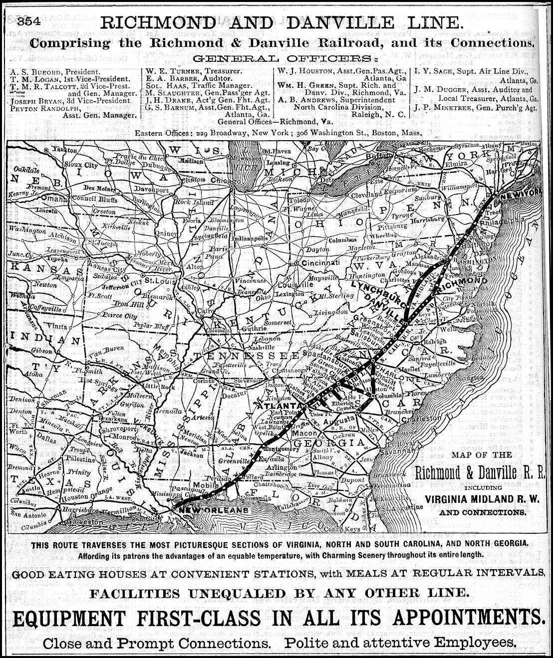
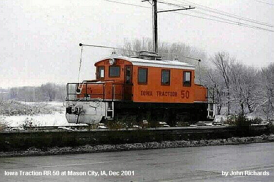
References
- Guillaudeu, David A.; Forward by McCray, Paul E. (2013). Washington & Old Dominion Railroad. Images of Rail. Charleston, South Carolina: Arcadia Publishing. ISBN 9780738597928. OCLC 811603181. Retrieved 2016-11-13. At Google Books
- Guillaudeu, David A.; McCray, Paul E. (2016). Washington & Old Dominion Railroad Revisited. Images of Rail. Charleston, South Carolina: Arcadia Publishing. ISBN 9781467116381. OCLC 944086523. Retrieved 2016-11-13. At Google Books
- Harwood, Herbert Hawley, Jr. (2000). Rails to the Blue Ridge: The Washington and Old Dominion Railroad, 1847–1968 (3rd ed.). Fairfax Station, Virginia: Northern Virginia Regional Park Authority. ISBN 0615114539. OCLC 44685168. At Google Books
- Interstate Commerce Commission (1916-07-01). "W&OD Railway 1916 ICC Valuation Maps". W&OD Railroad Maps. Northern Virginia Regional Park Authority: Washington & Old Dominion Railroad Regional Park. Retrieved 2010-09-24. Retrieved 2010-09-24.
- King, W.E. (1934-07-19). Index map showing Washington & Old Dominion Railway's line abandoned in relation to other railroads and common carriers in lower left corner of "GF&OD Railroad 1916 ICC Valuation Map No. 3" (PDF). Washington & Old Dominion Regional Park: W&OD Railroad Maps. Northern Virginia Regional Park Authority: Washington & Old Dominion Railroad Regional Park. 1916-07-01. Archived from the original (PDF) on 2013-10-08. Retrieved 2015-01-07.
- "Map of the W&OD". The Friends of the Washington & Old Dominion Trail. Archived from the original on 2010-11-24. Retrieved 2010-09-29.
- Neville, Ashley M., National Register of Historic Places Registration Form: Washington & Old Dominion Railroad Historic District (Virginia Department of Historic Resources (DHR) No. 053-0276), Gray & Pape, Inc., Richmond, Virginia, July 25, 2000, in Appendix J of NORTHERN VIRGINIA REGIONAL PARK AUTHORITY - PRE-FILED DIRECT TESTIMONY OF MR. HAFNER, MR. MCRAY AND MR. SIMMONS, November 30, 2005 (Part 4 of 5, pages 1–46). Retrieved on March 24, 2008, in Case Docket Search for documents in Case No. PUE-2005-00018 on official website of the Commonwealth of Virginia State Corporation Commission.
- Stone, Jim. "The Washington & Old Dominion Railroad in Del Ray". Alexandria, VA: Del Ray Citizens Association. Archived from the original on 2008-03-29. Retrieved 2010-01-17.
- Vetter, Peggy D (2000). "The W&OD Railroad is Heart of Herndon for 120 Years". The Observer. Herndon, VA: The Herndon Publishing Company, Inc. Archived from the original on 2008-08-07. Retrieved 2010-01-17. (A detailed history of the Washington and Old Dominion Railroad.)
- Washington and Old Dominion Railway (1911). "W&OD Railway Track Plats" (PDF). W&OD Railroad Maps. Northern Virginia Regional Park Authority: Washington & Old Dominion Railroad Regional Park. Retrieved 2010-09-24. Retrieved 2010-09-24.
- Williams, Ames W. (1989). The Washington and Old Dominion Railroad. Arlington, Virginia: Arlington Historical Society. ISBN 0926984004. OCLC 20461397. At Google Books

Videos
- Crockett, Bob. "W&OD 1939". Video uploaded by Paul McCray on 2011-01-17. YouTube. Retrieved 2012-10-26. Video filmed in 1939 from Rosslyn to Difficult Run Bridge.
- Fairfax County Government Television. "The Civil War on the W&OD in Vienna, VA". Video narrated by Roger Mudd; uploaded by Northern Virginia Regional Park Authority on 2012-01-04. YouTube. Retrieved 2012-10-28.: 1861 Civil War skirmish on Alexandria, Loudoun and Hampshire Railroad in Vienna.
- McCray, Paul (2011-12-18). "Frank Tosh Interview about the W&OD Railroad". YouTube. Retrieved 2012-10-29.
- McCray, Paul (2011-12-19). "Interview with W&OD Train Driver Douglas Lee and Brakeman Randolph Shutts Part 1". YouTube. Retrieved 2012-10-29.
- McCray, Paul (2011-12-19). "Interview with W&OD Train Driver Douglas Lee and Brakeman Randolph Shutts Part 2". YouTube. Retrieved 2015-01-07.
External links
- Photograph by Craig Swain, Leesburg, VA, dated 2009-11-22. "Circa 1920 system map of Washington and Old Dominion Railway". Northern Virginia Regional Park Authority historical marker: "Bluemont Junction". HMdb.org: The Historical Marker Database. Retrieved 2010-08-18.
- "Washington and Old Dominion Railroad Markers series". HMdb.org: The Historical Marker Database. Retrieved 2010-08-18. Photographs and descriptions of markers describing the history of the W&OD Railroad.
- McCray, Paul. "Washington & Old Dominion Railroad, 1847 to 1968: A Photographic History". Retrieved 2010-06-28. Website describing the history of the W&OD Railroad.
- Ross, Don. "Washington & Old Dominion Ry.". Don's Rail Photos. Don Ross Group. Archived from the original on 2013-04-04. Retrieved 2014-09-18.
- Timetable: "Southern Railway: Between Washington, Alexandria and Bluemont: Schedule effective July 1, 1900". Town of Round Hill, Virginia, government. 1900-07-12. Archived from the original on 2002-11-16. Retrieved 2012-11-22. First timetable for Bluemont service.
- "W&OD Railroad Timetable, January 31, 1944". McCray, Paul. "Washington & Old Dominion Railroad, 1847 to 1968: A Photographic History". Retrieved 2011-12-24.
- Washington and Old Dominion Railway (1912-10-01). "Rules and Regulations for the Government of Employees of the Washington and Old Dominion Railway". Archived from the original (PDF) on 2015-04-05. Retrieved 2015-04-05.
| Administration |  | ||||||||||
|---|---|---|---|---|---|---|---|---|---|---|---|
| Organizations | |||||||||||
| Landmarks | |||||||||||
| Transportation |
| ||||||||||
| Culture |
| ||||||||||
| Education | |||||||||||