Waterville Township, Lucas County, Ohio
| Waterville Township, Lucas County, Ohio | |
|---|---|
| Township | |
|
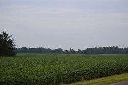
Fields southwest of Waterville | |
 Waterville Township, Lucas County, Ohio | |
| Coordinates: 41°30′33″N 83°45′42″W / 41.50917°N 83.76167°WCoordinates: 41°30′33″N 83°45′42″W / 41.50917°N 83.76167°W | |
| Country | United States |
| State | Ohio |
| County | Lucas |
| Area | |
| • Total | 24.1 sq mi (62.3 km2) |
| • Land | 23.2 sq mi (60.2 km2) |
| • Water | 0.8 sq mi (2.1 km2) |
| Elevation[1] | 643 ft (196 m) |
| Population (2010) | |
| • Total | 11,336 |
| • Density | 488/sq mi (188.3/km2) |
| Time zone | Eastern (EST) (UTC-5) |
| • Summer (DST) | EDT (UTC-4) |
| ZIP code | 43566 |
| Area code(s) | 419 |
| FIPS code | 39-81872[2] |
| GNIS feature ID | 1086539[1] |
| Website |
www |
Waterville Township is one of the eleven townships of Lucas County, Ohio, United States. The 2010 census found 11,336 people in the township,[3] up from 9,469 people in 2000.
Geography
Located in the southern part of the county along the Maumee River, it borders the following townships:
- Monclova Township - north
- Perrysburg Township, Wood County - northeast
- Middleton Township, Wood County - east
- Washington Township, Wood County - south
- Providence Township - southwest
- Swanton Township - northwest
Two villages are located in Waterville Township: Waterville in the southeast along the Maumee River, and Whitehouse in the northwest.
Name and history
It is the only Waterville Township statewide.[4]
Education
Students from Waterville Township attend the Anthony Wayne Local School District.
Government
The township is governed by a three-member board of trustees, who are elected in November of odd-numbered years to a four-year term beginning on the following January 1. Two are elected in the year after the presidential election and one is elected in the year before it. There is also an elected township fiscal officer,[5] who serves a four-year term beginning on April 1 of the year after the election, which is held in November of the year before the presidential election. Vacancies in the fiscal officership or on the board of trustees are filled by the remaining trustees.
References
- 1 2 "US Board on Geographic Names". United States Geological Survey. 2007-10-25. Retrieved 2008-01-31.
- ↑ "American FactFinder". United States Census Bureau. Retrieved 2008-01-31.
- ↑ "Geographic Identifiers: 2010 Demographic Profile Data (G001): Waterville township, Lucas County, Ohio". U.S. Census Bureau, American Factfinder. Retrieved February 7, 2013.
- ↑ "Detailed map of Ohio" (PDF). United States Census Bureau. 2000. Retrieved 2007-02-16.
- ↑ §503.24, §505.01, and §507.01 of the Ohio Revised Code. Accessed 4/30/2009.
External links
Municipalities and communities of Lucas County, Ohio, United States | ||
|---|---|---|
| Cities | 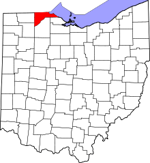 | |
| Villages | ||
| Townships | ||
| CDPs | ||
| Unincorporated communities |
| |
| Ghost town | ||
| Footnotes | ‡This populated place also has portions in an adjacent county or counties | |