White Pine, Michigan
| White Pine, Michigan | |
|---|---|
| Census-designated place (CDP) & Unincorporated community | |
|
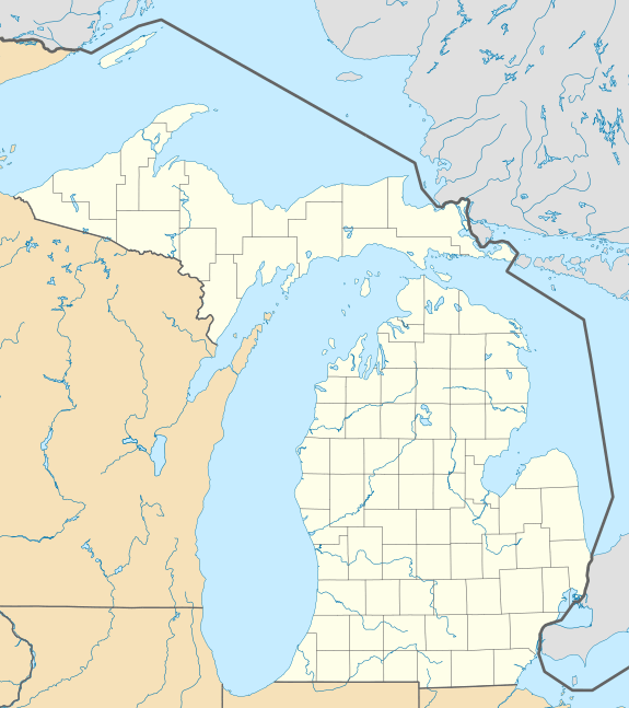
An elegant fan of native copper from the White Pine mine. Size 12.3 x 6.8 x 0.1 cm. | |
 White Pine, Michigan | |
| Coordinates: 46°45′14″N 89°35′03″W / 46.75389°N 89.58417°WCoordinates: 46°45′14″N 89°35′03″W / 46.75389°N 89.58417°W[1] | |
| Country | United States |
| State | Michigan |
| County | Ontonagon |
| Township | Carp Lake |
| Area[2] | |
| • Total | 5.002 sq mi (12.96 km2) |
| • Land | 5.002 sq mi (12.96 km2) |
| • Water | 0 sq mi (0 km2) |
| Elevation[1] | 899 ft (274 m) |
| Population (2010)[3] | |
| • Total | 474 |
| • Density | 95/sq mi (37/km2) |
| Time zone | Eastern (EST) (UTC-5) |
| • Summer (DST) | EDT (UTC-4) |
| ZIP code | 49971 |
| Area code(s) | 906 |
| GNIS feature ID | 1622143[1] |

White Pine is an unincorporated community census-designated place in Ontonagon County in the U.S. state of Michigan.[4] As of the 2010 census, its population was 474.[3]
White Pine is located at 46°45′14″N 89°35′03″W / 46.75389°N 89.58417°W[1] in Carp Lake Township between Bergland, Michigan and Silver City, Michigan, and east of the Porcupine Mountains Wilderness State Park. The Copper Range Company operated a copper mine in White Pine.
It was a station on the Chicago, Minneapolis and St. Paul Railway. Thomas H. Wilcox, a mining engineer, found mass copper in the Mineral River and formed the White Pine Copper Company to mine it. The settlement was given a post office as "White Pine Mine" in June 1915.[5]
The White Pine ZIP code 49971 is a post office box only office serving two noncontiguous areas in Carp Lake Township.[6][7]
Notes
- 1 2 3 4 U.S. Geological Survey Geographic Names Information System: White Pine, Michigan
- ↑ "US Gazetteer files: 2010, 2000, and 1990". United States Census Bureau. 2011-02-12. Retrieved 2011-04-23.
- 1 2 "American FactFinder". United States Census Bureau. Retrieved 2011-05-14.
- ↑ White Pine - Michigan's Upper Peninsula
- ↑ Romig, Walter (1986) [1973]. Michigan Place Names. Detroit, Michigan: Wayne State University Press. ISBN 0-8143-1838-X.
- ↑ 49971 5-Digit ZCTA, 499 3-Digit ZCTA - Reference Map - American FactFinder, U.S. Census Bureau, 2000 Census.
- ↑ USPS ZIP Code Lookup
External links
- Mine Site Visit: Copper Range Company White Pine Mine. U.S. Environmental Protection Agency, Office of Solid Waste, observations from EPA site visit May 5 and 6, 1992
| Wikimedia Commons has media related to White Pine Mine. |
Municipalities and communities of Ontonagon County, Michigan, United States | ||
|---|---|---|
| Village | 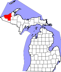 | |
| Townships | ||
| CDP | ||
| Other unincorporated communities | ||
| Ghost towns | ||