Whitewater Township, Bollinger County, Missouri
| Whitewater Township | |
|---|---|
| Township | |
 | |
| Coordinates: 37°32′26″N 089°55′33″W / 37.54056°N 89.92583°WCoordinates: 37°32′26″N 089°55′33″W / 37.54056°N 89.92583°W | |
| Country | United States |
| State | Missouri |
| County | Bollinger |
| Area | |
| • Total | 51.76 sq mi (134.05 km2) |
| • Land | 51.76 sq mi (134.05 km2) |
| • Water | 0 sq mi (0 km2) 0% |
| Elevation[1] | 571 ft (174 m) |
| Population (2000) | |
| • Total | 1,029 |
| • Density | 19.88/sq mi (51.49/km2) |
| FIPS code | 29-79594[2] |
| GNIS feature ID | 0766328 |
Whitewater Township is one of eight townships in Bollinger County, Missouri, USA. As of the 2000 U.S. Census, its population was 911. As of the 2010 U.S. Census, the population had increased to 1,029. Whitewater Township covers an area of 51.76 square miles (134.1 km2).
Whitewater Township was erected in 1872, and named after the nearby Whitewater River.[3]
Demographics
As of the 2010 U.S. Census, there were 1,029 people residing in the township. The population density was 19.88 people per square mile (51.49/km²). There were 438 households in the township. The racial makeup of the township was 99.13% White, 0.10% Native American, 0.10% from other races, and 0.68% from two or more races. Approximately 1.46% of the population were Hispanic or Latino of any race.
Geography
Incorporated Areas
The township contains one incorporated settlement: Sedgewickville.
Unincorporated Areas
The town contains the unincorporated area and historical community of Lixville.
Cemeteries
The township contains the eight following cemeteries: Bollinger, Flatwood, Grindstaff, Jones, Meyer, Old Bollinger, Shrum, and Statler.
Streams
The streams of Allie Creek, Bollinger Creek, Buck Creek, Caney Fork, Jack Creek, Little Muddy Creek, Shrum Creek, South Fork Apple Creek, and Wolf Creek flow through Whitewater Township. Other bodies of water located in the township include Richardet Lake and the Whitewater River.
Landmarks
There are no known landmarks in the township.
Administrative Districts
School Districts
- Jackson R-II School District
- Meadow Heights R-II School District
- Oak Ridge R-VI School District
- Perry County 32 School District
References
- ↑ "US Board on Geographic Names". United States Geological Survey. 2007-10-25. Retrieved 2008-01-31.
- ↑ "American FactFinder". United States Census Bureau. Retrieved 2008-01-31.
- ↑ "Bollinger County Place Names, 1928-1945 (archived)". The State Historical Society of Missouri. Retrieved 3 September 2016.
External links
Municipalities and communities of Bollinger County, Missouri, United States | ||
|---|---|---|
| City | 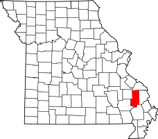 | |
| Villages | ||
| Townships | ||
| Unincorporated communities | ||
| Abandoned villages | ||