Arab, Missouri
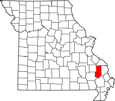
Coordinates: 37°05′37″N 90°04′36″W / 37.09361°N 90.07667°W Arab is an unincorporated community in southern Bollinger County, Missouri, United States. It is located about four miles south of Zalma and 12 miles north of Puxico on at the intersection of Highway 51 with Highway C and Highway P, twenty miles northwest of Dexter. The community was founded in 1908 and receives its name from the city of Arab, Alabama. Like that city, the name of the community is pronounced "AY-rab".
Arab is part of the Cape Girardeau–Jackson, MO-IL Metropolitan Statistical Area.
The community was probably initially founded for the purposes of postal delivery with the mail gathered twice a week from Zalma and delivered to Arab by horseback. Arab is located along Route 51 at the intersection of State Highway C which runs east to Advance and State Highway P which runs west towards Lowndes and Greenville, near Stoddard County, and Wayne County. Arab was originally located in Wayne County; in 1943, the post office and community were moved four miles away to extreme southern Bollinger County.
In 2000 the population of Arab was 7, all members of the same family. Arab is home to the Arab Station, a convenience store that in addition to selling small selections of groceries and cigarettes and alcohol, also consists of a deli that serves pizza and a bait shop.
References
- Corbin, Paul, Reflections From Missouri Mud, Concord Publishing House, Inc., Cape Giradeau, Missouri, 2002.
