Whitlash, Montana
| Whitlash | |
|---|---|
| Unincorporated community | |
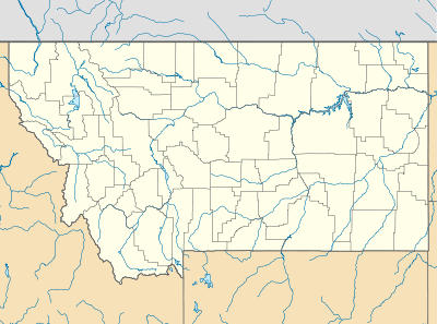 Whitlash Location within the state of Montana | |
| Coordinates: 48°54′29″N 111°15′11″W / 48.90806°N 111.25306°WCoordinates: 48°54′29″N 111°15′11″W / 48.90806°N 111.25306°W | |
| Country | United States |
| State | Montana |
| County | Liberty |
| Time zone | Mountain (MST) (UTC-7) |
| • Summer (DST) | MDT (UTC-6) |
Whitlash is an unincorporated community in northwestern Liberty County, Montana, United States, about five miles south of the province of Alberta across the Canada–US border.
Whitlash has a post office and an elementary school that provides educational services in grades prekindergarten through 8. The community is accessible only by unpaved road. The Whitlash Border Crossing is about five miles to the north.
Whitlash is located near the East Butte of the Sweet Grass Hills which are major historic and physical landmarks of the Great Plains. Sacred to the American Indians, "The Hills" served as hunting grounds, battlegrounds, spiritual grounds, and of course were used for navigational purposes as well.
It is approximately tied with Lothair, Montana as the closest of any community in the contiguous United States to being antipodal of land, with the opposite point on the Earth being about 5 km offshore of Cape d'Aiguillon of Kerguelen Island, in the southern Indian Ocean. (See . Lothair is within about 5 km of a tiny islet to the north of Kerguelen.)
External links
Municipalities and communities of Liberty County, Montana, United States | ||
|---|---|---|
| Town | 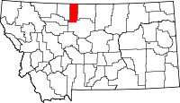 | |
| CDP | ||
| Unincorporated communities | ||