| Wildlife Protection Area |
Designated Name |
Prefecture |
Area (km2) |
First Established |
Image |
Class |
Coordinates |
|---|
| Daisetsuzan | 大雪山鳥獣保護区 | Hokkaidō | 355.34 | 1992 |  | 1 | 43°39′08″N 142°54′09″E / 43.652224°N 142.902603°E / 43.652224; 142.902603 (Daisetsuzan) |
| Towada | 十和田鳥獣保護区 | Aomori, Akita | 376.74 | 1953 | 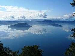 | 1 | 40°27′52″N 140°52′40″E / 40.464450°N 140.877686°E / 40.464450; 140.877686 (Towada) |
| Shirakami-Sanchi | 白神山地鳥獣保護区 | Aomori, Akita | 171.57 | 2004 |  | 1 | 40°28′09″N 140°07′50″E / 40.469151°N 140.130444°E / 40.469151; 140.130444 (Shirakami-Sanchi) |
| Asama | 浅間鳥獣保護区 | Gunma, Nagano | 309.40 | 1951 |  | 1 | 36°24′19″N 138°31′20″E / 36.405396°N 138.522320°E / 36.405396; 138.522320 (Asama) |
| Hakusan | 白山鳥獣保護区 | Ishikawa, Gifu | 380.61 | 1969 |  | 1 | 36°09′19″N 136°45′41″E / 36.155237°N 136.761289°E / 36.155237; 136.761289 (Hakusan) |
| Ōdai Mountains | 大台山系鳥獣保護区 | Mie, Nara | 180.54 | 1972 |  | 1 | 34°10′59″N 136°05′01″E / 34.183051°N 136.083612°E / 34.183051; 136.083612 (Ōdai Mountains) |
| Tsurugi Mountains | 剣山山系鳥獣保護区 | Tokushima, Kōchi | 118.17 | 1988 | 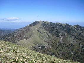 | 1 | 33°51′14″N 134°05′41″E / 33.853916°N 134.094787°E / 33.853916; 134.094787 (Tsurugi Mountains) |
| Daisen | 大山鳥獣保護区 | Tottori | 51.56 | 1958 |  | 1 | 35°22′34″N 133°32′40″E / 35.376174°N 133.544312°E / 35.376174; 133.544312 (Daisen) |
| Ishizuchi Mountains | 石鎚山系鳥獣保護区 | Ehime, Kōchi | 108.58 | 1977 |  | 1 | 33°46′18″N 133°06′43″E / 33.771728°N 133.111982°E / 33.771728; 133.111982 (Ishizuchi Mountains) |
| Kirishima | 霧島鳥獣保護区 | Miyazaki, Kagoshima | 113.90 | 1978 | 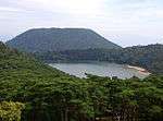 | 1 | 31°55′00″N 130°52′48″E / 31.916762°N 130.880127°E / 31.916762; 130.880127 (Kirishima) |
| Hamatonbetsu Lake Kutcharo | 浜頓別クッチャロ湖鳥獣保護区 | Hokkaidō | 28.03 | 1983 | | 2 | 45°08′01″N 142°19′43″E / 45.133739°N 142.328739°E / 45.133739; 142.328739 (Hamatonbetsu Lake Kutcharo) |
| Sarobetsu | サロベツ鳥獣保護区 | Hokkaidō | 37.39 | 1992 |  | 2 | 45°06′20″N 141°41′07″E / 45.105516°N 141.685181°E / 45.105516; 141.685181 (Sarobetsu) |
| Lake Tōfutsu | 濤沸湖鳥獣保護区 | Hokkaidō | 20.51 | 1992 |  | 2 | 43°55′04″N 144°26′15″E / 43.917804°N 144.437599°E / 43.917804; 144.437599 (Lake Tōfutsu) |
| Notsuke Peninsula-Notsuke Bay | 野付半島・野付湾鳥獣保護区 | Hokkaidō | 61.46 | 2005 |  | 2 | 43°37′29″N 145°12′41″E / 43.624768°N 145.211277°E / 43.624768; 145.211277 (Notsuke Peninsula-Notsuke Bay) |
| Lake Furen | 風蓮湖鳥獣保護区 | Hokkaidō | 78.06 | 1993 |  | 2 | 43°20′21″N 145°16′00″E / 43.339162°N 145.266724°E / 43.339162; 145.266724 (Lake Furen) |
| Akkeshi-Bekanbeushi-Kiritappu | 厚岸・別寒辺牛・霧多布鳥獣保護区 | Hokkaidō | 112.71 | 1993 |  | 2 | 43°05′01″N 145°04′48″E / 43.083684°N 145.079956°E / 43.083684; 145.079956 (Akkeshi-Bekanbeushi-Kiritappu) |
| Miyajima-numa | 宮島沼鳥獣保護区 | Hokkaidō | 0.41 | 1992 |  | 2 | 43°19′57″N 141°42′49″E / 43.332389°N 141.713719°E / 43.332389; 141.713719 (Miyajima-numa) |
| Lake Utonai | ウトナイ湖鳥獣保護区 | Hokkaidō | 5.10 | 1982 | 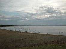 | 2 | 42°41′57″N 141°42′43″E / 42.699091°N 141.711831°E / 42.699091; 141.711831 (Lake Utonai) |
| Kominato | 小湊鳥獣保護区 | Aomori | 45.18 | 1971 | | 2 | 40°56′14″N 140°58′23″E / 40.937118°N 140.973129°E / 40.937118; 140.973129 (Kominato) |
| Izu-numa | 伊豆沼鳥獣保護区 | Miyagi | 14.55 | 1982 |  | 2 | 38°42′55″N 141°06′14″E / 38.715351°N 141.103935°E / 38.715351; 141.103935 (Izu-numa) |
| Sendai Beach | 仙台海浜鳥獣保護区 | Miyagi | 75.96 | 1987 | | 2 | 38°12′28″N 140°58′48″E / 38.207702°N 140.979996°E / 38.207702; 140.979996 (Sendai Beach) |
| Kabukuri-numa and the surrounding rice paddies | 蕪栗沼・周辺水田鳥獣保護区 | Miyagi | 30.61 | 2005 |  | 2 | 38°38′13″N 141°06′18″E / 38.636919°N 141.105137°E / 38.636919; 141.105137 (Kabukuri-numa) |
| Kejo-numa | 化女沼鳥獣保護区 | Miyagi | 0.78 | 2008 |  | 2 | 38°37′50″N 140°57′46″E / 38.630550°N 140.962701°E / 38.630550; 140.962701 (Kejo-numa) |
| Mogami River Mouth | 最上川河口鳥獣保護区 | Yamagata | 15.37 | 2005 | | 2 | 38°55′23″N 139°48′40″E / 38.923159°N 139.811068°E / 38.923159; 139.811068 (Mogami River Mouth) |
| Ōyama Kamiike-Shimoike | 大山上池・下池鳥獣保護区 | Yamagata | 0.39 | 2008 | | 2 | 38°45′00″N 139°45′20″E / 38.750134°N 139.755664°E / 38.750134; 139.755664 (Ōyama Kamiike-Shimoike) |
| Watara Reservoir | 渡良瀬遊水地鳥獣保護区 | Ibaraki, Tochigi, Gunma, Saitama | 28.61 | 2012 |  | 2 | 36°14′20″N 139°42′00″E / 36.238874°N 139.699917°E / 36.238874; 139.699917 (Watara Reservoir) |
| Fukushimagata | 福島潟鳥獣保護区 | Niigata | 1.63 | 1974 |  | 2 | 37°54′39″N 139°15′06″E / 37.910922°N 139.251795°E / 37.910922; 139.251795 (Fukushimagata) |
| Lake Hyōko | 瓢湖鳥獣保護区 | Niigata | 2.81 | 2005 |  | 2 | 37°50′19″N 139°14′15″E / 37.838699°N 139.237461°E / 37.838699; 139.237461 (Lake Hyōko) |
| Sakata Lagoon | 佐潟鳥獣保護区 | Niigata | 2.51 | 1981 |  | 2 | 37°48′58″N 138°52′27″E / 37.816056°N 138.874054°E / 37.816056; 138.874054 (Sakata) |
| Yatsu | 谷津鳥獣保護区 | Chiba | 0.41 | 1988 |  | 2 | 35°40′39″N 140°00′28″E / 35.677413°N 140.007813°E / 35.677413; 140.007813 (Yatsu) |
| Katano Kamoike | 片野鴨池鳥獣保護区 | Ishikawa | 0.10 | 1993 |  | 2 | 36°19′18″N 136°17′39″E / 36.321669°N 136.294069°E / 36.321669; 136.294069 (Katano Kamoike) |
| Fujimae-higata | 藤前干潟鳥獣保護区 | Aichi | 7.70 | 2002 |  | 2 | 35°04′54″N 136°50′15″E / 35.081638°N 136.837635°E / 35.081638; 136.837635 (Fujimae-higata) |
| Hamakōshien | 浜甲子園鳥獣保護区 | Hyōgo | 0.30 | 1978 | | 2 | 34°42′54″N 135°21′03″E / 34.714895°N 135.350704°E / 34.714895; 135.350704 (Hamakōshien) |
| Nakaumi | 中海鳥獣保護区 | Tottori, Shimane | 87.24 | 1974 | 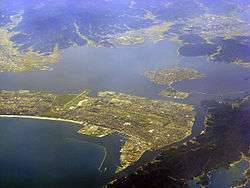 | 2 | 35°28′01″N 133°11′39″E / 35.466822°N 133.194122°E / 35.466822; 133.194122 (Nakaumi) |
| Lake Shinji | 宍道湖鳥獣保護区 | Shimane | 78.51 | 2005 |  | 2 | 35°27′48″N 133°02′59″E / 35.463466°N 133.049669°E / 35.463466; 133.049669 (Lake Shinji) |
| Wajiro-higata | 和白干潟鳥獣保護区 | Fukuoka | 2.54 | 2003 |  | 2 | 33°41′12″N 130°25′46″E / 33.686639°N 130.429516°E / 33.686639; 130.429516 (Wajiro-higata) |
| Arao-higata | 荒尾干潟鳥獣保護区 | Kumamoto | 18.23 | 2012 | | 2 | 32°59′11″N 130°25′45″E / 32.986456°N 130.429215°E / 32.986456; 130.429215 (Arao-higata) |
| Izumi-Takaono | 出水・高尾野鳥獣保護区 | Kagoshima | 8.42 | 1987 |  | 2 | 32°06′12″N 130°16′27″E / 32.103226°N 130.274162°E / 32.103226; 130.274162 (Izumi-Takaono) |
| Yagaji | 屋我地鳥獣保護区 | Okinawa | 32.24 | 1976 |  | 2 | 26°38′54″N 128°01′59″E / 26.648255°N 128.033187°E / 26.648255; 128.033187 (Yagaji) |
| Lake Man | 漫湖鳥獣保護区 | Okinawa | 1.74 | 1977 | 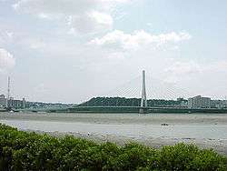 | 2 | 43°55′04″N 144°26′15″E / 43.917804°N 144.437599°E / 43.917804; 144.437599 (Lake Man) |
| Yonaha Bay | 与那覇湾鳥獣保護区 | Okinawa | 13.66 | 2011 | | 2 | 24°45′34″N 125°15′47″E / 24.759517°N 125.263174°E / 24.759517; 125.263174 (Yonaha Bay) |
| Ikema | 池間鳥獣保護区 | Okinawa | 2.82 | 2011 | 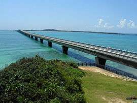 | 2 | 24°55′56″N 125°14′31″E / 24.932171°N 125.241909°E / 24.932171; 125.241909 (Ikema) |
| Teuri Island | 天売島鳥獣保護区 | Hokkaidō | 5.51 | 1982 |  | 3 | 44°25′18″N 141°18′32″E / 44.421705°N 141.308813°E / 44.421705; 141.308813 (Teuri Island) |
| Yururi-Moyururi | ユルリ・モユルリ鳥獣保護区 | Hokkaidō | 1.99 | 1982 | | 3 | 43°13′37″N 145°36′27″E / 43.226991°N 145.607600°E / 43.226991; 145.607600 (Yururi-Moyururi) |
| Daikoku Island | 大黒島鳥獣保護区 | Hokkaidō | 1.07 | 1972 | | 3 | 42°57′17″N 144°52′24″E / 42.954664°N 144.873276°E / 42.954664; 144.873276 (Daikoku Island) |
| Hide Island | 日出島鳥獣保護区 | Iwate | 0.08 | 1982 | | 3 | 39°41′14″N 141°59′16″E / 39.687152°N 141.987648°E / 39.687152; 141.987648 (Hide Island) |
| Sangan Island | 三貫島鳥獣保護区 | Iwate | 0.25 | 1981 | | 3 | 39°18′21″N 141°58′57″E / 39.305878°N 141.982498°E / 39.305878; 141.982498 (Sangan Island) |
| Tadanae-jima | 祗苗島鳥獣保護区 | Tokyo | 5.93 | 2010 | | 3 | 34°12′28″N 139°11′30″E / 34.207685°N 139.191713°E / 34.207685; 139.191713 (Tadanae-jima) |
| Ōnohara-jima | 大野原島鳥獣保護区 | Tokyo | 5.46 | 2010 |  | 3 | 34°02′41″N 139°23′15″E / 34.044722°N 139.3875°E / 34.044722; 139.3875 (Ōnohara-jima) |
| Nishinoshima | 西之島鳥獣保護区 | Tokyo | 0.29 | 2008 |  | 3 | 27°14′49″N 140°52′28″E / 27.246944°N 140.874444°E / 27.246944; 140.874444 (Nishinoshima) |
| North Iwo Jima | 北硫黄島鳥獣保護区 | Tokyo | 8.60 | 2009 |  | 3 | 25°26′17″N 141°16′59″E / 25.438082°N 141.282978°E / 25.438082; 141.282978 (North Iwo Jima) |
| Minamitorishima | 南鳥島鳥獣保護区 | Tokyo | 3.95 | 2009 | 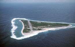 | 3 | 24°16′59″N 153°59′11″E / 24.283056°N 153.986389°E / 24.283056; 153.986389 (Minamitorishima) |
| Nanatsu-jima | 七ツ島鳥獣保護区 | Ishikawa | 0.24 | 1973 |  | 3 | 37°36′35″N 136°54′05″E / 37.609722°N 136.901389°E / 37.609722; 136.901389 (Nanatsu-jima) |
| Kiinagashima | 紀伊長島鳥獣保護区 | Mie | 61.31 | 1969 | | 3 | 34°11′52″N 136°19′45″E / 34.197818°N 136.329045°E / 34.197818; 136.329045 (Kiinagashima) |
| Kanmurijima-Kutsujima | 冠島・沓島鳥獣保護区 | Kyoto | 13.00 | 2010 |  | 3 | 35°40′53″N 135°25′28″E / 35.681370°N 135.424433°E / 35.681370; 135.424433 (Kanmurijima-Kutsujima) |
| Kakuijima | 鹿久居島鳥獣保護区 | Okayama | 6.62 | 1953 |  | 3 | 34°43′10″N 134°18′20″E / 34.719444°N 134.305556°E / 34.719444; 134.305556 (Kakuijima) |
| Okinoshima | 沖ノ島鳥獣保護区 | Fukuoka | 0.97 | 1984 | | 3 | 34°14′40″N 130°06′15″E / 34.244411°N 130.104046°E / 34.244411; 130.104046 (Okinoshima) |
| Danjo Islands | 男女群島鳥獣保護区 | Nagasaki | 4.16 | 1973 | | 3 | 31°59′20″N 128°21′07″E / 31.988889°N 128.351944°E / 31.988889; 128.351944 (Tanjo Islands) |
| Birōjima | 枇榔島鳥獣保護区 | Miyazaki | 4.82 | 2010 |  | 3 | 32°27′54″N 131°43′51″E / 32.464911°N 131.730795°E / 32.464911; 131.730795 (Birōjima) |
| Kusagakijima | 草垣島鳥獣保護区 | Kagoshima | 0.21 | 1973 | | 3 | 30°50′32″N 129°26′01″E / 30.842184°N 129.433665°E / 30.842184; 129.433665 (Kusagakijima) |
| Nakanokamijima | 仲の神島鳥獣保護区 | Okinawa | 0.18 | 1981 |  | 3 | 24°11′42″N 123°33′50″E / 24.195°N 123.563889°E / 24.195; 123.563889 (Nakanokamijima) |
| Shiretoko | 知床鳥獣保護区 | Hokkaidō | 440.53 | 1982 |  | 4 | 44°03′17″N 145°06′14″E / 44.054778°N 145.103989°E / 44.054778; 145.103989 (Shiretoko) |
| Kushiro Shitsugen | 釧路湿原鳥獣保護区 | Hokkaidō | 115.23 | 1958 |  | 4 | 43°03′59″N 144°17′49″E / 43.066254°N 144.297009°E / 43.066254; 144.297009 (Kushiro Shitsugen) |
| Western Shimokita | 下北西部鳥獣保護区 | Aomori | 49.46 | 1984 | | 4 | 41°18′52″N 141°05′21″E / 41.314434°N 141.089172°E / 41.314434; 141.089172 (Western Shimokita) |
| Hotokenuma | 仏沼鳥獣保護区 | Aomori | 7.37 | 2005 |  | 4 | 40°48′55″N 141°22′52″E / 40.815303°N 141.381083°E / 40.815303; 141.381083 (Hotokenuma) |
| Ōgata-sōgen | 大潟草原鳥獣保護区 | Akita | 1.35 | 1977 | | 4 | 40°00′56″N 139°57′08″E / 40.015520°N 139.952259°E / 40.015520; 139.952259 (Ōgata-sōgen) |
| Moriyoshizan | 森吉山鳥獣保護区 | Akita | 66.16 | 1973 |  | 4 | 39°58′35″N 140°32′40″E / 39.976265°N 140.544577°E / 39.976265; 140.544577 (Moriyoshizan) |
| Ōshima Asahi | 大鳥朝日鳥獣保護区 | Yamagata, Niigata | 382.85 | 1984 | 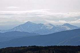 | 4 | 38°15′38″N 139°55′20″E / 38.260592°N 139.922261°E / 38.260592; 139.922261 (Ōshima Asahi) |
| Torishima | 鳥島鳥獣保護区 | Tokyo | 4.53 | 1954 |  | 4 | 30°29′02″N 140°18′11″E / 30.483889°N 140.303056°E / 30.483889; 140.303056 (Torishima) |
| Ogasawara | 小笠原群島鳥獣保護区 | Tokyo | 200.58 | 1980 |  | 4 | 27°06′32″N 142°12′14″E / 27.108798°N 142.203941°E / 27.108798; 142.203941 (Ogasawara) |
| Eastern Sado | 小佐渡東部鳥獣保護区 | Niigata | 126.20 | 1982 |  | 4 | 38°03′55″N 138°26′14″E / 38.065392°N 138.437347°E / 38.065392; 138.437347 (Eastern Sado) |
| Northern Alps | 北アルプス鳥獣保護区 | Toyama, Nagano, Gifu | 1,103.06 | 1984 |  | 4 | 36°16′19″N 137°38′12″E / 36.271957°N 137.636719°E / 36.271957; 137.636719 (Northern Alps) |
| Maruyama River Basin | 円山川下流域鳥獣保護区 | Hyōgo | 5.50 | 2012 | | 4 | 35°38′45″N 134°49′49″E / 35.645788°N 134.830399°E / 35.645788; 134.830399 (Maruyama River Basin) |
| Sainan | 西南鳥獣保護区 | Kōchi | 15.33 | 1979 | | 4 | 32°53′53″N 133°01′21″E / 32.898038°N 133.022461°E / 32.898038; 133.022461 (Sainan) |
| Ina | 伊奈鳥獣保護区 | Nagasaki | 11.73 | 1988 |  | 4 | 34°36′22″N 129°25′08″E / 34.606085°N 129.418945°E / 34.606085; 129.418945 (Ina) |
| Yuwan-dake | 湯湾岳鳥獣保護区 | Kagoshima | 3.20 | 1965 | | 4 | 31°44′18″N 130°38′51″E / 31.738387°N 130.647440°E / 31.738387; 130.647440 (Yuwan-dake) |
| Nagura-Anparu | 名蔵アンパル鳥獣保護区 | Okinawa | 11.45 | 2003 |  | 4 | 24°22′50″N 124°07′56″E / 24.380522°N 124.132161°E / 24.380522; 124.132161 (Nagura-Anparu) |
| Yanbaru (Ada) | やんばる(安田)鳥獣保護区 | Okinawa | 12.79 | 2009 | | 4 | 26°45′10″N 128°19′32″E / 26.752700°N 128.325419°E / 26.752700; 128.325419 (Yanbaru (Ada)) |
| Yanbaru (Aha) | やんばる(安波)鳥獣保護区 | Okinawa | 4.65 | 2009 | | 4 | 26°42′59″N 128°15′55″E / 26.716404°N 128.265209°E / 26.716404; 128.265209 (Yanbaru (Aha)) |
| Daitō Islands | 大東諸島鳥獣保護区 | Okinawa | 42.51 | 2004 |  | 4 | 25°51′26″N 131°14′18″E / 25.857293°N 131.238470°E / 25.857293; 131.238470 (Daitō Islands) |
| Yonaguni | 与那国鳥獣保護区 | Okinawa | 10.40 | 2010 |  | 4 | 24°26′59″N 122°58′27″E / 24.449650°N 122.974262°E / 24.449650; 122.974262 (Yonaguni) |
| Iriomote | 西表鳥獣保護区 | Okinawa | 102.18 | 1992 |  | 4 | 24°20′29″N 123°49′26″E / 24.341466°N 123.823814°E / 24.341466; 123.823814 (Iriomote) |
|
