Windsor (CDP), Vermont
| Windsor, Vermont | |
|---|---|
| Census-designated place | |
_highlighted.svg.png) Location in Windsor County and the state of Vermont. | |
| Coordinates: 43°28′31″N 72°23′18″W / 43.47528°N 72.38833°WCoordinates: 43°28′31″N 72°23′18″W / 43.47528°N 72.38833°W | |
| Country | United States |
| State | Vermont |
| County | Windsor |
| Area | |
| • Total | 1.3 sq mi (3.4 km2) |
| • Land | 1.2 sq mi (3.1 km2) |
| • Water | 0.1 sq mi (0.3 km2) |
| Elevation | 341 ft (104 m) |
| Population (2010) | |
| • Total | 2,066 |
| • Density | 1,600/sq mi (610/km2) |
| Time zone | Eastern (EST) (UTC-5) |
| • Summer (DST) | EDT (UTC-4) |
| ZIP code | 05089 |
| Area code(s) | 802 |
| FIPS code | 50-85000[1] |
| GNIS feature ID | 1460299[2] |
Windsor is a census-designated place (CDP) comprising the main settlement within the town of Windsor, Windsor County, Vermont, United States. The population of the CDP was 2,066 at the 2010 census,[3] compared with 3,553 for the town as a whole.
Geography
According to the United States Census Bureau, the CDP has a total area of 1.3 square miles (3.4 km2), of which 1.2 square miles (3.1 km2) is land and 0.12 square miles (0.3 km2), or 8.13%, is water.[4] It is located along the Connecticut River, which forms the state boundary with New Hampshire.
U.S. Route 5 runs north-south through the village, connecting White River Junction to the north with Springfield and Bellows Falls to the south. Vermont Route 44 (Union Street) runs west from the center of the village towards Brownsville and South Reading. Interstate 91 passes west of the village but does not serve it directly; the closest access is Exit 9 in Hartland. The Cornish–Windsor Covered Bridge, one of the longest covered bridges in the world, crosses the Connecticut River from Windsor into Cornish, New Hampshire.
References
- ↑ "American FactFinder". United States Census Bureau. Retrieved 2008-01-31.
- ↑ "US Board on Geographic Names". United States Geological Survey. 2007-10-25. Retrieved 2008-01-31.
- ↑ "Profile of General Population and Housing Characteristics: 2010 Demographic Profile Data (DP-1): Windsor CDP, Vermont". U.S. Census Bureau, American Factfinder. Retrieved August 3, 2012.
- ↑ "Geographic Identifiers: 2010 Demographic Profile Data (DP-1): Springfield CDP, Vermont". U.S. Census Bureau, American Factfinder. Retrieved August 3, 2012.
Municipalities and communities of Windsor County, Vermont, United States | ||
|---|---|---|
| Towns | 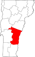 | |
| Villages | ||
| CDPs | ||
| Other communities | ||