Addison, New York
| Addison | |
| Town | |
| Country | United States |
|---|---|
| State | New York |
| County | Steuben County |
| Elevation | 998 ft (304.2 m) |
| Coordinates | 42°06′14″N 77°14′02″W / 42.10389°N 77.23389°WCoordinates: 42°06′14″N 77°14′02″W / 42.10389°N 77.23389°W |
| Area | 25.64 sq mi (66.4 km2) |
| - land | 25.6 sq mi (66 km2) |
| - water | 0.04 sq mi (0 km2), 0.16% |
| Population | 2,595 (2010) |
| Incorporated | 1796 |
| Timezone | EST (UTC-5) |
| - summer (DST) | EDT (UTC-4) |
| ZIP code | 14801 |
| Area code | 607 |
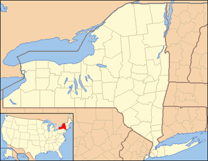 Location of Addison in New York
| |
| Website: Town of Addison | |
Addison is a town in Steuben County, New York, United States. The population was 2,595 at the 2010 census. The name was selected to honor the author Joseph Addison.
The Town of Addison contains a village, also called Addison. The town is an interior town in the southeastern part of the county.
History
The town was first settled in 1791 by Samuel Rice. Addison, originally a part of the old town of Painted Post, was organized as Middletown at the time of the organization of Steuben county in March 1796. The name was changed to Addison, in honor of Joseph Addison, the English author, on April 6, 1808. The early settlers called it also "Tuscarora". In 1890 the population of Addison was 2,884.[1]
Geography
According to the United States Census Bureau, the town has a total area of 25.7 square miles (66.5 km²), of which, 25.6 square miles (66.4 km²) of it is land and 0.04 square miles (0.1 km²) of it (0.16%) is water.
Former New York State Route 432, now County Road 119, is an east-west highway through the town. New York State Route 417 passes through the southeast corner of the town.
Addison is on the Southern Tier Main Line of the Norfolk Southern Railway, ultimate successor to the Erie/Erie Lackawanna Railroads which ran the railroad from its opening in 1850 to 1976. From c. 1885 to 1961 Addison was also the northern terminus of the Wellsville, Addison & Galeton Railroad/Baltimore & Ohio/Buffalo & Susquehanna line from Galeton, Penn.
The Canisteo River flows through the south part of the town. Goodhue Creek flows into the river near the east town line.
Demographics
| Historical population | |||
|---|---|---|---|
| Census | Pop. | %± | |
| 1820 | 652 | — | |
| 1830 | 944 | 44.8% | |
| 1840 | 1,920 | 103.4% | |
| 1850 | 3,721 | 93.8% | |
| 1860 | 1,715 | −53.9% | |
| 1870 | 2,218 | 29.3% | |
| 1880 | 2,534 | 14.2% | |
| 1890 | 2,908 | 14.8% | |
| 1900 | 2,637 | −9.3% | |
| 1910 | 2,509 | −4.9% | |
| 1920 | 2,122 | −15.4% | |
| 1930 | 1,975 | −6.9% | |
| 1940 | 2,032 | 2.9% | |
| 1950 | 2,368 | 16.5% | |
| 1960 | 2,645 | 11.7% | |
| 1970 | 2,698 | 2.0% | |
| 1980 | 2,734 | 1.3% | |
| 1990 | 2,645 | −3.3% | |
| 2000 | 2,640 | −0.2% | |
| 2010 | 2,595 | −1.7% | |
| Est. 2014 | 2,560 | [2] | −1.3% |
As of the census[4] of 2000, there were 2,640 people, 1,026 households, and 687 families residing in the town. The population density was 103.0 people per square mile (39.8/km²). There were 1,177 housing units at an average density of 45.9 per square mile (17.7/km²). The racial makeup of the town was 98.45% White, 0.30% Black or African American, 0.34% Native American, 0.04% Asian, 0.08% from other races, and 0.80% from two or more races. Hispanic or Latino of any race were 0.61% of the population.
There were 1,026 households out of which 34.1% had children under the age of 18 living with them, 48.4% were married couples living together, 12.5% had a female householder with no husband present, and 33.0% were non-families. 25.7% of all households were made up of individuals and 12.1% had someone living alone who was 65 years of age or older. The average household size was 2.57 and the average family size was 3.06.
In the town the population was spread out with 27.1% under the age of 18, 8.9% from 18 to 24, 26.7% from 25 to 44, 23.9% from 45 to 64, and 13.3% who were 65 years of age or older. The median age was 36 years. For every 100 females there were 92.3 males. For every 100 females age 18 and over, there were 90.9 males.
The median income for a household in the town was $31,942, and the median income for a family was $37,813. Males had a median income of $32,159 versus $22,708 for females. The per capita income for the town was $15,473. About 13.2% of families and 17.7% of the population were below the poverty line, including 23.1% of those under age 18 and 9.7% of those age 65 or over.
Communities and locations in the Town of Addison
- Addison – The Village of Addison is on Route 417.
- Goodhue Lake – A small lake at the north town line.
- Jones Corners – A location on the west town line and County Road 2.
- America - A 600 Acre plot of land home to the annual AmericaFest.
- Pinnacle State Park – A state park east of Addison village.
Notable people
- Charles W. Gillet, former United States Congressman
- Bud Heine, former MLB player
- Jim Greengrass, former MLB player
- John V. McDuffie, (1841–1896), born in Addison, United States Congressman from Alabama.[5]
- Levi E. Pond, (1833-1895), farmer and Wisconsin state senator, was born in Addison.[6]
Climate
According to the Köppen Climate Classification system, Addison has a humid continental climate, abbreviated "Dfb" on climate maps.[7]
References
- ↑ http://www.rootsweb.ancestry.com/~nysteube/ad/ad.html
- ↑ "Annual Estimates of the Resident Population for Incorporated Places: April 1, 2010 to July 1, 2014". Retrieved June 4, 2015.
- ↑ "Census of Population and Housing". Census.gov. Archived from the original on May 11, 2015. Retrieved June 4, 2015.
- ↑ "American FactFinder". United States Census Bureau. Archived from the original on 2013-09-11. Retrieved 2008-01-31.
- ↑ Who Was Who in America, Historical Volume, 1607-1896. Chicago: Marquis Who's Who. 1963.
- ↑ 'Wisconsin Blue Book 1889,' Biographical Sketch of Levi Elwin Pond, pg. 499
- ↑ Climate Summary for Addison, New York
External links
- Town of Addison
- Brief Addison information
- Addison history/links
- http://www.schooldistricthq.com/addison-ny-14801/[]
Municipalities and communities of Steuben County, New York, United States | ||
|---|---|---|
| Cities | 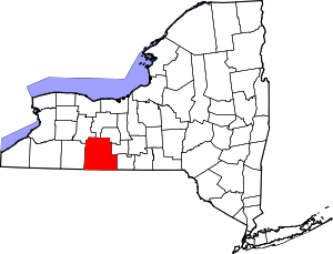 | |
| Towns | ||
| Villages | ||
| CDPs |
| |
| Hamlets | ||
| Footnotes | ‡This populated place also has portions in an adjacent county or counties | |