North Hornell, New York
| North Hornell, New York | |
|---|---|
| Village | |
 North Hornell, New York Location within the state of New York | |
| Coordinates: 42°20′44″N 77°39′39″W / 42.34556°N 77.66083°WCoordinates: 42°20′44″N 77°39′39″W / 42.34556°N 77.66083°W | |
| Country | United States |
| State | New York |
| County | Steuben |
| Government | |
| • Mayor | John Falci |
| Area | |
| • Total | 0.6 sq mi (1.4 km2) |
| • Land | 0.6 sq mi (1.4 km2) |
| • Water | 0.0 sq mi (0.0 km2) |
| Elevation | 1,165 ft (355 m) |
| Population (2000) | |
| • Total | 851 |
| • Density | 1,533.4/sq mi (592.0/km2) |
| Time zone | Eastern (EST) (UTC-5) |
| • Summer (DST) | EDT (UTC-4) |
| FIPS code | 36-53055 |
| GNIS feature ID | 0958823 |
North Hornell is a village in Steuben County, New York, United States. The population was 851 at the 2000 census.
The Village of North Hornell is in the Town of Hornellsville, north of the City of Hornell.
History
In 2004, the North Hornell village council started studies on a possible merger with the City of Hornell, dissolving the village, or remaining an independent entity (village) to reduce annual costs. The study is still going on.
The citizens of the village voted not to merger with the City of Hornell.
Geography
North Hornell is located at 42°20′44″N 77°39′39″W / 42.345440°N 77.660890°W.[1]
According to the United States Census Bureau, the village has a total area of 0.6 square miles (1.6 km2), all of it land.
Conjoined New York State Route 21 and New York State Route 36 form a major highway through the village.
North Hornell is on the east bank of the Canisteo River.
There is a creek running through the village named Elmhurst creek.
Streets and Layout
Primary Streets
Cleveland Avenue North--South Direction, Seneca Road North--South Direction
Secondary Streets
Bowen Street East--West Direction, Country Club Road East up Hillside, Rural Avenue East--West Direction, McKinley Avenue North--South Direction, Avondale Avenue Loops West, Woodbury Place East--West Direction, Wells Street East--West Direction, Jones Street East--West Direction, Gifford Street North--South Direction, Linwood Avenue East--West Direction, Bethesda Drive East--West Direction, Elmwood Avenue East--West Direction, Maplewood Avenue East--West Direction, First Street North--South Direction, Second Street North--South Direction, Wightman Avenue East--West Direction, Third Street North--South Direction, Fourth Street North--South Direction, West Maplewood Avenue East--West Direction, Park Street East-West Direction, Mary Street East--West Direction, Pittsburgh Street East--West Direction, Cameron Boulevard Loops East, Marick Park Drive North--South Direction, Richland Street East--West Direction, Chambers Street North--South Direction
Alleys and Fire Lanes
Totten Lane East--West Direction, First Alley North--South Direction, Second Alley North--South Direction, Third Alley North--South Direction, Fourth Alley North--South Direction, South Circle North--South Direction
Demographics
| Historical population | |||
|---|---|---|---|
| Census | Pop. | %± | |
| 1930 | 452 | — | |
| 1940 | 589 | 30.3% | |
| 1950 | 605 | 2.7% | |
| 1960 | 917 | 51.6% | |
| 1970 | 919 | 0.2% | |
| 1980 | 813 | −11.5% | |
| 1990 | 822 | 1.1% | |
| 2000 | 851 | 3.5% | |
| 2010 | 778 | −8.6% | |
| Est. 2015 | 747 | [2] | −4.0% |
As of the census[4] of 2000, there were 851 people, 303 households, and 210 families residing in the village. The population density was 1,533.4 people per square mile (597.4/km2). There were 324 housing units at an average density of 583.8 per square mile (227.4/km2). The racial makeup of the village was 97.06% White, 0.47% African American, 1.88% Asian, 0.12% from other races, and 0.47% from two or more races. Hispanic or Latino of any race were 1.06% of the population.
There were 303 households out of which 30.4% had children under the age of 18 living with them, 55.4% were married couples living together, 7.6% had a female householder with no husband present, and 30.4% were non-families. 26.1% of all households were made up of individuals and 16.8% had someone living alone who was 65 years of age or older. The average household size was 2.39 and the average family size was 2.88.
In the village the population was spread out with 19.6% under the age of 18, 4.7% from 18 to 24, 20.4% from 25 to 44, 24.2% from 45 to 64, and 31.0% who were 65 years of age or older. The median age was 48 years. For every 100 females there were 81.1 males. For every 100 females age 18 and over, there were 76.7 males.
The median income for a household in the village was $48,571, and the median income for a family was $61,125. Males had a median income of $42,000 versus $23,125 for females. The per capita income for the village was $24,825. About 3.4% of families and 6.5% of the population were below the poverty line, including 5.5% of those under age 18 and 1.9% of those age 65 or over.
References
- ↑ "US Gazetteer files: 2010, 2000, and 1990". United States Census Bureau. 2011-02-12. Retrieved 2011-04-23.
- ↑ "Annual Estimates of the Resident Population for Incorporated Places: April 1, 2010 to July 1, 2015". Retrieved July 2, 2016.
- ↑ "Census of Population and Housing". Census.gov. Retrieved June 4, 2015.
- ↑ "American FactFinder". United States Census Bureau. Retrieved 2008-01-31.
Links
Municipalities and communities of Steuben County, New York, United States | ||
|---|---|---|
| Cities | 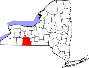 | |
| Towns | ||
| Villages | ||
| CDPs |
| |
| Hamlets | ||
| Footnotes | ‡This populated place also has portions in an adjacent county or counties | |